
| Memorials | : | 1 |
| Location | : | Mount Laurel, Burlington County, USA |
| Coordinate | : | 39.9297670, -74.8852350 |
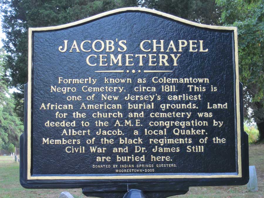
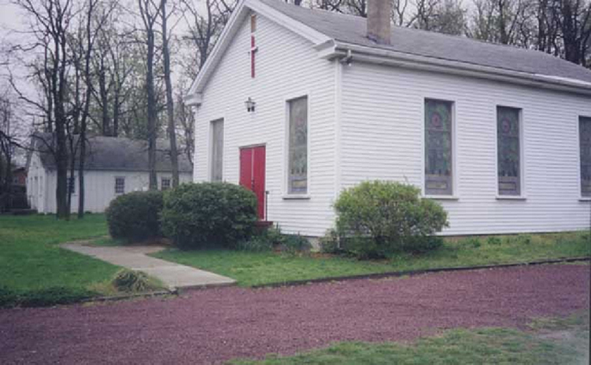
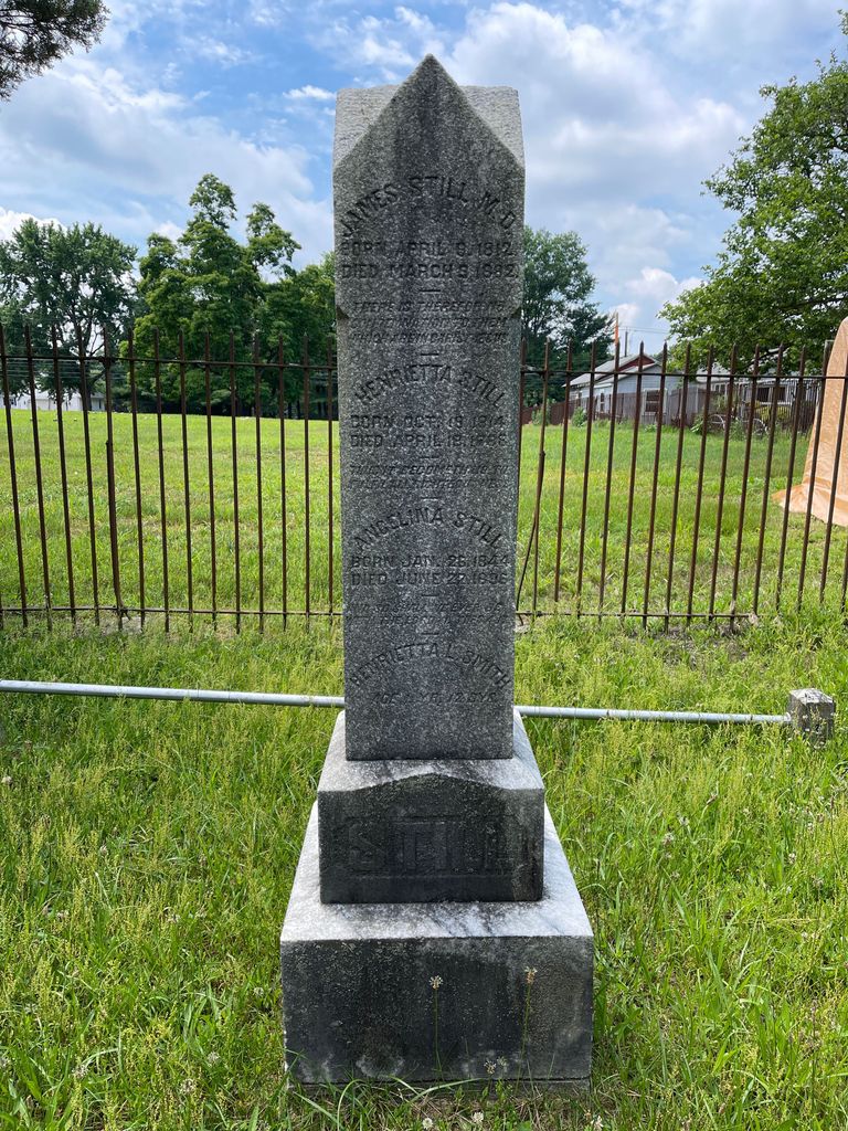
| Description | : | Located behind (entry is around the corner) of the Mount Laurel/Evesham Friends Burial Ground, this cemetery is one of the earliest African American burial grounds in Burlington County. The Jacobs Chapel Colemantown Foundation is working to research, restore tombstones and catalog burial records. Visit their website for more information at: http://jacobschapelame.org/Home.php |
frequently asked questions (FAQ):
-
Where is Jacob's Chapel Cemetery?
Jacob's Chapel Cemetery is located at 318 Elbo Lane Mount Laurel, Burlington County ,New Jersey , 08054USA.
-
Jacob's Chapel Cemetery cemetery's updated grave count on graveviews.com?
1 memorials
-
Where are the coordinates of the Jacob's Chapel Cemetery?
Latitude: 39.9297670
Longitude: -74.8852350

Nearby Cemetories:
1. Mount Laurel Friends Burying Ground
Mount Laurel, Burlington County, USA
Coordinate: 39.9286000, -74.8853920
2. Evesham Friends Cemetery
Mount Laurel, Burlington County, USA
Coordinate: 39.9351130, -74.8915510
3. Eldridge Cemetery
Mount Laurel, Burlington County, USA
Coordinate: 39.9268837, -74.8968887
4. Mount Laurel Cemetery
Mount Laurel, Burlington County, USA
Coordinate: 39.9272003, -74.8977966
5. Darnell Family Cemetery
Mount Laurel, Burlington County, USA
Coordinate: 39.9535520, -74.8728800
6. Easton Union Cemetery
Hainesport, Burlington County, USA
Coordinate: 39.9658012, -74.8503036
7. Prince of Peace Lutheran Church Memorial Garden
Marlton, Burlington County, USA
Coordinate: 39.8928080, -74.9201920
8. Old Marlton Baptist Cemetery
Marlton, Burlington County, USA
Coordinate: 39.8899300, -74.9183400
9. Marlton United Methodist Cemetery
Marlton, Burlington County, USA
Coordinate: 39.8899918, -74.9195023
10. Jesus Bread of Life Catholic Cemetery
Mount Laurel, Burlington County, USA
Coordinate: 39.9773600, -74.8673100
11. Cropwell Friends Meeting House Cemetery
Cropwell, Burlington County, USA
Coordinate: 39.8931732, -74.9364319
12. Marlton Cemetery
Marlton, Burlington County, USA
Coordinate: 39.8767320, -74.9039320
13. Medford Friends Meeting Cemetery
Medford, Burlington County, USA
Coordinate: 39.8992081, -74.8255463
14. Moorestown Friends Cemetery
Moorestown, Burlington County, USA
Coordinate: 39.9661522, -74.9430237
15. Medford Methodist Cemetery
Medford, Burlington County, USA
Coordinate: 39.9008408, -74.8200302
16. Medford Friends Hicksite Burial Ground
Medford, Burlington County, USA
Coordinate: 39.8978940, -74.8219260
17. Park View Cemetery
Medford, Burlington County, USA
Coordinate: 39.8983955, -74.8207779
18. Medford Baptist Cemetery
Medford, Burlington County, USA
Coordinate: 39.8997536, -74.8187943
19. First Baptist Church Cemetery
Moorestown, Burlington County, USA
Coordinate: 39.9644737, -74.9483109
20. Haines Family Farm Cemetery
Medford, Burlington County, USA
Coordinate: 39.9235020, -74.8079980
21. Saint Matthew Lutheran Church Garden of Remembranc
Moorestown, Burlington County, USA
Coordinate: 39.9684660, -74.9444600
22. Saint Peters Episcopal Church Garden
Medford, Burlington County, USA
Coordinate: 39.8849360, -74.8337860
23. Park View Cemetery at Kirbys Mill
Medford, Burlington County, USA
Coordinate: 39.9222300, -74.8076800
24. Trinity Episcopal Churchyard
Moorestown, Burlington County, USA
Coordinate: 39.9634056, -74.9507599