
| Memorials | : | 8 |
| Location | : | Medford, Burlington County, USA |
| Coordinate | : | 39.8978940, -74.8219260 |
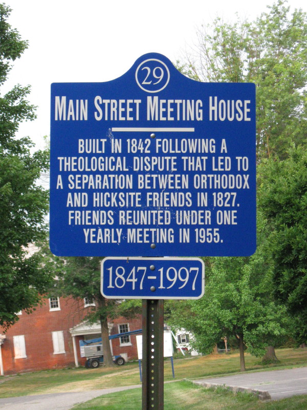
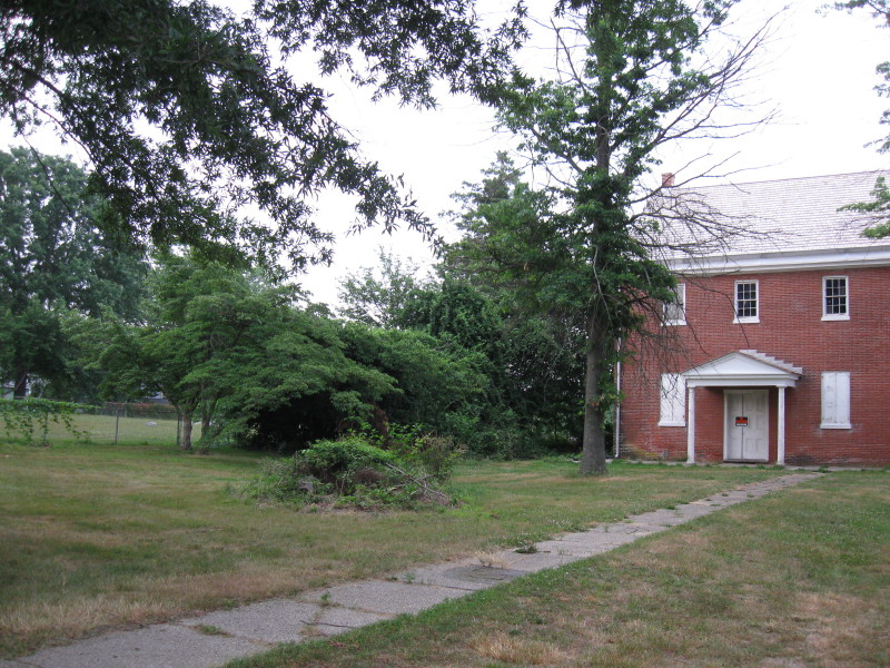
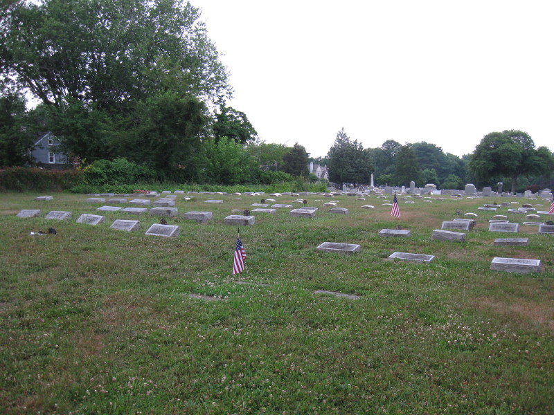
| Description | : | In 1827, during the time of the theological controversy among the Friends, adherents of Elias Hicks separated from the Union Street meeting and organized a Hicksite group. The meeting house is located on left side of South street just off of Main street. The cemetery is on the left side of the building in a fenced in area. It is adjacent to the Park View Cemetery (IOOF Cemetery). |
frequently asked questions (FAQ):
-
Where is Medford Friends Hicksite Burial Ground?
Medford Friends Hicksite Burial Ground is located at South Street Medford, Burlington County ,New Jersey , 08055USA.
-
Medford Friends Hicksite Burial Ground cemetery's updated grave count on graveviews.com?
8 memorials
-
Where are the coordinates of the Medford Friends Hicksite Burial Ground?
Latitude: 39.8978940
Longitude: -74.8219260


Nearby Cemetories:
1. Park View Cemetery
Medford, Burlington County, USA
Coordinate: 39.8983955, -74.8207779
2. Medford Baptist Cemetery
Medford, Burlington County, USA
Coordinate: 39.8997536, -74.8187943
3. Medford Friends Meeting Cemetery
Medford, Burlington County, USA
Coordinate: 39.8992081, -74.8255463
4. Medford Methodist Cemetery
Medford, Burlington County, USA
Coordinate: 39.9008408, -74.8200302
5. Stratton Burying Ground
Medford, Burlington County, USA
Coordinate: 39.8839836, -74.8203583
6. Saint Peters Episcopal Church Garden
Medford, Burlington County, USA
Coordinate: 39.8849360, -74.8337860
7. Peacock Cemetery
Chairville, Burlington County, USA
Coordinate: 39.8988991, -74.7889023
8. Park View Cemetery at Kirbys Mill
Medford, Burlington County, USA
Coordinate: 39.9222300, -74.8076800
9. Haines Family Farm Cemetery
Medford, Burlington County, USA
Coordinate: 39.9235020, -74.8079980
10. Mount Laurel Friends Burying Ground
Mount Laurel, Burlington County, USA
Coordinate: 39.9286000, -74.8853920
11. Jacob's Chapel Cemetery
Mount Laurel, Burlington County, USA
Coordinate: 39.9297670, -74.8852350
12. Evergreen Cemetery
Lumberton, Burlington County, USA
Coordinate: 39.9562988, -74.8094025
13. Saint Martin in the Fields Memorial Garden
Lumberton, Burlington County, USA
Coordinate: 39.9581480, -74.8081230
14. Old Lumberton Cemetery
Lumberton, Burlington County, USA
Coordinate: 39.9590988, -74.8058014
15. Vincentown Baptist Cemetery
Vincentown, Burlington County, USA
Coordinate: 39.9395400, -74.7609690
16. Eldridge Cemetery
Mount Laurel, Burlington County, USA
Coordinate: 39.9268837, -74.8968887
17. Evesham Friends Cemetery
Mount Laurel, Burlington County, USA
Coordinate: 39.9351130, -74.8915510
18. Mount Laurel Cemetery
Mount Laurel, Burlington County, USA
Coordinate: 39.9272003, -74.8977966
19. Marlton Cemetery
Marlton, Burlington County, USA
Coordinate: 39.8767320, -74.9039320
20. Vincentown Friends Cemetery
Vincentown, Burlington County, USA
Coordinate: 39.9352400, -74.7495500
21. Lord of Life Memorial Garden
Tabernacle, Burlington County, USA
Coordinate: 39.8510860, -74.7590690
22. Darnell Family Cemetery
Mount Laurel, Burlington County, USA
Coordinate: 39.9535520, -74.8728800
23. Vincentown Methodist Cemetery
Vincentown, Burlington County, USA
Coordinate: 39.9370900, -74.7488600
24. Easton Union Cemetery
Hainesport, Burlington County, USA
Coordinate: 39.9658012, -74.8503036