
| Memorials | : | 0 |
| Location | : | Wertheim, Main-Tauber-Kreis, Germany |
| Coordinate | : | 49.7598800, 9.5236300 |
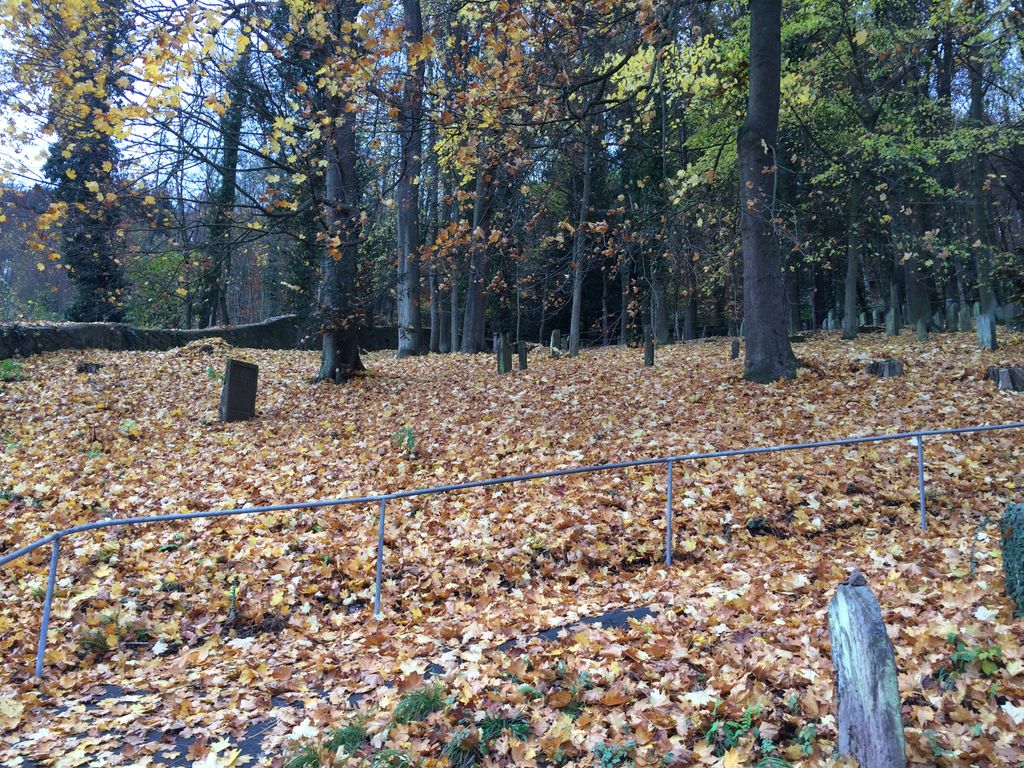
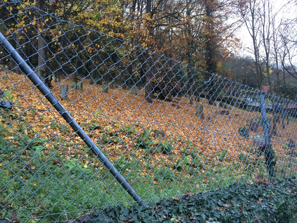
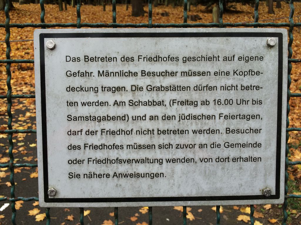
| Description | : | This old Jewish Cemetery (Jud Friedhof) is built on a very steep slope at the edge of the village. In front of the former "Eicheler Tor" the Jewish cemetery was established in 1406, thus among the oldest cemeteries in Germany, 72 headstones from 15th century remained preserved, even more of a later date. In 1714 enlarged by the foundation of Viennese court banker Samson Wertheimer. Possibly from 13th century on wards. Oldest datable gravestone 1405. In use until 1938. NUMBER OF GRAVESTONES: 498 Most of Wertheim's Jewish population fled Germany during Hitler's rise to power and those who didn't escape were... Read More |
frequently asked questions (FAQ):
-
Where is Jüdischer Friedhof Wertheim?
Jüdischer Friedhof Wertheim is located at Eichelgasse 92 Wertheim, Main-Tauber-Kreis ,Baden-Württemberg , 97877Germany.
-
Jüdischer Friedhof Wertheim cemetery's updated grave count on graveviews.com?
0 memorials
-
Where are the coordinates of the Jüdischer Friedhof Wertheim?
Latitude: 49.7598800
Longitude: 9.5236300
Nearby Cemetories:
1. Evangelische Stiftskirche
Wertheim, Main-Tauber-Kreis, Germany
Coordinate: 49.7588890, 9.5175000
2. Bergfriedhof Wertheim
Wertheim, Main-Tauber-Kreis, Germany
Coordinate: 49.7587500, 9.5114600
3. Sachsenhausen Nordfriedhof
Sachsenhausen, Main-Tauber-Kreis, Germany
Coordinate: 49.7329959, 9.4917324
4. Klosterkirche Bronnbach
Weinsberg, Landkreis Heilbronn, Germany
Coordinate: 49.7127330, 9.5481280
5. Nassig Friedhof
Nassig, Main-Tauber-Kreis, Germany
Coordinate: 49.7378280, 9.4496690
6. Friedhof Rettersheim
Rettersheim, Landkreis Main-Spessart, Germany
Coordinate: 49.8005077, 9.5858191
7. Sonderriet Friedhof
Sonderriet, Main-Tauber-Kreis, Germany
Coordinate: 49.7189840, 9.4390620
8. Friedhof Michelrieth
Michelrieth, Landkreis Main-Spessart, Germany
Coordinate: 49.8288681, 9.5231760
9. Friedhof Trennfeld
Trennfeld, Landkreis Main-Spessart, Germany
Coordinate: 49.7955771, 9.6160685
10. RuheForst Südspessart Stadtprozelten
Stadtprozelten, Landkreis Miltenberg, Germany
Coordinate: 49.7870383, 9.4156397
11. Pfarrkirche St. Laurentius in Uissigheim
Uissigheim, Main-Tauber-Kreis, Germany
Coordinate: 49.6794800, 9.5732600
12. Friedhof Holzkirchhausen
Holzkirchhausen, Landkreis Würzburg, Germany
Coordinate: 49.7577057, 9.6676369
13. Friedhof Neubrunn
Neubrunn bei Würzburg, Landkreis Würzburg, Germany
Coordinate: 49.7291660, 9.6704130
14. St.-Georg-Kirche
Trennfeld, Landkreis Main-Spessart, Germany
Coordinate: 49.8500000, 9.6000000
15. Friedhof Holzkirchen Unterfanken
Holzkirchen, Landkreis Würzburg, Germany
Coordinate: 49.7833220, 9.6822060
16. Jüdischer Friedhof Bad König
Bad König, Odenwaldkreis, Germany
Coordinate: 49.7449500, 9.3471000
17. Steinfurt Friedhof
Steinfurt, Main-Tauber-Kreis, Germany
Coordinate: 49.6470210, 9.4843450
18. Friedhof Helmstadt
Helmstadt, Landkreis Würzburg, Germany
Coordinate: 49.7647975, 9.7109818
19. Friedhof Hafenlohr
Hafenlohr, Landkreis Main-Spessart, Germany
Coordinate: 49.8701429, 9.6017881
20. Friedhof Remlingen
Remlingen, Landkreis Würzburg, Germany
Coordinate: 49.8066432, 9.6976671
21. Dammbach Privatfriedhof Rexroth
Dammbach, Landkreis Aschaffenburg, Germany
Coordinate: 49.8303670, 9.3553300
22. Friedhof Karbach (bei Wertheim)
Karbach, Landkreis Main-Spessart, Germany
Coordinate: 49.8680520, 9.6383134
23. Friedhof Wenkheim
Wenkheim, Main-Tauber-Kreis, Germany
Coordinate: 49.6985380, 9.7045372
24. Friedhof Uettingen
Uettingen, Landkreis Würzburg, Germany
Coordinate: 49.7946300, 9.7275320