
| Memorials | : | 0 |
| Location | : | Uissigheim, Main-Tauber-Kreis, Germany |
| Coordinate | : | 49.6794800, 9.5732600 |
frequently asked questions (FAQ):
-
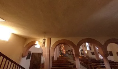
Where is Pfarrkirche St. Laurentius in Uissigheim?
Pfarrkirche St. Laurentius in Uissigheim is located at Ritter-Arnold-Straße 33 Uissigheim, Main-Tauber-Kreis ,Baden-Württemberg , 97900Germany.
-
Pfarrkirche St. Laurentius in Uissigheim cemetery's updated grave count on graveviews.com?
0 memorials
-
Where are the coordinates of the Pfarrkirche St. Laurentius in Uissigheim?
Latitude: 49.6794800
Longitude: 9.5732600
Nearby Cemetories:
1. Klosterkirche Bronnbach
Weinsberg, Landkreis Heilbronn, Germany
Coordinate: 49.7127330, 9.5481280
2. Friedhof Königheim
Königheim, Main-Tauber-Kreis, Germany
Coordinate: 49.6170233, 9.5909377
3. Steinfurt Friedhof
Steinfurt, Main-Tauber-Kreis, Germany
Coordinate: 49.6470210, 9.4843450
4. Sachsenhausen Nordfriedhof
Sachsenhausen, Main-Tauber-Kreis, Germany
Coordinate: 49.7329959, 9.4917324
5. Friedhof Tauberbischofsheim
Tauberbischofsheim, Main-Tauber-Kreis, Germany
Coordinate: 49.6251332, 9.6571023
6. Friedhof Neubrunn
Neubrunn bei Würzburg, Landkreis Würzburg, Germany
Coordinate: 49.7291660, 9.6704130
7. Jüdischer Friedhof Wertheim
Wertheim, Main-Tauber-Kreis, Germany
Coordinate: 49.7598800, 9.5236300
8. Friedhof Wenkheim
Wenkheim, Main-Tauber-Kreis, Germany
Coordinate: 49.6985380, 9.7045372
9. Evangelische Stiftskirche
Wertheim, Main-Tauber-Kreis, Germany
Coordinate: 49.7588890, 9.5175000
10. Bergfriedhof Wertheim
Wertheim, Main-Tauber-Kreis, Germany
Coordinate: 49.7587500, 9.5114600
11. Saint Alban Catholic Church Cemetery
Hardheim, Neckar-Odenwald-Kreis, Germany
Coordinate: 49.6087700, 9.4745800
12. Sonderriet Friedhof
Sonderriet, Main-Tauber-Kreis, Germany
Coordinate: 49.7189840, 9.4390620
13. Jüdischer Friedhof Wenkheim
Wenkheim, Main-Tauber-Kreis, Germany
Coordinate: 49.7019912, 9.7179682
14. Nassig Friedhof
Nassig, Main-Tauber-Kreis, Germany
Coordinate: 49.7378280, 9.4496690
15. Friedhof Holzkirchhausen
Holzkirchhausen, Landkreis Würzburg, Germany
Coordinate: 49.7577057, 9.6676369
16. Friedhof Unteraltertheim
Unteraltertheim, Landkreis Würzburg, Germany
Coordinate: 49.7236721, 9.7354962
17. Friedhof Bretzingen
Bretzingen, Neckar-Odenwald-Kreis, Germany
Coordinate: 49.5799045, 9.4843562
18. Friedhof Trennfeld
Trennfeld, Landkreis Main-Spessart, Germany
Coordinate: 49.7955771, 9.6160685
19. Friedhof Rettersheim
Rettersheim, Landkreis Main-Spessart, Germany
Coordinate: 49.8005077, 9.5858191
20. Friedhof Helmstadt
Helmstadt, Landkreis Würzburg, Germany
Coordinate: 49.7647975, 9.7109818
21. Friedhof Holzkirchen Unterfanken
Holzkirchen, Landkreis Würzburg, Germany
Coordinate: 49.7833220, 9.6822060
22. Friedhof Grünsfeld
Grünsfeld, Main-Tauber-Kreis, Germany
Coordinate: 49.6084170, 9.7445000
23. Bergfriedhof in Lauda-Königshofen
Lauda-Königshofen, Main-Tauber-Kreis, Germany
Coordinate: 49.5663810, 9.6963940
24. Stadtfriedhof Lauda
Lauda-Königshofen, Main-Tauber-Kreis, Germany
Coordinate: 49.5690680, 9.7051500