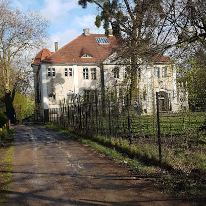
| Memorials | : | 0 |
| Location | : | Wołczyn, Powiat kluczborski, Poland |
| Coordinate | : | 51.0244000, 18.0688000 |
| Description | : | Polish: Wolczyn (German: Konstadt) is a town in Kluczbork County, Opole Voivodeship, Poland, with 6,221 inhabitants (2004). In 1742, when Wolczyn was under Prussian rule, Jewish settlement in the region began. In 1787, the total of 86 Jews were living in the town. In the 1840s the Jewish Community, which owned a synagogue and cemetery, was established. In 1845, 160 Jews lived in the town which consituted 11% of the total population[1.1]. In 1853, a new synagogue, whose inauguration took place on 7 December 1853 , was erected[1.1]. In 1871, the Jewish community of Wolczyn numbered 197 i.e. 9. 1% of... Read More |
frequently asked questions (FAQ):
-
Where is Jewish Cemetery of Wolczyn?
Jewish Cemetery of Wolczyn is located at Byczyñska St. Wołczyn, Powiat kluczborski ,Opolskie ,Poland.
-
Jewish Cemetery of Wolczyn cemetery's updated grave count on graveviews.com?
0 memorials
-
Where are the coordinates of the Jewish Cemetery of Wolczyn?
Latitude: 51.0244000
Longitude: 18.0688000
Nearby Cemetories:
1. Gierałcice Church of St. Michael
Opole, Miasto Opole, Poland
Coordinate: 50.9897399, 18.0471510
2. Kluczbork Communal Cemetery
Opole, Miasto Opole, Poland
Coordinate: 50.9649900, 18.2205400
3. Byczyna Communal Cemetery
Opole, Miasto Opole, Poland
Coordinate: 51.1123870, 18.2076290
4. Ligota Górna Cemetery
Opole, Miasto Opole, Poland
Coordinate: 50.9729459, 18.2525612
5. Maciejów Protestant Church Graveyard
Opole, Miasto Opole, Poland
Coordinate: 51.0324227, 18.2851525
6. Tuły Church of Our Lady of Sorrows
Opole, Miasto Opole, Poland
Coordinate: 50.8657331, 18.1441011
7. Gręboszów Church of St. Catherine
Opole, Miasto Opole, Poland
Coordinate: 51.0553766, 17.8068436
8. Rychnów Church of St. John the Baptist
Powiat namysłowski, Poland
Coordinate: 51.0766805, 17.7855284
9. Pokój Evangelical Cemetery
Opole, Miasto Opole, Poland
Coordinate: 50.9038650, 17.8397640
10. Protestant Church
Opole, Miasto Opole, Poland
Coordinate: 50.9041700, 17.8389400
11. Miejsce Jewish Cemetery
Opole, Miasto Opole, Poland
Coordinate: 50.9547948, 17.7756000
12. Gorzów Śląski Communal Cemetery
Opole, Miasto Opole, Poland
Coordinate: 51.0285753, 18.4139883
13. Namysłów Church of the Immaculate Conception
Brzeg, Powiat brzeski, Poland
Coordinate: 51.0863453, 17.7357720
14. Cmentarz Komunalny w Namysłowie - Stary
Powiat namysłowski, Poland
Coordinate: 51.0690924, 17.7169168
15. Cmentarz Komunalny w Namysłowie - Nowy
Powiat namysłowski, Poland
Coordinate: 51.0688577, 17.6925790
16. Cmentarz Parafialny w Praszce
Powiat oleski, Poland
Coordinate: 51.0593569, 18.4542750
17. Kup Old Cemetery
Opole, Miasto Opole, Poland
Coordinate: 50.8055550, 17.8856400
18. Cmentarz Parafii św. Michała w Kępnie
Kępno, Powiat kępiński, Poland
Coordinate: 51.2714497, 17.9838650
19. Sacken
Lubienia, Powiat opolski, Poland
Coordinate: 50.8428000, 17.7768300
20. Olesno Jewish Cemetery
Opole, Miasto Opole, Poland
Coordinate: 50.8761300, 18.4059400
21. Cmentarz Żydowski w Oleśnie
Powiat oleski, Poland
Coordinate: 50.8761708, 18.4060203
22. Olesno Communal Cemetery
Opole, Miasto Opole, Poland
Coordinate: 50.8823673, 18.4206485
23. Cmentarz św. Rocha w Wieruszowie-Podzamczu
Powiat wieruszowski, Poland
Coordinate: 51.2861968, 18.1398808
24. Cmentarz Parafialny w Osowcu
Powiat opolski, Poland
Coordinate: 50.7546475, 18.0181620

