
| Memorials | : | 0 |
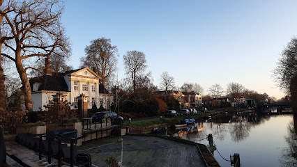
| Location | : | Maarssen, Stichtse Vecht Municipality, Netherlands |
| Coordinate | : | 52.1568400, 5.0456200 |
| Description | : | Established 1749 with the last burial occurring in 1926. All of the wooden matsevahs have disintegrated. Two remaining stone matsevahs are weathered and unreadable; one stone matsevah is broken in half and is unidentifiable. |
frequently asked questions (FAQ):
-
Where is Jodenbosje?
Jodenbosje is located at Machinekade Maarssen, Stichtse Vecht Municipality ,Utrecht , 3601ARNetherlands.
-
Jodenbosje cemetery's updated grave count on graveviews.com?
0 memorials
-
Where are the coordinates of the Jodenbosje?
Latitude: 52.1568400
Longitude: 5.0456200
Nearby Cemetories:
1. Maarssen General Cemetery
Maarssen, Stichtse Vecht Municipality, Netherlands
Coordinate: 52.1451469, 5.0306710
2. Oud-Zuilen Cemetery
Oud-Zuilen, Stichtse Vecht Municipality, Netherlands
Coordinate: 52.1326100, 5.0685200
3. Oude Algemene Begraafplaats
Breukelen, Stichtse Vecht Municipality, Netherlands
Coordinate: 52.1720700, 4.9986100
4. Breukelen Proostdijweg Cemetery
Breukelen, Stichtse Vecht Municipality, Netherlands
Coordinate: 52.1837300, 5.0090400
5. Utrecht Daelwijck Cemetery
Utrecht, Utrecht Municipality, Netherlands
Coordinate: 52.1285300, 5.0942700
6. Oud Protestant begraafplaats
Vleuten, Utrecht Municipality, Netherlands
Coordinate: 52.1065676, 5.0124286
7. Algemene Begraafplaats Loenen aan de Vecht
Loenen aan de Vecht, Stichtse Vecht Municipality, Netherlands
Coordinate: 52.2122100, 5.0189400
8. Katholieke begraafplaats
Vleuten, Utrecht Municipality, Netherlands
Coordinate: 52.1007835, 5.0162086
9. Loosdrecht Algemene Begraafplaats de Rading
Loosdrecht, Wijdemeren Municipality, Netherlands
Coordinate: 52.1930500, 5.1399300
10. Begraafplaats ‘t Spijck
Harmelen, Woerden Municipality, Netherlands
Coordinate: 52.1004944, 4.9735318
11. Utrecht Buurkerk
Utrecht, Utrecht Municipality, Netherlands
Coordinate: 52.0904890, 5.1192320
12. Mariakerk
Utrecht, Utrecht Municipality, Netherlands
Coordinate: 52.0891440, 5.1166030
13. Utrecht Dom Church
Utrecht, Utrecht Municipality, Netherlands
Coordinate: 52.0908090, 5.1217480
14. Groenekan Nederlands Hevormde Begraafplaats
Groenekan, De Bilt Municipality, Netherlands
Coordinate: 52.1192100, 5.1654300
15. 's-Graveland Algemene Begraafplaats Berestein
's-Graveland, Wijdemeren Municipality, Netherlands
Coordinate: 52.2248100, 5.1392200
16. Vinkeveen Roman Catholic Churchyard
Vinkeveen, De Ronde Venen Municipality, Netherlands
Coordinate: 52.2150700, 4.9337500
17. Utrecht Soestbergen Algemene Begraafplaats
Utrecht, Utrecht Municipality, Netherlands
Coordinate: 52.0776100, 5.1295100
18. Bilthoven Begraafplaats Brandenburg
Bilthoven, De Bilt Municipality, Netherlands
Coordinate: 52.1174800, 5.1856800
19. Wilnis Dutch Reformed Cemetery
Wilnis, De Ronde Venen Municipality, Netherlands
Coordinate: 52.1965600, 4.9049700
20. Bilthoven Den en Rust Cemetery
Bilthoven, De Bilt Municipality, Netherlands
Coordinate: 52.1407776, 5.2003312
21. De Ronde Venen General Cemetery
Wilnis, De Ronde Venen Municipality, Netherlands
Coordinate: 52.2010700, 4.9060900
22. Utrecht Kovelswade Algemene Begraafplaats
Utrecht, Utrecht Municipality, Netherlands
Coordinate: 52.0759735, 5.1351638
23. Oude Kerkhof Dorpskerk
De Bilt, De Bilt Municipality, Netherlands
Coordinate: 52.1044724, 5.1818385
24. Joodse Begraafplaats
Kortenhoef, Wijdemeren Municipality, Netherlands
Coordinate: 52.2452200, 5.1195500