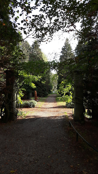
| Memorials | : | 0 |
| Location | : | Bilthoven, De Bilt Municipality, Netherlands |
| Coordinate | : | 52.1174800, 5.1856800 |
frequently asked questions (FAQ):
-
Where is Bilthoven Begraafplaats Brandenburg?
Bilthoven Begraafplaats Brandenburg is located at Bilthoven, De Bilt Municipality ,Utrecht ,Netherlands.
-
Bilthoven Begraafplaats Brandenburg cemetery's updated grave count on graveviews.com?
0 memorials
-
Where are the coordinates of the Bilthoven Begraafplaats Brandenburg?
Latitude: 52.1174800
Longitude: 5.1856800
Nearby Cemetories:
1. Groenekan Nederlands Hevormde Begraafplaats
Groenekan, De Bilt Municipality, Netherlands
Coordinate: 52.1192100, 5.1654300
2. Oude Kerkhof Dorpskerk
De Bilt, De Bilt Municipality, Netherlands
Coordinate: 52.1044724, 5.1818385
3. Bilthoven Den en Rust Cemetery
Bilthoven, De Bilt Municipality, Netherlands
Coordinate: 52.1407776, 5.2003312
4. Oude Algemene Begraafplaats
Zeist, Zeist Municipality, Netherlands
Coordinate: 52.0910100, 5.2400300
5. Utrecht Dom Church
Utrecht, Utrecht Municipality, Netherlands
Coordinate: 52.0908090, 5.1217480
6. Utrecht Buurkerk
Utrecht, Utrecht Municipality, Netherlands
Coordinate: 52.0904890, 5.1192320
7. Mariakerk
Utrecht, Utrecht Municipality, Netherlands
Coordinate: 52.0891440, 5.1166030
8. Utrecht Kovelswade Algemene Begraafplaats
Utrecht, Utrecht Municipality, Netherlands
Coordinate: 52.0759735, 5.1351638
9. Sint-Barbarakerk Begraafplaats
Bunnik, Bunnik Municipality, Netherlands
Coordinate: 52.0662689, 5.2050647
10. Utrecht Soestbergen Algemene Begraafplaats
Utrecht, Utrecht Municipality, Netherlands
Coordinate: 52.0776100, 5.1295100
11. Utrecht Tolsteeg Cemetery
Utrecht, Utrecht Municipality, Netherlands
Coordinate: 52.0724100, 5.1318400
12. Utrecht Daelwijck Cemetery
Utrecht, Utrecht Municipality, Netherlands
Coordinate: 52.1285300, 5.0942700
13. Begraafplaats Zeister Bosrust
Zeist, Zeist Municipality, Netherlands
Coordinate: 52.0898060, 5.2776180
14. Begraafplaats Soesterberg
Soest Municipality, Netherlands
Coordinate: 52.1091680, 5.2883344
15. Lage-Vuursche Kerkhof
Lage-Vuursche, Baarn Municipality, Netherlands
Coordinate: 52.1805100, 5.2238600
16. Oud-Zuilen Cemetery
Oud-Zuilen, Stichtse Vecht Municipality, Netherlands
Coordinate: 52.1326100, 5.0685200
17. Loosdrecht Algemene Begraafplaats de Rading
Loosdrecht, Wijdemeren Municipality, Netherlands
Coordinate: 52.1930500, 5.1399300
18. R.K. Begraafplaats Drieklinken
Driebergen-Rijsenburg, Utrechtse Heuvelrug Municipality, Netherlands
Coordinate: 52.0535356, 5.2747502
19. Utrecht Sint-Barbara Roman Catholic Cemetery
Utrecht, Utrecht Municipality, Netherlands
Coordinate: 52.0539430, 5.0832590
20. Noorderveld
Nieuwegein, Nieuwegein Municipality, Netherlands
Coordinate: 52.0421660, 5.1026720
21. Algemene Begraafplaats
Soest, Soest Municipality, Netherlands
Coordinate: 52.1712700, 5.3074300
22. Nieuwe Begraafplaats
Driebergen-Rijsenburg, Utrechtse Heuvelrug Municipality, Netherlands
Coordinate: 52.0641100, 5.3100900
23. Jodenbosje
Maarssen, Stichtse Vecht Municipality, Netherlands
Coordinate: 52.1568400, 5.0456200
24. Maarssen General Cemetery
Maarssen, Stichtse Vecht Municipality, Netherlands
Coordinate: 52.1451469, 5.0306710

