
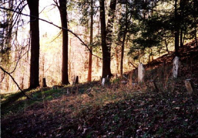
| Memorials | : | 1 |
| Location | : | Plank, Clay County, USA |
| Coordinate | : | 37.0794100, -83.6522600 |
| Description | : | From Goose Rock Elementary, take 1524 to 2000, go about 1.9 miles on 2000 and turn left onto Carpenter Branch, go 0.1 mile into drive on left. Cemetery is on the hill to the left of the old white house. |
frequently asked questions (FAQ):
-
Where is Joe Smith Cemetery?
Joe Smith Cemetery is located at Carpenter Branch Road Plank, Clay County ,Kentucky ,USA.
-
Joe Smith Cemetery cemetery's updated grave count on graveviews.com?
1 memorials
-
Where are the coordinates of the Joe Smith Cemetery?
Latitude: 37.0794100
Longitude: -83.6522600
Nearby Cemetories:
1. Smith-Henson Cemetery
Plank, Clay County, USA
Coordinate: 37.0766100, -83.6503200
2. Carpenter Cemetery
Plank, Clay County, USA
Coordinate: 37.0825390, -83.6507220
3. Riley-Wagers Cemetery
Plank, Clay County, USA
Coordinate: 37.0842300, -83.6506200
4. Walker Cemetery #1
Plank, Clay County, USA
Coordinate: 37.0760800, -83.6466400
5. Lipps Cemetery
Goose Rock, Clay County, USA
Coordinate: 37.0823300, -83.6618300
6. W O Wagers Cemetery
Plank, Clay County, USA
Coordinate: 37.0735000, -83.6699900
7. Wagers Cemetery
Botto, Clay County, USA
Coordinate: 37.0949100, -83.6606700
8. Brush Harbor
Goose Rock, Clay County, USA
Coordinate: 37.0949170, -83.6606730
9. Steve Mitchell Cemetery
Botto, Clay County, USA
Coordinate: 37.0930100, -83.6668400
10. Mitchell-Combs Cemetery
Botto, Clay County, USA
Coordinate: 37.0946000, -83.6644100
11. Hubbard-Brumley Cemetery
Botto, Clay County, USA
Coordinate: 37.0945000, -83.6659300
12. Mitchell Cemetery
Botto, Clay County, USA
Coordinate: 37.0958300, -83.6646400
13. Jackson Family Cemetery
Botto, Clay County, USA
Coordinate: 37.0876500, -83.6742500
14. Hollen Cemetery
Botto, Clay County, USA
Coordinate: 37.0852200, -83.6758700
15. Jones Cemetery
Big Creek, Clay County, USA
Coordinate: 37.0987510, -83.6464560
16. Hoskins Cemetery
Botto, Clay County, USA
Coordinate: 37.0988300, -83.6465200
17. Daugh Henson Cemetery
Botto, Clay County, USA
Coordinate: 37.0946500, -83.6690700
18. Thompson Family Cemetery
Botto, Clay County, USA
Coordinate: 37.0912660, -83.6730770
19. Howard Cemetery
Lake, Laurel County, USA
Coordinate: 37.0784480, -83.6793570
20. Henson-Marcum Cemetery
Botto, Clay County, USA
Coordinate: 37.0961500, -83.6695300
21. Earnest Henson Cemetery
Botto, Clay County, USA
Coordinate: 37.0981900, -83.6692000
22. Bill Henson Cemetery
Botto, Clay County, USA
Coordinate: 37.0993700, -83.6681700
23. Henson Family Cemetery
Botto, Clay County, USA
Coordinate: 37.0993900, -83.6690500
24. Tip Smith Cemetery
Goose Rock, Clay County, USA
Coordinate: 37.0779680, -83.6823570