
| Memorials | : | 0 |
| Location | : | Fetterville, Lancaster County, USA |
| Coordinate | : | 40.1066000, -76.0137000 |
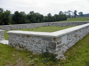
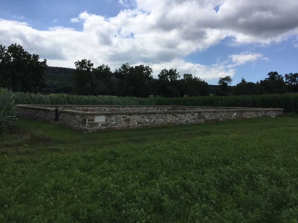
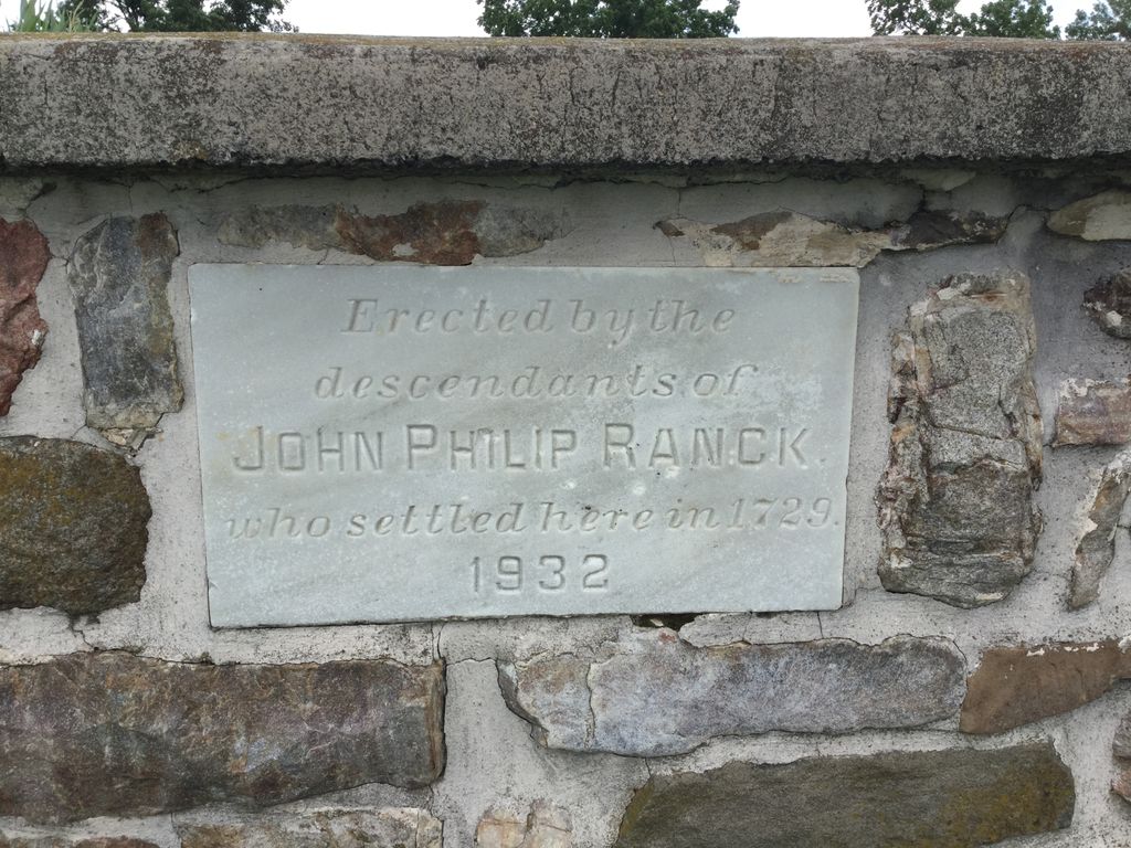
| Description | : | From the Ranck Family Heritage web site, ranck.org: Finding the John Philip Ranck Family Cemetery -- From US Route 322 east of Blue Ball in the Village of Fetterville, turn south onto Briartown Road. Briartown Road immediately turns left; DO NOT turn left. Instead, proceed straight into what looks like the entrance to a nursery. This road/lane very shortly turns RIGHT through the fields. 150 or so yards out, the road turns left; INSTEAD, continue straight over a small culvert, and wind between the barn and the house, bear left, and continue along the farm lane another 100 yards or... Read More |
frequently asked questions (FAQ):
-
Where is John Philip Ranck Cemetery?
John Philip Ranck Cemetery is located at Fetterville, Lancaster County ,Pennsylvania ,USA.
-
John Philip Ranck Cemetery cemetery's updated grave count on graveviews.com?
0 memorials
-
Where are the coordinates of the John Philip Ranck Cemetery?
Latitude: 40.1066000
Longitude: -76.0137000
Nearby Cemetories:
1. Cedar Grove Presbyterian Church Cemetery
East Earl, Lancaster County, USA
Coordinate: 40.1127129, -76.0280457
2. Goodville Mennonite Cemetery
Goodville, Lancaster County, USA
Coordinate: 40.1245640, -76.0055960
3. Blue Ball Mennonite Cemetery
Blue Ball, Lancaster County, USA
Coordinate: 40.1178000, -76.0346000
4. Weaverland Old Order Mennonite Cemetery
East Earl, Lancaster County, USA
Coordinate: 40.1250502, -76.0447072
5. Mount Hope Christian Chapel Cemetery
Gap, Lancaster County, USA
Coordinate: 40.0760790, -76.0113160
6. Weaverland Mennonite Cemetery
East Earl, Lancaster County, USA
Coordinate: 40.1276000, -76.0432000
7. Blue Ball Church of the Brethren Cemetery
Blue Ball, Lancaster County, USA
Coordinate: 40.1155000, -76.0577000
8. Meadville Mennonite Cemetery
Gap, Lancaster County, USA
Coordinate: 40.0717020, -75.9875280
9. Spring Grove Mennonite Church Cemetery
East Earl, Lancaster County, USA
Coordinate: 40.1470460, -76.0339530
10. Lichty's Mennonite Church Cemetery
East Earl, Lancaster County, USA
Coordinate: 40.1489000, -75.9985000
11. Bethany Grace Fellowship Cemetery
East Earl, Lancaster County, USA
Coordinate: 40.1494920, -76.0280410
12. Gault Graveyard
Gap, Lancaster County, USA
Coordinate: 40.0698060, -75.9767970
13. Bangor Episcopal Cemetery
Churchtown, Lancaster County, USA
Coordinate: 40.1338081, -75.9614944
14. Caernarvon Church Cemetery
Churchtown, Lancaster County, USA
Coordinate: 40.1339000, -75.9577000
15. Mount Culmen Evangelical Congregational Cemetery
East Earl, Lancaster County, USA
Coordinate: 40.1558120, -75.9914540
16. Churchtown United Methodist Church Cemetery
Churchtown, Lancaster County, USA
Coordinate: 40.1352400, -75.9564230
17. Churchtown Old Order Mennonite Cemetery
Churchtown, Lancaster County, USA
Coordinate: 40.1364720, -75.9531210
18. Saint Johns Evangelical Lutheran Church Cemetery
East Earl, Lancaster County, USA
Coordinate: 40.1619420, -76.0139810
19. Pequea Presbyterian Cemetery
Gap, Lancaster County, USA
Coordinate: 40.0523380, -75.9916900
20. Honey Brook Mennonite Cemetery
Honey Brook Township, Chester County, USA
Coordinate: 40.1110000, -75.9307000
21. Cambridge Methodist Burial Ground
Cambridge, Chester County, USA
Coordinate: 40.0814918, -75.9360128
22. Blank Cemetery
Lancaster County, USA
Coordinate: 40.0448520, -76.0386890
23. Cambridge Union Cemetery
Cambridge, Chester County, USA
Coordinate: 40.0816100, -75.9355900
24. Cambridge Friends Burial Ground
Cambridge, Chester County, USA
Coordinate: 40.0821700, -75.9351500