
| Memorials | : | 12 |
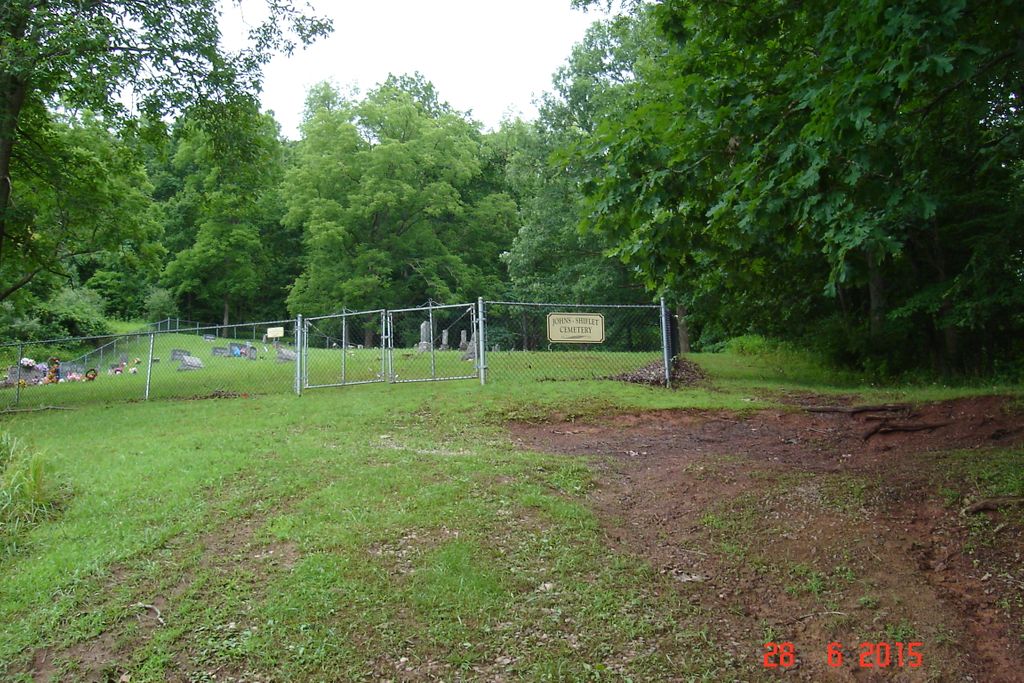
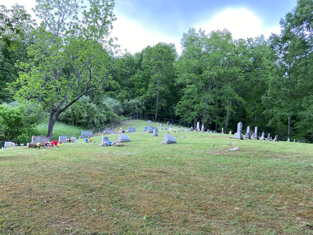
| Location | : | Stouts Mills, Gilmer County, USA |
| Coordinate | : | 38.8850100, -80.7658300 |
| Description | : | From Stouts Mills, Dusk Camp Road to right on Turkey Fork Rd (sign to Dusk Camp Baptist Church)about one mile to road on right up the hill, well traveled residential road. There are over 100 burials at this location, mostly uphill outside the fence. Also known as HITE, Johns, Shiflet,Collins. |
frequently asked questions (FAQ):
-
Where is Johns-Shiflet Cemetery?
Johns-Shiflet Cemetery is located at Turkey Fork Rd Stouts Mills, Gilmer County ,West Virginia ,USA.
-
Johns-Shiflet Cemetery cemetery's updated grave count on graveviews.com?
12 memorials
-
Where are the coordinates of the Johns-Shiflet Cemetery?
Latitude: 38.8850100
Longitude: -80.7658300
Nearby Cemetories:
1. Self Family Cemetery
Glenville, Gilmer County, USA
Coordinate: 38.8852270, -80.7660100
2. Putnam Cemetery
Gilmer County, USA
Coordinate: 38.8813700, -80.7721830
3. Isaac B. Garrett Burial Site
Sand Fork, Gilmer County, USA
Coordinate: 38.8934000, -80.7443200
4. Stout Cemetery
Stouts Mills, Gilmer County, USA
Coordinate: 38.8863000, -80.7341000
5. Church of God of Prophecy Cemetery
Stouts Mills, Gilmer County, USA
Coordinate: 38.8616490, -80.7553370
6. Smith Cemetery
Stouts Mills, Gilmer County, USA
Coordinate: 38.8901800, -80.7333800
7. Dusk Camp United Methodist Church Cemetery
Gilmer County, USA
Coordinate: 38.8961140, -80.7325440
8. Conrad Cemetery
Stouts Mills, Gilmer County, USA
Coordinate: 38.8869019, -80.7264023
9. Hart Wilson Cemetery
Gilmer, Gilmer County, USA
Coordinate: 38.8714110, -80.8053740
10. Sand Fork Cemetery
Gilmer County, USA
Coordinate: 38.9158890, -80.7480520
11. Killingsworth Cemetery
Sand Fork, Gilmer County, USA
Coordinate: 38.9169640, -80.7249834
12. Hess Cemetery
Cedarville, Gilmer County, USA
Coordinate: 38.9047200, -80.8185300
13. Rhoades Cemetery
Cedarville, Gilmer County, USA
Coordinate: 38.9049988, -80.8189011
14. Longshoal Cemetery
Gilmer, Gilmer County, USA
Coordinate: 38.8774030, -80.7055340
15. Unity Memorial Garden
Eastover, Richland County, USA
Coordinate: 38.8840220, -80.7040760
16. Otterbein Cemetery
Glenville, Gilmer County, USA
Coordinate: 38.9298550, -80.7916820
17. Hays Cemetery
Truebada, Gilmer County, USA
Coordinate: 38.9294400, -80.8026800
18. Varner Cemetery
Sand Fork, Gilmer County, USA
Coordinate: 38.9254709, -80.7212012
19. Moss Cemetery
Gilmer County, USA
Coordinate: 38.8678017, -80.8311005
20. Burk Cemetery
Gilmer County, USA
Coordinate: 38.8426000, -80.8084000
21. Snyder Cemetery
Gilmer County, USA
Coordinate: 38.9006004, -80.6964035
22. Conrad Cemetery
Sand Fork, Gilmer County, USA
Coordinate: 38.9364014, -80.7296982
23. Burk Church Cemetery
Cedarville, Gilmer County, USA
Coordinate: 38.8322220, -80.7986110
24. Weese Family Cemeter
Gilmer County, USA
Coordinate: 38.9208120, -80.8259930