
| Memorials | : | 1 |
| Location | : | Monroe County, USA |
| Coordinate | : | 35.4686000, -84.4102000 |
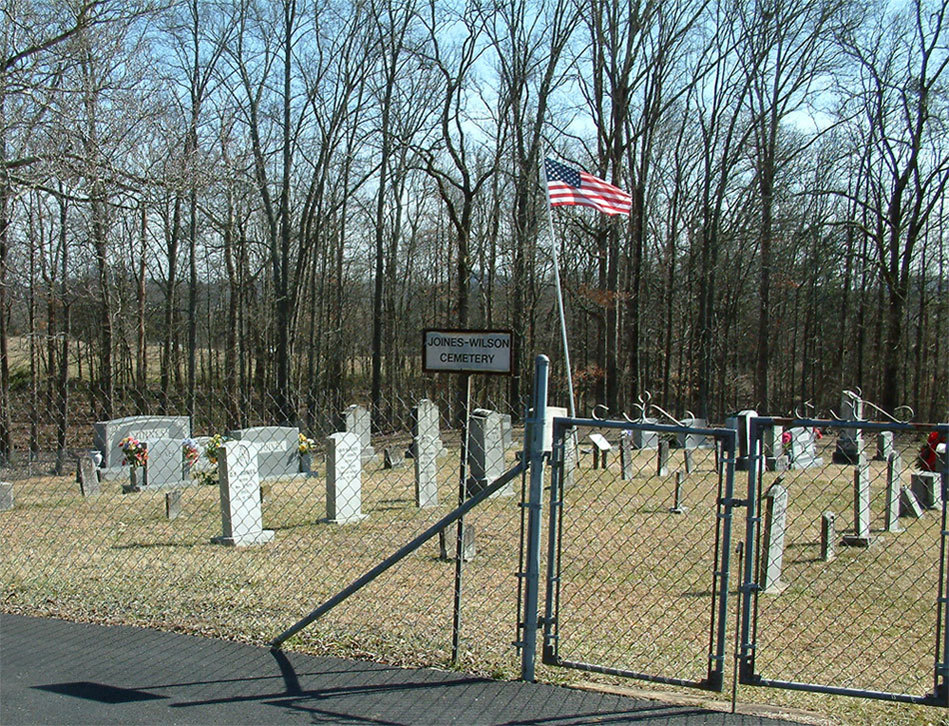
| Description | : | The Joines- Wilson Cemetery is at the Chestua Baptist Church but is a seperate cemetery with a fence around it and its own sign. The Chestua Baptist Church Cemetery is to the left of the church and Joines-Wilson is directly behind the church. |
frequently asked questions (FAQ):
-
Where is Joines-Wilson Family Cemetery?
Joines-Wilson Family Cemetery is located at Monroe County ,Tennessee ,USA.
-
Joines-Wilson Family Cemetery cemetery's updated grave count on graveviews.com?
1 memorials
-
Where are the coordinates of the Joines-Wilson Family Cemetery?
Latitude: 35.4686000
Longitude: -84.4102000
Nearby Cemetories:
1. Chestua Baptist Church Cemetery
Madisonville, Monroe County, USA
Coordinate: 35.4695000, -84.4088000
2. Haven of Light Cemetery
Madisonville, Monroe County, USA
Coordinate: 35.4755960, -84.4069870
3. Chestua Campground Community Cemetery
Madisonville, Monroe County, USA
Coordinate: 35.4627991, -84.4233017
4. Fain Family Cemetery
McMinn County, USA
Coordinate: 35.4630013, -84.3928986
5. Monroe County Paupers Cemetery
Madisonville, Monroe County, USA
Coordinate: 35.4697850, -84.3895270
6. Friendship Cemetery
Monroe County, USA
Coordinate: 35.4847980, -84.4002000
7. Notchey Creek Cemetery
Notchy Creek, Monroe County, USA
Coordinate: 35.4611015, -84.3713989
8. Notchey Creek Cemetery Old
Madisonville, Monroe County, USA
Coordinate: 35.4610000, -84.3710000
9. Boyd Cemetery
Notchy Creek, Monroe County, USA
Coordinate: 35.4350830, -84.4279670
10. Saint Mary's Church Cemetery
Madisonville, Monroe County, USA
Coordinate: 35.4869995, -84.4564972
11. Liberality Baptist Church Cemetery
Madisonville, Monroe County, USA
Coordinate: 35.4870610, -84.4565060
12. Wilson Station Presbyterian Church Cemetery
Madisonville, Monroe County, USA
Coordinate: 35.4273940, -84.4215310
13. New Bethel Cemetery
Madisonville, Monroe County, USA
Coordinate: 35.4291992, -84.3867035
14. Harrill Cemetery
Madisonville, Monroe County, USA
Coordinate: 35.5036230, -84.3721300
15. Mount Arnon-Manila Methodist Cemetery
Englewood, McMinn County, USA
Coordinate: 35.4505997, -84.4636002
16. Watson Chapel Baptist Church Cemetery
Madisonville, Monroe County, USA
Coordinate: 35.5160890, -84.4117160
17. McClellan Cemetery
Madisonville, Monroe County, USA
Coordinate: 35.4921989, -84.3499985
18. Hickory Grove Cemetery
Mount Vernon, Monroe County, USA
Coordinate: 35.4200974, -84.3763275
19. Madisonville Church of God of Prophecy Cemetery
Madisonville, Monroe County, USA
Coordinate: 35.5185290, -84.3790300
20. Notchey Creek Cemetery
Madisonville, Monroe County, USA
Coordinate: 35.5197182, -84.3636093
21. Bethlehem Cemetery
Monroe County, USA
Coordinate: 35.4371986, -84.3422012
22. Lands Chapel Cemetery
Monroe County, USA
Coordinate: 35.4043999, -84.4178009
23. Haven Hill Memorial Gardens
Madisonville, Monroe County, USA
Coordinate: 35.5182660, -84.3551930
24. Sunset Cemetery
Madisonville, Monroe County, USA
Coordinate: 35.5172890, -84.3528380