
| Memorials | : | 1 |
| Location | : | Madisonville, Monroe County, USA |
| Coordinate | : | 35.4273940, -84.4215310 |
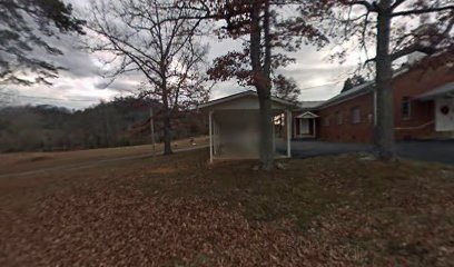
| Description | : | This cemetery is located on Wilson Station Road, you must take route 68 to Old Tellico highway (or old route 68) to Old Federal Road, Wilson Station Road is off of Old Federal Road |
frequently asked questions (FAQ):
-
Where is Wilson Station Presbyterian Church Cemetery?
Wilson Station Presbyterian Church Cemetery is located at Madisonville, Monroe County ,Tennessee ,USA.
-
Wilson Station Presbyterian Church Cemetery cemetery's updated grave count on graveviews.com?
1 memorials
-
Where are the coordinates of the Wilson Station Presbyterian Church Cemetery?
Latitude: 35.4273940
Longitude: -84.4215310
Nearby Cemetories:
1. Boyd Cemetery
Notchy Creek, Monroe County, USA
Coordinate: 35.4350830, -84.4279670
2. Lands Chapel Cemetery
Monroe County, USA
Coordinate: 35.4043999, -84.4178009
3. New Bethel Cemetery
Madisonville, Monroe County, USA
Coordinate: 35.4291992, -84.3867035
4. Burger Family Cemetery
McMinn County, USA
Coordinate: 35.3997993, -84.4394989
5. Ebenezer Cemetery
Mount Vernon, Monroe County, USA
Coordinate: 35.4005210, -84.3999600
6. Chestua Campground Community Cemetery
Madisonville, Monroe County, USA
Coordinate: 35.4627991, -84.4233017
7. Hickory Grove Cemetery
Mount Vernon, Monroe County, USA
Coordinate: 35.4200974, -84.3763275
8. Mount Arnon-Manila Methodist Cemetery
Englewood, McMinn County, USA
Coordinate: 35.4505997, -84.4636002
9. Joines-Wilson Family Cemetery
Monroe County, USA
Coordinate: 35.4686000, -84.4102000
10. Fain Family Cemetery
McMinn County, USA
Coordinate: 35.4630013, -84.3928986
11. Chestua Baptist Church Cemetery
Madisonville, Monroe County, USA
Coordinate: 35.4695000, -84.4088000
12. Liberty Hill Church of Christ Cemetery
Englewood, McMinn County, USA
Coordinate: 35.3852997, -84.4375000
13. Cochran Cemetery
McMinn County, USA
Coordinate: 35.4183006, -84.4753036
14. Haven of Light Cemetery
Madisonville, Monroe County, USA
Coordinate: 35.4755960, -84.4069870
15. Monroe County Paupers Cemetery
Madisonville, Monroe County, USA
Coordinate: 35.4697850, -84.3895270
16. Miller Cemetery
Mecca, McMinn County, USA
Coordinate: 35.3852997, -84.4597015
17. Shoal Creek Baptist Church Cemetery
Tellico Plains, Monroe County, USA
Coordinate: 35.3846590, -84.3839480
18. Notchey Creek Cemetery
Notchy Creek, Monroe County, USA
Coordinate: 35.4611015, -84.3713989
19. Notchey Creek Cemetery Old
Madisonville, Monroe County, USA
Coordinate: 35.4610000, -84.3710000
20. Adams Cemetery
McMinn County, USA
Coordinate: 35.3750000, -84.4356003
21. Jacks Family Cemetery
Mecca, McMinn County, USA
Coordinate: 35.3823013, -84.4609985
22. Eleazar Cemetery
Mount Vernon, Monroe County, USA
Coordinate: 35.4085999, -84.3527985
23. Sitzlar Family Cemetery
Mount Vernon, Monroe County, USA
Coordinate: 35.4074200, -84.3530900
24. Friendship Cemetery
Monroe County, USA
Coordinate: 35.4847980, -84.4002000