| Memorials | : | 0 |
| Location | : | Deventer, Deventer Municipality, Netherlands |
| Coordinate | : | 52.2604200, 6.1577160 |
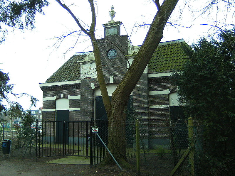
| Description | : | The first Jewish cemetery was established in 1805 on the Lange Rij. The second Jewish cemetery opened in 1870 on the Diepenveenseweg. The cemetery on the Lange Rij was closed to new burials in 1878. In 1960, the older cemetery was cleared and the remains of 308 burials were moved to a collective grave in the cemetery on Diepenveenseweg. |
frequently asked questions (FAQ):
-
Where is Joodse Begraafplaats?
Joodse Begraafplaats is located at Diepenveenseweg Deventer, Deventer Municipality ,Overijssel , 7413CBNetherlands.
-
Joodse Begraafplaats cemetery's updated grave count on graveviews.com?
0 memorials
-
Where are the coordinates of the Joodse Begraafplaats?
Latitude: 52.2604200
Longitude: 6.1577160
Nearby Cemetories:
1. Oude Begraafplaats Deventer
Deventer, Deventer Municipality, Netherlands
Coordinate: 52.2599700, 6.1582900
2. Broederenkerk
Deventer, Deventer Municipality, Netherlands
Coordinate: 52.2544620, 6.1570820
3. Steenbrugge Cemetery
Diepenveen, Deventer Municipality, Netherlands
Coordinate: 52.2743300, 6.1777500
4. Terwolde General Cemetery
Terwolde, Voorst Municipality, Netherlands
Coordinate: 52.2589300, 6.1102400
5. Diepenveen General Cemetery
Diepenveen, Deventer Municipality, Netherlands
Coordinate: 52.2908500, 6.1470200
6. Oude Begraafplaats Colmschate
Colmschate, Deventer Municipality, Netherlands
Coordinate: 52.2473100, 6.2218600
7. Voorst General Cemetery
Voorst, Voorst Municipality, Netherlands
Coordinate: 52.2041100, 6.1364900
8. Nijbroek Algemene Begraafplaats
Nijbroek, Voorst Municipality, Netherlands
Coordinate: 52.2820600, 6.0598800
9. Gorssel General Cemetery
Gorssel, Lochem Municipality, Netherlands
Coordinate: 52.1922700, 6.2033700
10. St. Antonius RK Kerkhof
De Vecht, Voorst Municipality, Netherlands
Coordinate: 52.2582100, 6.0363300
11. Bathmen General Cemetery
Bathmen, Deventer Municipality, Netherlands
Coordinate: 52.2505400, 6.2829400
12. Duur General Cemetery
Duur, Olst-Wijhe Municipality, Netherlands
Coordinate: 52.3577300, 6.1107300
13. Joodse Begraafplaats
Den Nul, Olst-Wijhe Municipality, Netherlands
Coordinate: 52.3590800, 6.1122400
14. Almen Cemetery
Almen, Lochem Municipality, Netherlands
Coordinate: 52.1738500, 6.2861500
15. Vaassen General Cemetery
Vaassen, Epe Municipality, Netherlands
Coordinate: 52.2823600, 5.9654300
16. Begraafplaats Wenum-Wiesel
Wenum, Apeldoorn Municipality, Netherlands
Coordinate: 52.2657500, 5.9608700
17. Zutphen General Cemetery
Zutphen, Zutphen Municipality, Netherlands
Coordinate: 52.1436300, 6.2132400
18. Apeldoorn Arnhemseweg Catholic Cemetery
Apeldoorn, Apeldoorn Municipality, Netherlands
Coordinate: 52.2062100, 5.9624700
19. Joodse Begraafplaats
Zutphen Municipality, Netherlands
Coordinate: 52.1294720, 6.2053340
20. Apeldoorn Joodse Begraafplaats
Apeldoorn, Apeldoorn Municipality, Netherlands
Coordinate: 52.1970310, 5.9617940
21. Raalte General Cemetery
Raalte, Raalte Municipality, Netherlands
Coordinate: 52.3774400, 6.2703600
22. Warnsveld Cemetery
Warnsveld, Zutphen Municipality, Netherlands
Coordinate: 52.1350600, 6.2543600
23. Joodse Begraafplaats
Raalte Municipality, Netherlands
Coordinate: 52.3828200, 6.2677900
24. Begraafplaats Soerenseweg
Apeldoorn, Apeldoorn Municipality, Netherlands
Coordinate: 52.2194500, 5.9395700

