
| Memorials | : | 0 |
| Location | : | Terwolde, Voorst Municipality, Netherlands |
| Coordinate | : | 52.2589300, 6.1102400 |
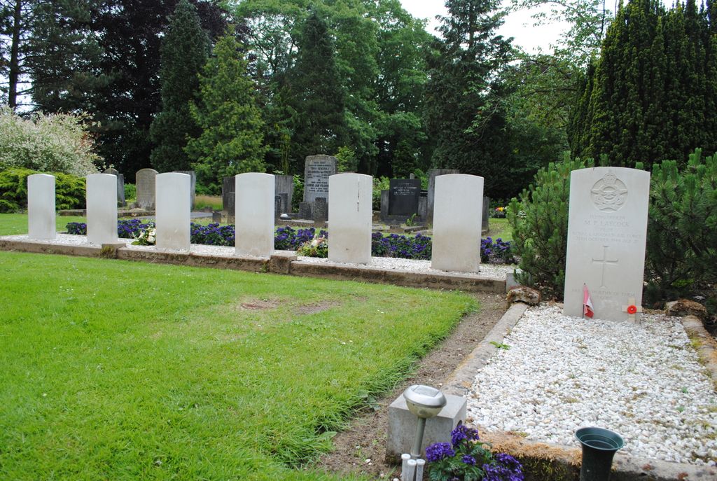
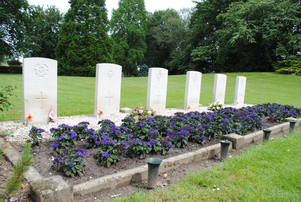
| Description | : | Voorst is a large village and commune situated on the main Zutphen-Apeldoorn-Deventer road, about 5 kilometres west of Zutphen. The village of Terwolde is 16 kilometres north of Voorst and 4 kilometres northwest of Deventer, on the west bank of the river Ijssel. The cemetery is under 3 kilometres south of the village on the road to Twello. |
frequently asked questions (FAQ):
-
Where is Terwolde General Cemetery?
Terwolde General Cemetery is located at Terwolde, Voorst Municipality ,Gelderland ,Netherlands.
-
Terwolde General Cemetery cemetery's updated grave count on graveviews.com?
0 memorials
-
Where are the coordinates of the Terwolde General Cemetery?
Latitude: 52.2589300
Longitude: 6.1102400
Nearby Cemetories:
1. Broederenkerk
Deventer, Deventer Municipality, Netherlands
Coordinate: 52.2544620, 6.1570820
2. Joodse Begraafplaats
Deventer, Deventer Municipality, Netherlands
Coordinate: 52.2604200, 6.1577160
3. Oude Begraafplaats Deventer
Deventer, Deventer Municipality, Netherlands
Coordinate: 52.2599700, 6.1582900
4. Nijbroek Algemene Begraafplaats
Nijbroek, Voorst Municipality, Netherlands
Coordinate: 52.2820600, 6.0598800
5. Diepenveen General Cemetery
Diepenveen, Deventer Municipality, Netherlands
Coordinate: 52.2908500, 6.1470200
6. Steenbrugge Cemetery
Diepenveen, Deventer Municipality, Netherlands
Coordinate: 52.2743300, 6.1777500
7. St. Antonius RK Kerkhof
De Vecht, Voorst Municipality, Netherlands
Coordinate: 52.2582100, 6.0363300
8. Voorst General Cemetery
Voorst, Voorst Municipality, Netherlands
Coordinate: 52.2041100, 6.1364900
9. Oude Begraafplaats Colmschate
Colmschate, Deventer Municipality, Netherlands
Coordinate: 52.2473100, 6.2218600
10. Gorssel General Cemetery
Gorssel, Lochem Municipality, Netherlands
Coordinate: 52.1922700, 6.2033700
11. Vaassen General Cemetery
Vaassen, Epe Municipality, Netherlands
Coordinate: 52.2823600, 5.9654300
12. Begraafplaats Wenum-Wiesel
Wenum, Apeldoorn Municipality, Netherlands
Coordinate: 52.2657500, 5.9608700
13. Duur General Cemetery
Duur, Olst-Wijhe Municipality, Netherlands
Coordinate: 52.3577300, 6.1107300
14. Joodse Begraafplaats
Den Nul, Olst-Wijhe Municipality, Netherlands
Coordinate: 52.3590800, 6.1122400
15. Apeldoorn Arnhemseweg Catholic Cemetery
Apeldoorn, Apeldoorn Municipality, Netherlands
Coordinate: 52.2062100, 5.9624700
16. Bathmen General Cemetery
Bathmen, Deventer Municipality, Netherlands
Coordinate: 52.2505400, 6.2829400
17. Apeldoorn Joodse Begraafplaats
Apeldoorn, Apeldoorn Municipality, Netherlands
Coordinate: 52.1970310, 5.9617940
18. Begraafplaats Soerenseweg
Apeldoorn, Apeldoorn Municipality, Netherlands
Coordinate: 52.2194500, 5.9395700
19. Epe General Cemetery
Epe, Epe Municipality, Netherlands
Coordinate: 52.3473700, 5.9743200
20. Zutphen General Cemetery
Zutphen, Zutphen Municipality, Netherlands
Coordinate: 52.1436300, 6.2132400
21. Begraafplaats Heidehof
Ugchelen, Apeldoorn Municipality, Netherlands
Coordinate: 52.1777800, 5.9326800
22. Almen Cemetery
Almen, Lochem Municipality, Netherlands
Coordinate: 52.1738500, 6.2861500
23. Begraafplaats Beekbergen
Beekbergen, Apeldoorn Municipality, Netherlands
Coordinate: 52.1531400, 5.9644400
24. Heerde Old General Cemetery
Heerde, Heerde Municipality, Netherlands
Coordinate: 52.3908300, 6.0354900