
| Memorials | : | 0 |
| Location | : | Den Nul, Olst-Wijhe Municipality, Netherlands |
| Coordinate | : | 52.3590800, 6.1122400 |
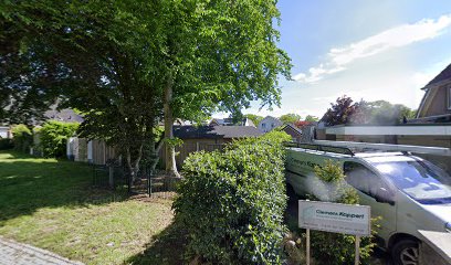
| Description | : | Located between two houses on the Beukenweg. Often considered "the most forgotten Jewish cemetery in the Netherlands", the cemetery contains one matsevah, erected in 1914. It is unclear when the cemetery was founded and whether more people are buried here. |
frequently asked questions (FAQ):
-
Where is Joodse Begraafplaats?
Joodse Begraafplaats is located at Beukenweg 6 Den Nul, Olst-Wijhe Municipality ,Overijssel , 8121ECNetherlands.
-
Joodse Begraafplaats cemetery's updated grave count on graveviews.com?
0 memorials
-
Where are the coordinates of the Joodse Begraafplaats?
Latitude: 52.3590800
Longitude: 6.1122400
Nearby Cemetories:
1. Duur General Cemetery
Duur, Olst-Wijhe Municipality, Netherlands
Coordinate: 52.3577300, 6.1107300
2. Wijhe General Cemetery
Wijhe, Olst-Wijhe Municipality, Netherlands
Coordinate: 52.4009900, 6.1525800
3. Heerde Old General Cemetery
Heerde, Heerde Municipality, Netherlands
Coordinate: 52.3908300, 6.0354900
4. Heerde Begraafplaats Engelmanskamp
Heerde, Heerde Municipality, Netherlands
Coordinate: 52.3890900, 6.0060200
5. Diepenveen General Cemetery
Diepenveen, Deventer Municipality, Netherlands
Coordinate: 52.2908500, 6.1470200
6. Nijbroek Algemene Begraafplaats
Nijbroek, Voorst Municipality, Netherlands
Coordinate: 52.2820600, 6.0598800
7. Epe General Cemetery
Epe, Epe Municipality, Netherlands
Coordinate: 52.3473700, 5.9743200
8. Windesheim General Cemetery
Windesheim, Zwolle Municipality, Netherlands
Coordinate: 52.4485900, 6.1307100
9. Steenbrugge Cemetery
Diepenveen, Deventer Municipality, Netherlands
Coordinate: 52.2743300, 6.1777500
10. Joodse Begraafplaats
Raalte Municipality, Netherlands
Coordinate: 52.3828200, 6.2677900
11. Raalte General Cemetery
Raalte, Raalte Municipality, Netherlands
Coordinate: 52.3774400, 6.2703600
12. Terwolde General Cemetery
Terwolde, Voorst Municipality, Netherlands
Coordinate: 52.2589300, 6.1102400
13. Joodse Begraafplaats
Deventer, Deventer Municipality, Netherlands
Coordinate: 52.2604200, 6.1577160
14. Oude Begraafplaats Deventer
Deventer, Deventer Municipality, Netherlands
Coordinate: 52.2599700, 6.1582900
15. Broederenkerk
Deventer, Deventer Municipality, Netherlands
Coordinate: 52.2544620, 6.1570820
16. St. Antonius RK Kerkhof
De Vecht, Voorst Municipality, Netherlands
Coordinate: 52.2582100, 6.0363300
17. Joodse Begraafplaats
Hattem Municipality, Netherlands
Coordinate: 52.4696060, 6.0762350
18. Vaassen General Cemetery
Vaassen, Epe Municipality, Netherlands
Coordinate: 52.2823600, 5.9654300
19. Oude Begraafplaats Colmschate
Colmschate, Deventer Municipality, Netherlands
Coordinate: 52.2473100, 6.2218600
20. Begraafplaats Wenum-Wiesel
Wenum, Apeldoorn Municipality, Netherlands
Coordinate: 52.2657500, 5.9608700
21. Verscholen Dorp Hidden Village Memorial
Nunspeet Municipality, Netherlands
Coordinate: 52.3363600, 5.8721700
22. De Eekelenburg
Oldebroek, Oldebroek Municipality, Netherlands
Coordinate: 52.4472600, 5.9157800
23. Bathmen General Cemetery
Bathmen, Deventer Municipality, Netherlands
Coordinate: 52.2505400, 6.2829400
24. Joodse Begraafplaats
Zwolle, Zwolle Municipality, Netherlands
Coordinate: 52.5107800, 6.1402900