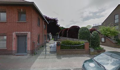
| Memorials | : | 0 |
| Location | : | Kalmthout, Arrondissement Antwerpen, Belgium |
| Coordinate | : | 51.3970500, 4.5026600 |
| Description | : | Location Information: The village of Achterbroek is located north of the town of Antwerp off the E19/A1 which runs between Antwerp and Breda, driving from Antwerp follow the E19 to junction 3 Brecht, at the T junction turn left direction Wuustwezel on the N133. Follow the N133 through the village to the junction with the N111 direction Kalmthout. Bear left on the N111 direction Kalmthout and follow this road to the village of Achterbroek, as you enter the village the cemetery is on the left before the village centre. The grave is located at the far left hand side from... Read More |
frequently asked questions (FAQ):
-
Where is Kalmthout Achterbroek Communal Cemetery?
Kalmthout Achterbroek Communal Cemetery is located at Kalmthout, Arrondissement Antwerpen ,Antwerp (Antwerpen) ,Belgium.
-
Kalmthout Achterbroek Communal Cemetery cemetery's updated grave count on graveviews.com?
0 memorials
-
Where are the coordinates of the Kalmthout Achterbroek Communal Cemetery?
Latitude: 51.3970500
Longitude: 4.5026600
Nearby Cemetories:
1. Kalmthout Centrum Cemetery
Kalmthout, Arrondissement Antwerpen, Belgium
Coordinate: 51.3826500, 4.4766500
2. Wildert Begraafplaats
Essen, Arrondissement Antwerpen, Belgium
Coordinate: 51.4277400, 4.4714200
3. Kalmthout Heide Cemetery
Kalmthout, Arrondissement Antwerpen, Belgium
Coordinate: 51.3665600, 4.4588200
4. Wuustwezel Gooreind Churchyard
Wuustwezel, Arrondissement Antwerpen, Belgium
Coordinate: 51.3581900, 4.5414800
5. Wuustwezel Churchyard
Wuustwezel, Arrondissement Antwerpen, Belgium
Coordinate: 51.3887500, 4.5992900
6. Essen Horendonk Communal Cemetery
Essen, Arrondissement Antwerpen, Belgium
Coordinate: 51.4694900, 4.5039100
7. Machsike Hadas Jewish Cemetery of Antwerp
Putte, Woensdrecht Municipality, Netherlands
Coordinate: 51.3758400, 4.3902200
8. Essen Centrum Cemetery
Essen, Arrondissement Antwerpen, Belgium
Coordinate: 51.4681100, 4.4699800
9. Kerkhof H. Cornelius
Achtmaal, Zundert Municipality, Netherlands
Coordinate: 51.4533160, 4.5828415
10. Joodse begraafplaats Frechie stichting
Putte, Woensdrecht Municipality, Netherlands
Coordinate: 51.3750720, 4.3849510
11. Shomre Hadas Jewish Cemetery of Antwerp
Putte, Woensdrecht Municipality, Netherlands
Coordinate: 51.3714320, 4.3860770
12. Brasschaat Maria Ter Heide Communal Cemetery
Brasschaat, Arrondissement Antwerpen, Belgium
Coordinate: 51.3199780, 4.5226980
13. Kapellen-Centrum Communal Cemetery
Kapellen, Arrondissement Antwerpen, Belgium
Coordinate: 51.3251400, 4.4440200
14. Putte Drihoek Communal Cemetery
Arrondissement Mechelen, Belgium
Coordinate: 51.3516030, 4.3946600
15. Begraafplaats Broeders van Huijbergen
Huijbergen, Woensdrecht Municipality, Netherlands
Coordinate: 51.4302142, 4.3778444
16. Kapellen-Hoogboom Cemetery
Kapellen, Arrondissement Antwerpen, Belgium
Coordinate: 51.3159500, 4.4611600
17. Rooms Katholieke Begraafplaats Huijbergen
Huijbergen, Woensdrecht Municipality, Netherlands
Coordinate: 51.4325978, 4.3782266
18. Rooms Katholieke Begraafplaats
Nispen, Roosendaal Municipality, Netherlands
Coordinate: 51.4826245, 4.4629658
19. Brasschaat Rustoord Communal Cemetery
Brasschaat, Arrondissement Antwerpen, Belgium
Coordinate: 51.3025820, 4.4687960
20. Scheidreef Gemeentelijke Begraafplaats
Hoogerheide, Woensdrecht Municipality, Netherlands
Coordinate: 51.4158754, 4.3427250
21. Brecht Communal cemetery
Brecht, Arrondissement Antwerpen, Belgium
Coordinate: 51.3506500, 4.6494600
22. Brasschaat Centrum Communal Cemetery
Brasschaat, Arrondissement Antwerpen, Belgium
Coordinate: 51.2921500, 4.5055640
23. Begraafplaats Schijf
Schijf, Rucphen Municipality, Netherlands
Coordinate: 51.4978952, 4.5591589
24. R.K.Parochiebegraafplaats Wouwse Plantage
Wouwse Plantage, Roosendaal Municipality, Netherlands
Coordinate: 51.4819133, 4.3909965

