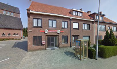
| Memorials | : | 0 |
| Location | : | Essen, Arrondissement Antwerpen, Belgium |
| Coordinate | : | 51.4694900, 4.5039100 |
| Description | : | The Cemetery is located north of the town Antwerpen off the N133, a turning off the N1 which runs from Antwerpen to Zundert. Driving from Antwerpen follow the N1 to the village of Wuustwezel, here you turn left onto the N133 towards Essen. Go through the village of Nieuwmoer and carry on to Essen. On the edge of the town is a junction, go straight over towards the town and take the next turning on the right, Watermolenstraat. Follow this road into Horendonk. Going into the village turn right past the school into Dreveneind and the cemetery is on the... Read More |
frequently asked questions (FAQ):
-
Where is Essen Horendonk Communal Cemetery?
Essen Horendonk Communal Cemetery is located at Dreveneind Essen, Arrondissement Antwerpen ,Antwerp (Antwerpen) , 2910Belgium.
-
Essen Horendonk Communal Cemetery cemetery's updated grave count on graveviews.com?
0 memorials
-
Where are the coordinates of the Essen Horendonk Communal Cemetery?
Latitude: 51.4694900
Longitude: 4.5039100
Nearby Cemetories:
1. Essen Centrum Cemetery
Essen, Arrondissement Antwerpen, Belgium
Coordinate: 51.4681100, 4.4699800
2. Rooms Katholieke Begraafplaats
Nispen, Roosendaal Municipality, Netherlands
Coordinate: 51.4826245, 4.4629658
3. Begraafplaats Schijf
Schijf, Rucphen Municipality, Netherlands
Coordinate: 51.4978952, 4.5591589
4. Wildert Begraafplaats
Essen, Arrondissement Antwerpen, Belgium
Coordinate: 51.4277400, 4.4714200
5. Kerkhof H. Cornelius
Achtmaal, Zundert Municipality, Netherlands
Coordinate: 51.4533160, 4.5828415
6. Begraafplaats Zegestede
Roosendaal, Roosendaal Municipality, Netherlands
Coordinate: 51.5338500, 4.5113600
7. Begraafplaats Rucphen
Rucphen, Rucphen Municipality, Netherlands
Coordinate: 51.5279365, 4.5526156
8. Roosendaal-en-Nispen General Cemetery
Roosendaal, Roosendaal Municipality, Netherlands
Coordinate: 51.5382800, 4.4794100
9. R.K.Parochiebegraafplaats Wouwse Plantage
Wouwse Plantage, Roosendaal Municipality, Netherlands
Coordinate: 51.4819133, 4.3909965
10. Roosendaal-en-Nispen Roman Catholic Cemetery
Roosendaal, Roosendaal Municipality, Netherlands
Coordinate: 51.5381600, 4.4718800
11. Kalmthout Achterbroek Communal Cemetery
Kalmthout, Arrondissement Antwerpen, Belgium
Coordinate: 51.3970500, 4.5026600
12. R.K.Abdij Maria Toevlucht
Klein-Zundert, Zundert Municipality, Netherlands
Coordinate: 51.4771808, 4.6376681
13. Rooms Katholieke Begraafplaats Huijbergen
Huijbergen, Woensdrecht Municipality, Netherlands
Coordinate: 51.4325978, 4.3782266
14. Kerkhof Zegge
Zegge, Rucphen Municipality, Netherlands
Coordinate: 51.5562542, 4.5147188
15. Begraafplaats Broeders van Huijbergen
Huijbergen, Woensdrecht Municipality, Netherlands
Coordinate: 51.4302142, 4.3778444
16. Kalmthout Centrum Cemetery
Kalmthout, Arrondissement Antwerpen, Belgium
Coordinate: 51.3826500, 4.4766500
17. Begraafplaats Sprundel
Sprundel, Rucphen Municipality, Netherlands
Coordinate: 51.5360801, 4.6035448
18. R.K. Begraafplaats O L Vrouw in het Woud
Wouw, Roosendaal Municipality, Netherlands
Coordinate: 51.5223800, 4.3834559
19. Roman Catholic Cemetery Klein Zundert
Klein-Zundert, Zundert Municipality, Netherlands
Coordinate: 51.4813640, 4.6555256
20. Kerkhof St. Willebrord
Sint Willebrord, Rucphen Municipality, Netherlands
Coordinate: 51.5517370, 4.5889150
21. Zundert Protestant Churchyard
Zundert, Zundert Municipality, Netherlands
Coordinate: 51.4716600, 4.6644300
22. Wuustwezel Churchyard
Wuustwezel, Arrondissement Antwerpen, Belgium
Coordinate: 51.3887500, 4.5992900
23. Kalmthout Heide Cemetery
Kalmthout, Arrondissement Antwerpen, Belgium
Coordinate: 51.3665600, 4.4588200
24. Bergen-op-Zoom War Cemetery
Bergen op Zoom, Bergen op Zoom Municipality, Netherlands
Coordinate: 51.5021200, 4.3337500

