
| Memorials | : | 0 |
| Location | : | Wuustwezel, Arrondissement Antwerpen, Belgium |
| Coordinate | : | 51.3887500, 4.5992900 |
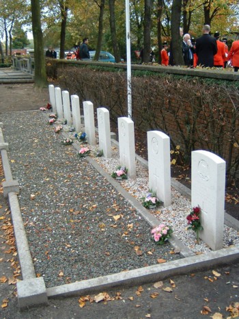
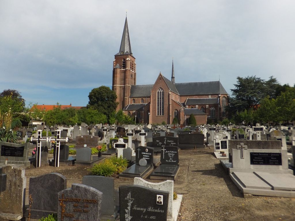
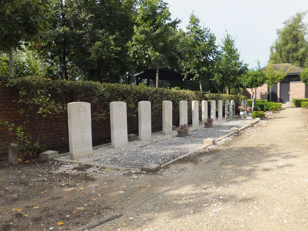
| Description | : | Location Information: The village of Wuurstwezel is located north of the town of Antwerp off the E19/A1 which runs between Antwerp and Breda, driving from Antwerp follow the E19 to junction 3 Brecht, at the T junction turn left direction Wuustwezel on the N133. Follow the N133 to the village and the church is on the left on entering the village. The graves are located along the rear wall of the churchyard. Historical Information: The British Expeditionary Force was involved in the later stages of the defence of Belgium following the German invasion in May 1940, and suffered many... Read More |
frequently asked questions (FAQ):
-
Where is Wuustwezel Churchyard?
Wuustwezel Churchyard is located at Wuustwezel, Arrondissement Antwerpen ,Antwerp (Antwerpen) ,Belgium.
-
Wuustwezel Churchyard cemetery's updated grave count on graveviews.com?
0 memorials
-
Where are the coordinates of the Wuustwezel Churchyard?
Latitude: 51.3887500
Longitude: 4.5992900
Nearby Cemetories:
1. Wuustwezel Gooreind Churchyard
Wuustwezel, Arrondissement Antwerpen, Belgium
Coordinate: 51.3581900, 4.5414800
2. Brecht Communal cemetery
Brecht, Arrondissement Antwerpen, Belgium
Coordinate: 51.3506500, 4.6494600
3. Kalmthout Achterbroek Communal Cemetery
Kalmthout, Arrondissement Antwerpen, Belgium
Coordinate: 51.3970500, 4.5026600
4. Kerkhof H. Cornelius
Achtmaal, Zundert Municipality, Netherlands
Coordinate: 51.4533160, 4.5828415
5. Kalmthout Centrum Cemetery
Kalmthout, Arrondissement Antwerpen, Belgium
Coordinate: 51.3826500, 4.4766500
6. Brasschaat Maria Ter Heide Communal Cemetery
Brasschaat, Arrondissement Antwerpen, Belgium
Coordinate: 51.3199780, 4.5226980
7. Wildert Begraafplaats
Essen, Arrondissement Antwerpen, Belgium
Coordinate: 51.4277400, 4.4714200
8. Kalmthout Heide Cemetery
Kalmthout, Arrondissement Antwerpen, Belgium
Coordinate: 51.3665600, 4.4588200
9. R.K.Abdij Maria Toevlucht
Klein-Zundert, Zundert Municipality, Netherlands
Coordinate: 51.4771808, 4.6376681
10. Zundert Protestant Churchyard
Zundert, Zundert Municipality, Netherlands
Coordinate: 51.4716600, 4.6644300
11. Sint-Job-in-'t-Goor Cemetery
Brecht, Arrondissement Antwerpen, Belgium
Coordinate: 51.2930500, 4.5802300
12. Roman Catholic Cemetery Klein Zundert
Klein-Zundert, Zundert Municipality, Netherlands
Coordinate: 51.4813640, 4.6555256
13. Essen Horendonk Communal Cemetery
Essen, Arrondissement Antwerpen, Belgium
Coordinate: 51.4694900, 4.5039100
14. Sint-Katharinakerk
Hoogstraten, Arrondissement Turnhout, Belgium
Coordinate: 51.4008900, 4.7620700
15. Rijkevorsel Centrum Cemetery
Rijkevorsel, Arrondissement Turnhout, Belgium
Coordinate: 51.3490300, 4.7532800
16. Minderhout Cemetery
Hoogstraten, Arrondissement Turnhout, Belgium
Coordinate: 51.4150700, 4.7611700
17. Westmalle Churchyard
Malle, Arrondissement Antwerpen, Belgium
Coordinate: 51.3013100, 4.6913200
18. Hoogstraten Cemetery
Hoogstraten, Arrondissement Turnhout, Belgium
Coordinate: 51.4002500, 4.7678700
19. Sint-Antonius Begraafplaats
Zoersel, Arrondissement Antwerpen, Belgium
Coordinate: 51.2816500, 4.6295100
20. Begraafplaats Schijf
Schijf, Rucphen Municipality, Netherlands
Coordinate: 51.4978952, 4.5591589
21. Kapellen-Hoogboom Cemetery
Kapellen, Arrondissement Antwerpen, Belgium
Coordinate: 51.3159500, 4.4611600
22. Brasschaat Centrum Communal Cemetery
Brasschaat, Arrondissement Antwerpen, Belgium
Coordinate: 51.2921500, 4.5055640
23. Essen Centrum Cemetery
Essen, Arrondissement Antwerpen, Belgium
Coordinate: 51.4681100, 4.4699800
24. Kapellen-Centrum Communal Cemetery
Kapellen, Arrondissement Antwerpen, Belgium
Coordinate: 51.3251400, 4.4440200