
| Memorials | : | 12 |
| Location | : | Clarksburg, Carroll County, USA |
| Coordinate | : | 35.8508230, -88.4438010 |
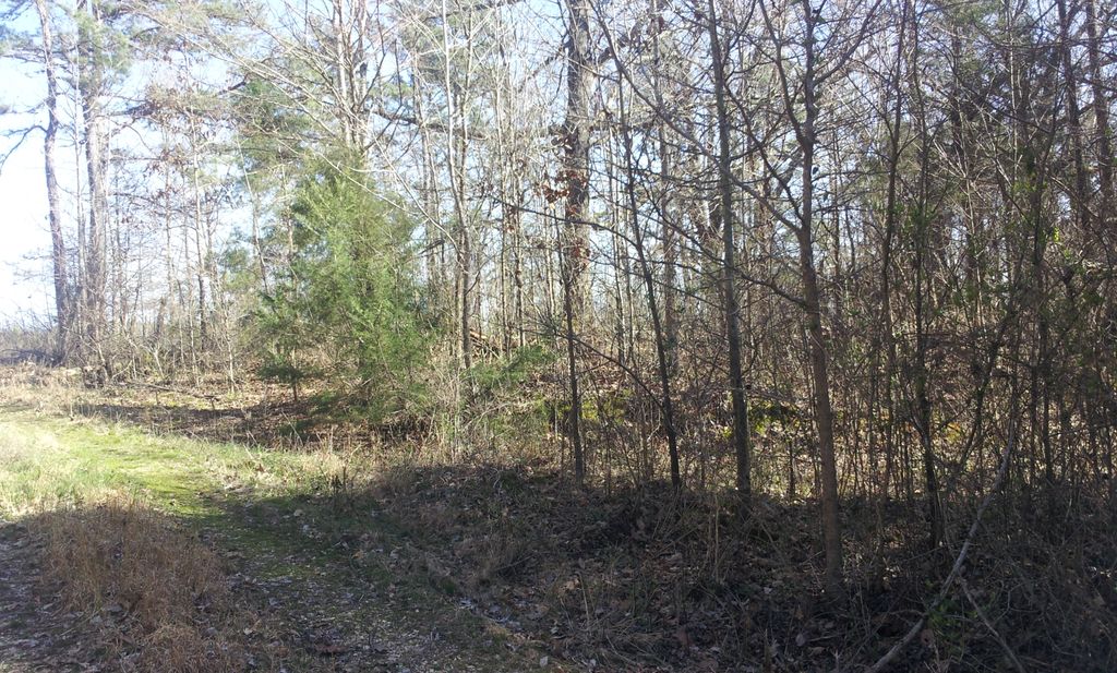
| Description | : | The cemetery is located 400 feet east of Neely Lane. The cemetery has its own deed but is surrounded by the property of Gregor Gurley. It is located in the forrest and has not been provided maintenance in many years. |
frequently asked questions (FAQ):
-
Where is Kee-Cox Family Cemetery?
Kee-Cox Family Cemetery is located at Neely Lane Clarksburg, Carroll County ,Tennessee , 38344USA.
-
Kee-Cox Family Cemetery cemetery's updated grave count on graveviews.com?
12 memorials
-
Where are the coordinates of the Kee-Cox Family Cemetery?
Latitude: 35.8508230
Longitude: -88.4438010
Nearby Cemetories:
1. Rosser Cemetery
Clarksburg, Carroll County, USA
Coordinate: 35.8403015, -88.4389038
2. Wiles Family Cemetery
Clarksburg, Carroll County, USA
Coordinate: 35.8653100, -88.4399340
3. Grant Family Cemetery
Clarksburg, Carroll County, USA
Coordinate: 35.8640310, -88.4533100
4. Pritchard Cemetery
Clarksburg, Carroll County, USA
Coordinate: 35.8421300, -88.4223200
5. Bennett-Belew Cemetery
Clarksburg, Carroll County, USA
Coordinate: 35.8688500, -88.4168800
6. Palestine Cemetery
Howley, Carroll County, USA
Coordinate: 35.8574982, -88.4783020
7. Kee Family Cemetery
Clarksburg, Carroll County, USA
Coordinate: 35.8285650, -88.4165100
8. Black Cemetery
Carroll County, USA
Coordinate: 35.8835983, -88.4610977
9. Coffman Cemetery
Parkers Crossroads, Henderson County, USA
Coordinate: 35.8149620, -88.4533040
10. Pritchard Family Cemetery
Clarksburg, Carroll County, USA
Coordinate: 35.8251250, -88.4112630
11. Brandon Cemetery
Clarksburg, Carroll County, USA
Coordinate: 35.8462140, -88.3957610
12. Smith-Hart Cemetery
Henderson County, USA
Coordinate: 35.8191986, -88.4753036
13. New Liberty Church Cemetery
Carroll County, USA
Coordinate: 35.8779730, -88.4817660
14. Roans Creek Cemetery
Clarksburg, Carroll County, USA
Coordinate: 35.8436470, -88.3937640
15. Wall Cemetery
Yuma, Carroll County, USA
Coordinate: 35.8363230, -88.3955470
16. Mount Aratt Primitive Baptist Church Cemetery
Rock Springs, Henderson County, USA
Coordinate: 35.8206000, -88.4798800
17. White Cemetery
Henderson County, USA
Coordinate: 35.8078003, -88.4392014
18. Parker's Chapel Cemetery
Clarksburg, Carroll County, USA
Coordinate: 35.8620730, -88.3916630
19. Clarksburg Cemetery
Clarksburg, Carroll County, USA
Coordinate: 35.8720730, -88.3960290
20. Brecheen Cemetery
Clarksburg, Carroll County, USA
Coordinate: 35.8498660, -88.3809860
21. Rock Springs Christian Fellowship Cemetery
Wildersville, Henderson County, USA
Coordinate: 35.7969270, -88.4473080
22. Rock Springs Cemetery
Wildersville, Henderson County, USA
Coordinate: 35.7956600, -88.4497500
23. Pearson Cemetery
Parkers Crossroads, Henderson County, USA
Coordinate: 35.7991800, -88.4190280
24. Leslie Cemetery
Carroll County, USA
Coordinate: 35.8514920, -88.3752250