
| Memorials | : | 0 |
| Location | : | Rock Springs, Henderson County, USA |
| Coordinate | : | 35.8206000, -88.4798800 |
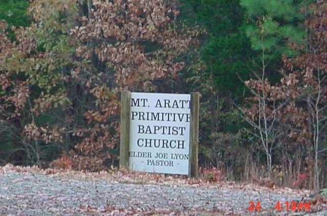
| Description | : | Located on Pearson Road near its intersection with Hart Cemetery Road in northwestern Henderson County next to Mount Aratt Primitive Baptist Church. This cemetery is noted as a black cemetery located in Henderson County, TN. |
frequently asked questions (FAQ):
-
Where is Mount Aratt Primitive Baptist Church Cemetery?
Mount Aratt Primitive Baptist Church Cemetery is located at Rock Springs, Henderson County ,Tennessee ,USA.
-
Mount Aratt Primitive Baptist Church Cemetery cemetery's updated grave count on graveviews.com?
0 memorials
-
Where are the coordinates of the Mount Aratt Primitive Baptist Church Cemetery?
Latitude: 35.8206000
Longitude: -88.4798800
Nearby Cemetories:
1. Smith-Hart Cemetery
Henderson County, USA
Coordinate: 35.8191986, -88.4753036
2. Seats Chapel Holiness Church Cemetery
Cedar Grove, Henderson County, USA
Coordinate: 35.8118860, -88.4964260
3. Mount Pleasant Church Cemetery
Wildersville, Henderson County, USA
Coordinate: 35.8095680, -88.4974310
4. Bible Hill Cemetery
Henderson County, USA
Coordinate: 35.8097000, -88.4985200
5. Rue Hammer Cemetery
Parkers Crossroads, Henderson County, USA
Coordinate: 35.8093400, -88.4994800
6. Coffman Cemetery
Parkers Crossroads, Henderson County, USA
Coordinate: 35.8149620, -88.4533040
7. Lucas Cemetery
Henderson County, USA
Coordinate: 35.7983589, -88.4765930
8. Rock Springs Cemetery
Wildersville, Henderson County, USA
Coordinate: 35.7956600, -88.4497500
9. White Cemetery
Henderson County, USA
Coordinate: 35.8078003, -88.4392014
10. Rock Springs Christian Fellowship Cemetery
Wildersville, Henderson County, USA
Coordinate: 35.7969270, -88.4473080
11. Palestine Cemetery
Howley, Carroll County, USA
Coordinate: 35.8574982, -88.4783020
12. Rosser Cemetery
Clarksburg, Carroll County, USA
Coordinate: 35.8403015, -88.4389038
13. New Bethel Cemetery
Cedar Grove, Carroll County, USA
Coordinate: 35.8319016, -88.5286636
14. Kee-Cox Family Cemetery
Clarksburg, Carroll County, USA
Coordinate: 35.8508230, -88.4438010
15. James Cemetery
Cedar Grove, Henderson County, USA
Coordinate: 35.8034590, -88.5310720
16. Douglass Cemetery
Bargerton, Henderson County, USA
Coordinate: 35.7734720, -88.4710370
17. Grant Family Cemetery
Clarksburg, Carroll County, USA
Coordinate: 35.8640310, -88.4533100
18. Pritchard Cemetery
Clarksburg, Carroll County, USA
Coordinate: 35.8421300, -88.4223200
19. Kee Family Cemetery
Clarksburg, Carroll County, USA
Coordinate: 35.8285650, -88.4165100
20. Poplar Corner Church Cemetery
Wildersville, Henderson County, USA
Coordinate: 35.7749690, -88.4483170
21. Pearson Cemetery
Parkers Crossroads, Henderson County, USA
Coordinate: 35.7991800, -88.4190280
22. Wiles Family Cemetery
Clarksburg, Carroll County, USA
Coordinate: 35.8653100, -88.4399340
23. Pritchard Family Cemetery
Clarksburg, Carroll County, USA
Coordinate: 35.8251250, -88.4112630
24. New Liberty Church Cemetery
Carroll County, USA
Coordinate: 35.8779730, -88.4817660