
| Memorials | : | 0 |
| Location | : | Evans Landing, Harrison County, USA |
| Coordinate | : | 38.0228480, -85.9366010 |
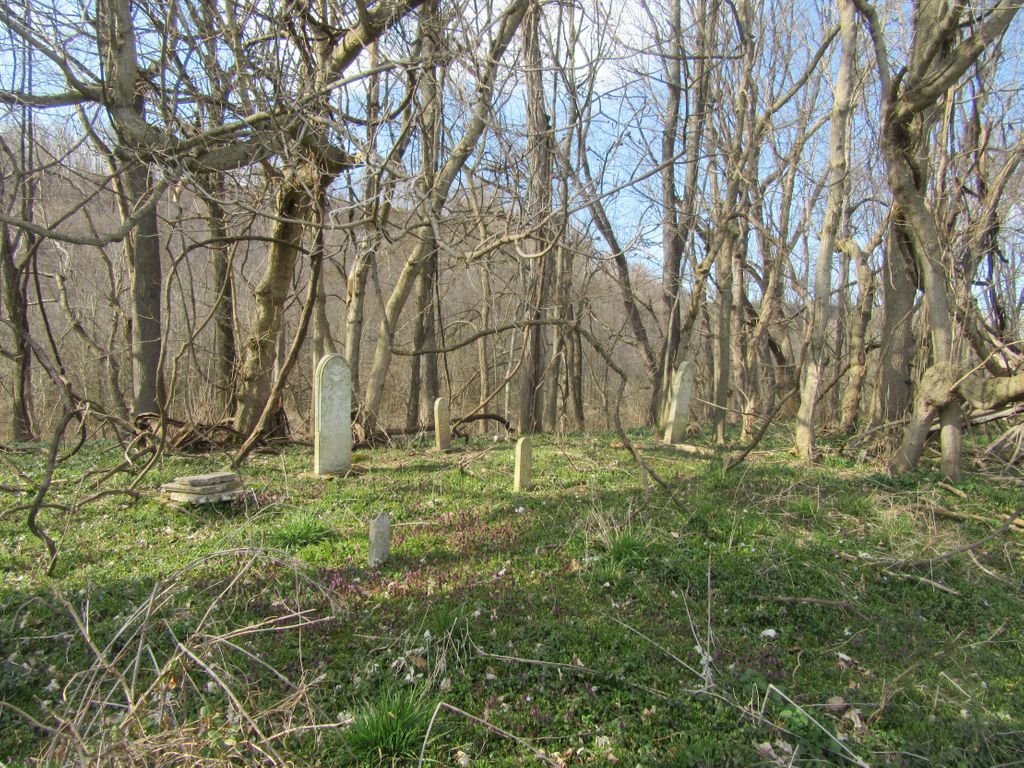
| Description | : | The cemetery is located in Taylor Township west of Indiana State Highway 111 about 0.4 miles north of its intersection with Keen Hill Road SE. Indiana Cemetery Locations, Volume 4, published by the Indiana Genealogical Society (April 2009), gives the primary cemetery name as Kimpel Cemetery. The cemetery is listed in the Cemetery and Burial Grounds Registry of the Indiana Department of Natural Resources (DNR) and in the State Historical Architectural and Archaeological Research Database (SHAARD) with Cemetery Record Number CR-31-283 (Kimbel Family Plot / Kimpel Family Plot). |
frequently asked questions (FAQ):
-
Where is Kimpel Family Cemetery?
Kimpel Family Cemetery is located at 12185 Indiana State Highway 111 Evans Landing, Harrison County ,Indiana , 47117USA.
-
Kimpel Family Cemetery cemetery's updated grave count on graveviews.com?
0 memorials
-
Where are the coordinates of the Kimpel Family Cemetery?
Latitude: 38.0228480
Longitude: -85.9366010
Nearby Cemetories:
1. Islamic Community Cemetery
Rosewood, Harrison County, USA
Coordinate: 38.0323530, -85.9414880
2. Hedden Cemetery
Rosewood, Harrison County, USA
Coordinate: 38.0328020, -85.9411350
3. Keene Cemetery
Buena Vista, Harrison County, USA
Coordinate: 38.0265320, -85.9512680
4. Colvin Cemetery
Harrison County, USA
Coordinate: 38.0381012, -85.9250031
5. Applegate Cemetery
Kosmosdale, Jefferson County, USA
Coordinate: 38.0308890, -85.9132920
6. Withers-Geoghegan Cemetery
West Point, Hardin County, USA
Coordinate: 37.9995000, -85.9436000
7. Geoghegan Cemetery
West Point, Hardin County, USA
Coordinate: 37.9977989, -85.9589005
8. Johnson Cemetery
Fort Knox, Bullitt County, USA
Coordinate: 37.9981003, -85.9132996
9. Old Log Baptist Church Cemetery
Evans Landing, Harrison County, USA
Coordinate: 38.0167330, -85.9752850
10. Fort Duffield Cemetery
West Point, Hardin County, USA
Coordinate: 37.9922660, -85.9474224
11. Jess Young Family Cemetery
West Point, Hardin County, USA
Coordinate: 37.9969554, -85.9612340
12. Strong Crawford Cemetery
Rosewood, Harrison County, USA
Coordinate: 38.0545320, -85.9262160
13. Smith Cemetery
Rosewood, Harrison County, USA
Coordinate: 38.0562690, -85.9399830
14. McNutt Cemetery
Bullitt County, USA
Coordinate: 38.0257988, -85.8942032
15. Evans Landing Presbyterian Cemetery
Evans Landing, Harrison County, USA
Coordinate: 38.0066795, -85.9872513
16. Ormes Cemetery
Shepherdsville, Bullitt County, USA
Coordinate: 37.9905560, -85.8994460
17. Fort Hill Cemetery
Fort Knox, Hardin County, USA
Coordinate: 37.9796982, -85.9281006
18. Arnold Cemetery
Louisville, Jefferson County, USA
Coordinate: 38.0452286, -85.8887288
19. Hiram Withers Cemetery
West Point, Hardin County, USA
Coordinate: 37.9802400, -85.9502320
20. Long Cemetery
Fort Knox, Hardin County, USA
Coordinate: 37.9794006, -85.9281006
21. Knob Creek Union Church Cemetery
Cupio, Bullitt County, USA
Coordinate: 38.0121910, -85.8800410
22. Brown Cemetery
Evans Landing, Harrison County, USA
Coordinate: 38.0188000, -85.9964000
23. Stowers Cemetery
Shepherdsville, Bullitt County, USA
Coordinate: 38.0011350, -85.8828970
24. Old Saint Peters Catholic Cemetery
Buena Vista, Harrison County, USA
Coordinate: 38.0473690, -85.9886200