
| Memorials | : | 523 |
| Location | : | Chelsea, Royal Borough of Kensington and Chelsea, England |
| Coordinate | : | 51.4874000, -0.1696900 |
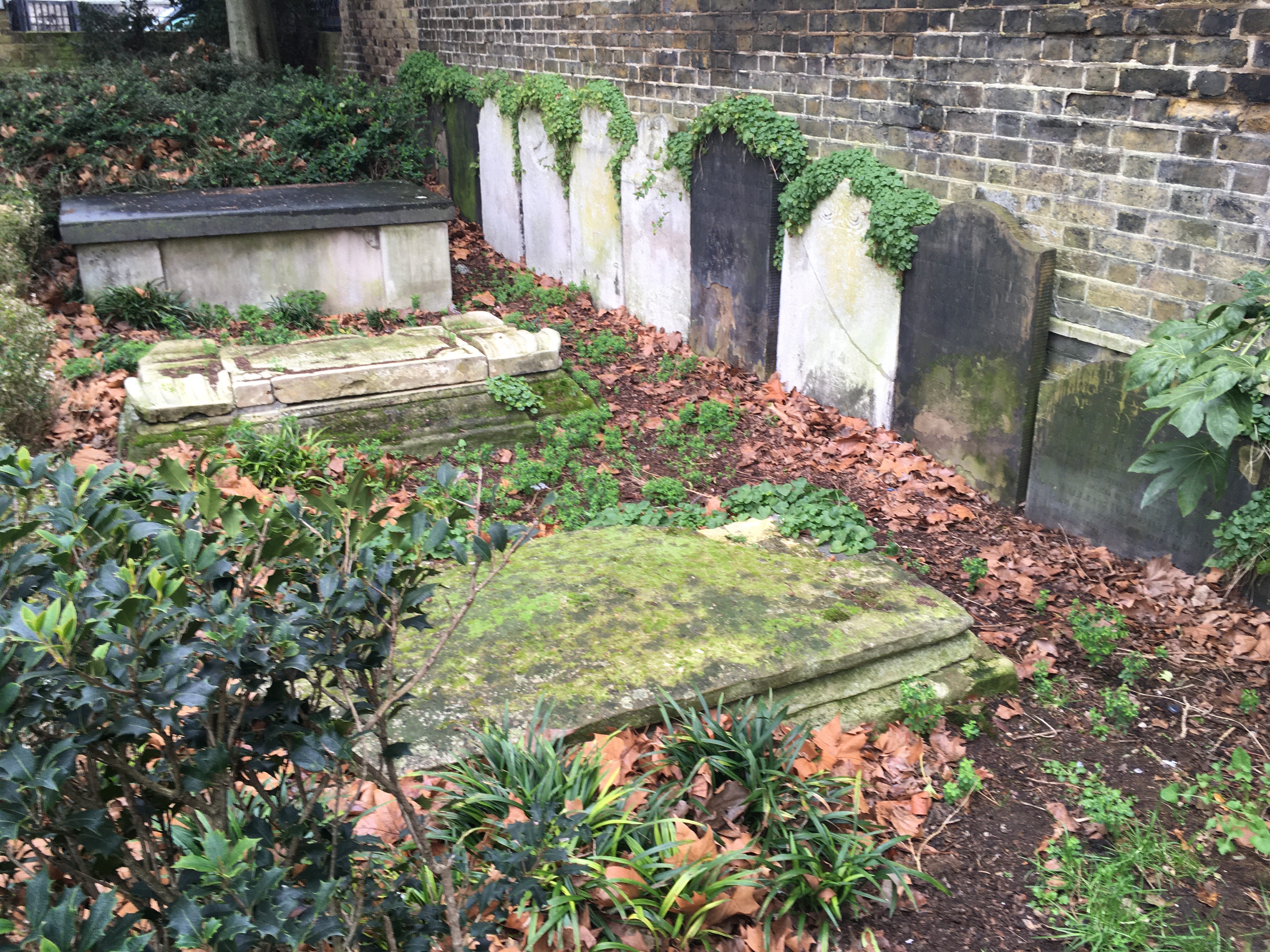
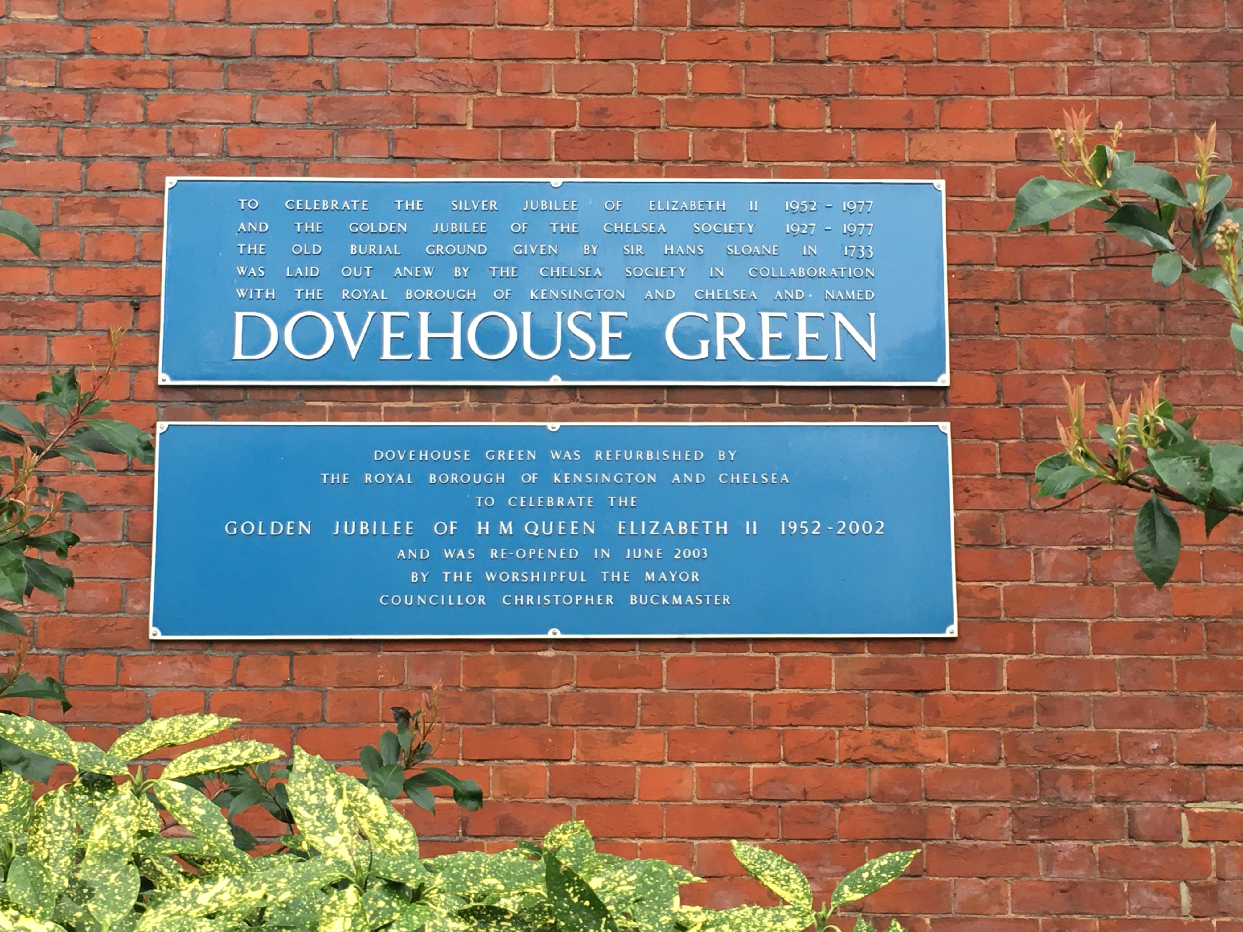
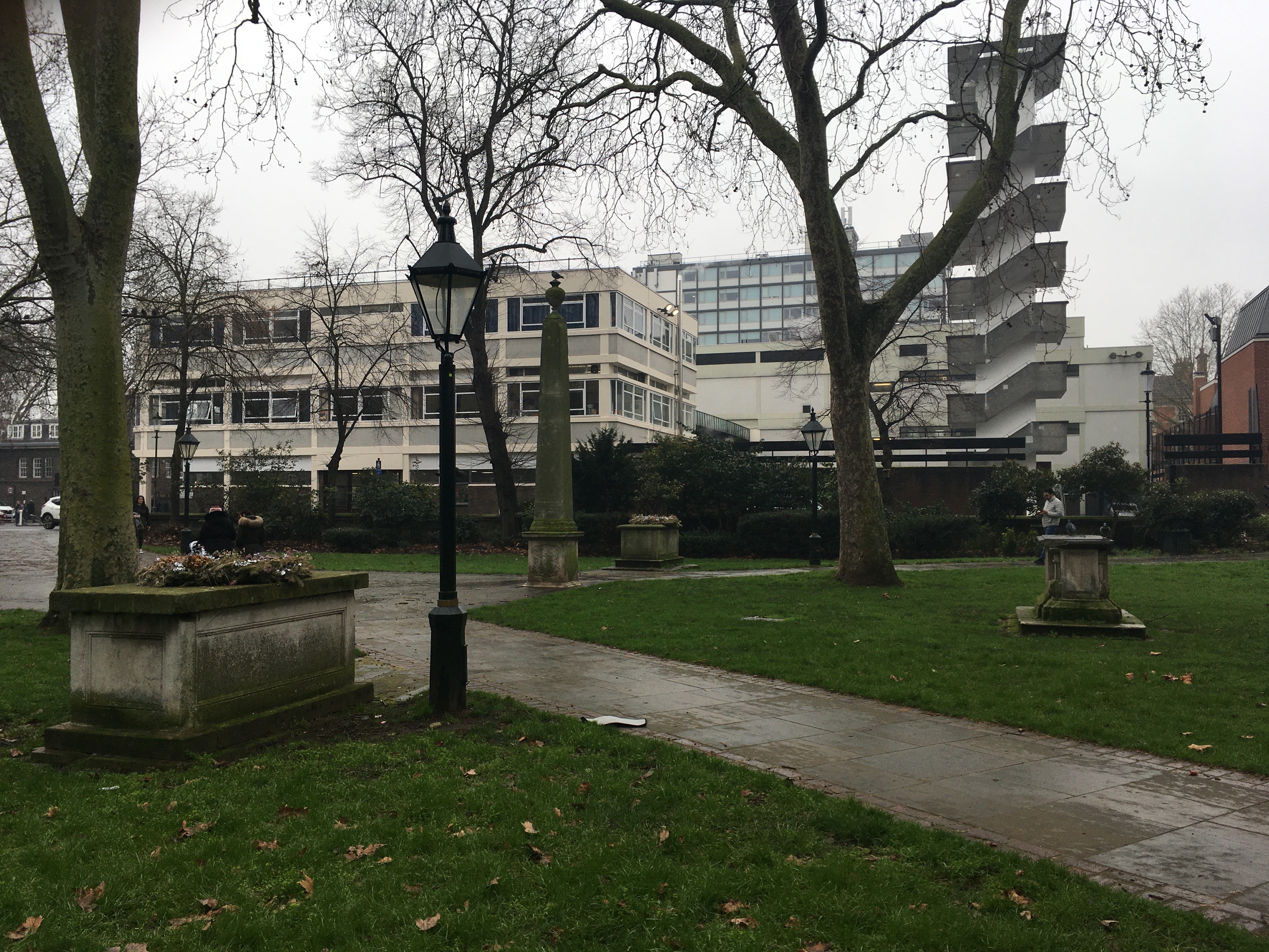
| Description | : | The land for the King's Road burial ground to serve the half mile distant Chelsea Parish Church of St Luke's (Chelsea Old Church) was originally given to the parish in 1733 by Sir Hans Sloane. The burial ground was consecrated in 1736 and later enlarged in 1790. It became known as the Old Burial Ground after provision for parish burials was supplemented in 1813 by the opening of a new burial ground, now the site of St Luke's Church and Gardens. It was closed for burials by 1882 and became a garden for inmates of the adjacent workhouse.... Read More |
frequently asked questions (FAQ):
-
Where is King’s Road Old Burial Ground?
King’s Road Old Burial Ground is located at Dovehouse Green, King's Road Chelsea, Royal Borough of Kensington and Chelsea ,Greater London , SW3 5UEEngland.
-
King’s Road Old Burial Ground cemetery's updated grave count on graveviews.com?
523 memorials
-
Where are the coordinates of the King’s Road Old Burial Ground?
Latitude: 51.4874000
Longitude: -0.1696900
Nearby Cemetories:
1. St. Lukes Graveyard
Chelsea, Royal Borough of Kensington and Chelsea, England
Coordinate: 51.4891530, -0.1692260
2. All Saints Churchyard
Chelsea, Royal Borough of Kensington and Chelsea, England
Coordinate: 51.4829865, -0.1709640
3. National Army Museum
Chelsea, Royal Borough of Kensington and Chelsea, England
Coordinate: 51.4862160, -0.1602510
4. Moravian Cemetery
Chelsea, Royal Borough of Kensington and Chelsea, England
Coordinate: 51.4824770, -0.1753010
5. All Soul's Churchyard
Chelsea, Royal Borough of Kensington and Chelsea, England
Coordinate: 51.4926500, -0.1618090
6. Royal Hospital Chelsea Burial Ground
Chelsea, Royal Borough of Kensington and Chelsea, England
Coordinate: 51.4872600, -0.1580700
7. St Marys Roman Catholic Church
Royal Borough of Kensington and Chelsea, England
Coordinate: 51.4932840, -0.1613680
8. St. Mary The Boltons
Brompton, Royal Borough of Kensington and Chelsea, England
Coordinate: 51.4892000, -0.1841000
9. Victoria and Albert Museum
Royal Borough of Kensington and Chelsea, England
Coordinate: 51.4966271, -0.1721437
10. Holy Trinity Brompton Churchyard
Knightsbridge, Royal Borough of Kensington and Chelsea, England
Coordinate: 51.4978570, -0.1699870
11. St Mary's Churchyard
Battersea, London Borough of Wandsworth, England
Coordinate: 51.4765340, -0.1755160
12. Brompton Cemetery
West Brompton, Royal Borough of Kensington and Chelsea, England
Coordinate: 51.4878670, -0.1939320
13. Kensington Gardens
Kensington, Royal Borough of Kensington and Chelsea, England
Coordinate: 51.5023994, -0.1777000
14. Saint Mary Abbots Churchyard
Kensington, Royal Borough of Kensington and Chelsea, England
Coordinate: 51.5023420, -0.1915820
15. St George the Martyr
Battersea, London Borough of Wandsworth, England
Coordinate: 51.4805000, -0.1388000
16. Westminster Cathedral
Westminster, City of Westminster, England
Coordinate: 51.4957870, -0.1394630
17. Hyde Park Memorials
Westminster, City of Westminster, England
Coordinate: 51.5087160, -0.1634220
18. Christchurch Gardens
Westminster, City of Westminster, England
Coordinate: 51.4980100, -0.1344370
19. Grosvenor Chapel
Mayfair, City of Westminster, England
Coordinate: 51.5089780, -0.1512960
20. St. George's Mount Street Burial Ground
Mayfair, City of Westminster, England
Coordinate: 51.5092230, -0.1504790
21. St George Hanover Square Burial Ground
Hyde Park, City of Westminster, England
Coordinate: 51.5132380, -0.1683300
22. St. Paul's Churchyard
Clapham, London Borough of Lambeth, England
Coordinate: 51.4688160, -0.1402690
23. St. George's Fields Burial Ground
Bayswater, City of Westminster, England
Coordinate: 51.5136400, -0.1654610
24. Marlborough House
City of Westminster, England
Coordinate: 51.5049710, -0.1363050