
| Memorials | : | 0 |
| Location | : | Kirschnerville, Lewis County, USA |
| Phone | : | (315) 346-1122 |
| Coordinate | : | 43.8948910, -75.3340000 |
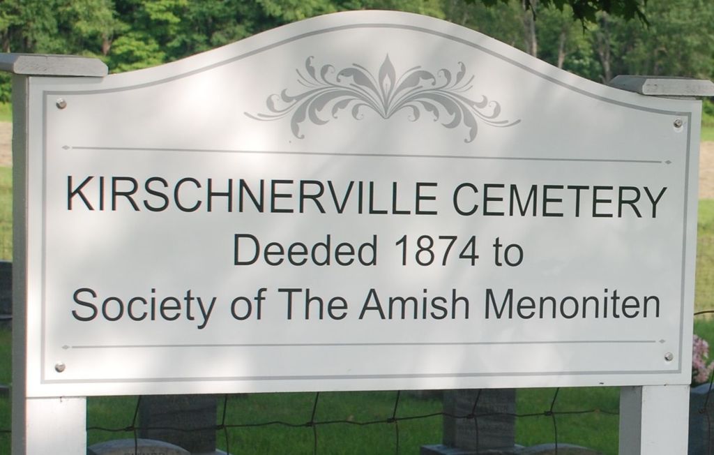
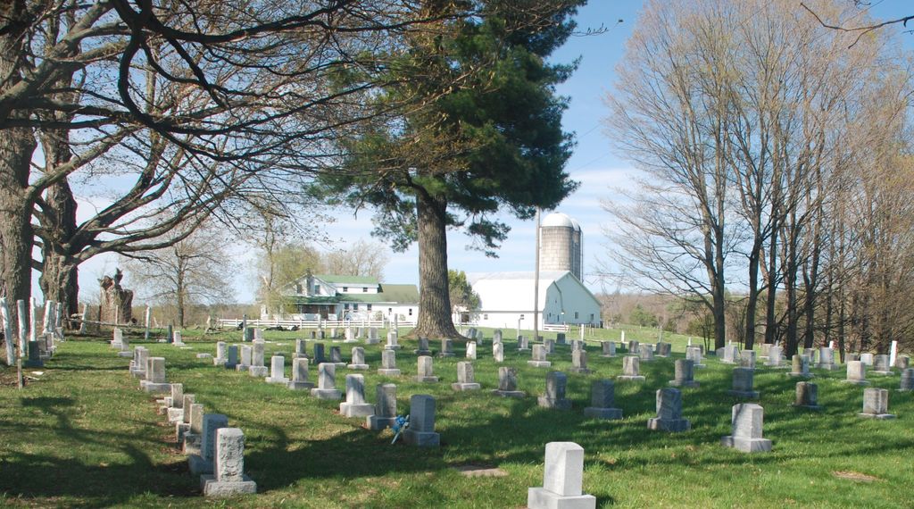
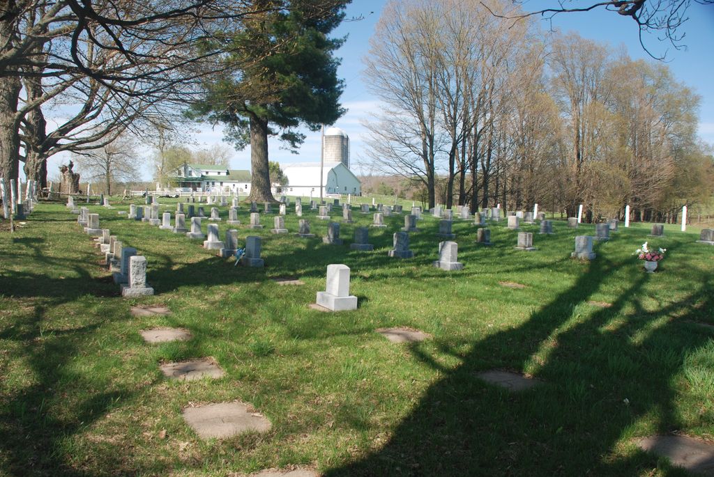
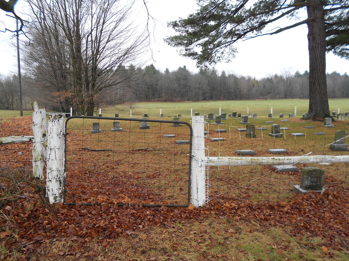
| Description | : | aka KIRSCHNERVILLE MENNONITE CEMETERY: Many of the early settlers and their families are buried there. Erie Canal Road, near the Mennonite Heritage Farm. The earliest settlers are buried at the Amish Zehr Cemetery in Croghan, NY. The Kirschnerville Mennonite Cemetery or the legal title "The Society of the Amish Menoniten of the County of Lewis" was deeded in 1874. The farmland was original to John (pioneer and minister) and Catherine Steiner Moser. Additional strips of land (ca. 1925) were assumed to be donated by neighbors, Philip Moser and Solomon Widrick. Wooden grave markers of uniformity were replaced with stone after 1982. No... Read More |
frequently asked questions (FAQ):
-
Where is Kirschnerville Cemetery?
Kirschnerville Cemetery is located at 8778 Erie Canal Road Kirschnerville, Lewis County ,New York , 13327USA.
-
Kirschnerville Cemetery cemetery's updated grave count on graveviews.com?
0 memorials
-
Where are the coordinates of the Kirschnerville Cemetery?
Latitude: 43.8948910
Longitude: -75.3340000
Nearby Cemetories:
1. Croghan Mennonite Cemetery
Lewis County, USA
Coordinate: 43.8949200, -75.3341700
2. Gospel Hall Cemetery
Belfort, Lewis County, USA
Coordinate: 43.9248900, -75.3361800
3. Saint Vincent dePaul Cemetery
Belfort, Lewis County, USA
Coordinate: 43.9297300, -75.3323000
4. Saint Stephens Cemetery
Croghan, Lewis County, USA
Coordinate: 43.9011002, -75.3855972
5. Amish Zehr Cemetery
Croghan, Lewis County, USA
Coordinate: 43.8976600, -75.3864880
6. Basselin Cemetery
Croghan, Lewis County, USA
Coordinate: 43.8944016, -75.3921967
7. Jacox Cemetery
Lewis County, USA
Coordinate: 43.9339700, -75.3121900
8. Dewight Jacox Cemetery
Belfort, Lewis County, USA
Coordinate: 43.9363740, -75.3047160
9. Croghan Apostolic Christian Cemetery
Croghan, Lewis County, USA
Coordinate: 43.8688090, -75.3914670
10. Riverside Cemetery
Beaver Falls, Lewis County, USA
Coordinate: 43.8854170, -75.4271670
11. Beaver Falls New Cemetery
Beaver Falls, Lewis County, USA
Coordinate: 43.8871390, -75.4400280
12. Saint Peters Catholic Cemetery
New Bremen, Lewis County, USA
Coordinate: 43.8388000, -75.4220900
13. Indian River Cemetery
Indian River, Lewis County, USA
Coordinate: 43.9766670, -75.3716670
14. First Mennonite Church Cemetery
New Bremen, Lewis County, USA
Coordinate: 43.8398460, -75.4262460
15. Seventh-Day Baptists Settlement Cemetery
Watson, Lewis County, USA
Coordinate: 43.8108330, -75.3883330
16. Petries Corners Cemetery
Petries Corners, Lewis County, USA
Coordinate: 43.8037100, -75.3626600
17. Campville Cemetery
Watson, Lewis County, USA
Coordinate: 43.8008400, -75.3541500
18. Wetmore Cemetery
Lewis County, USA
Coordinate: 43.8008003, -75.3544006
19. New Bremen Rural Cemetery
New Bremen, Lewis County, USA
Coordinate: 43.8376100, -75.4422400
20. Crystal Light Mennonite Church Cemetery
New Bremen, Lewis County, USA
Coordinate: 43.8358530, -75.4416550
21. Naumburg Mennonite Cemetery
Castorland, Lewis County, USA
Coordinate: 43.9011240, -75.4912660
22. Jerden Falls Cemetery
Jerden Falls, Lewis County, USA
Coordinate: 44.0112170, -75.3192500
23. Union Cemetery
Naumburg, Lewis County, USA
Coordinate: 43.9061012, -75.5008011
24. Sperryville Cemetery
Sperryville, Lewis County, USA
Coordinate: 43.7731600, -75.3103900