
| Memorials | : | 20 |
| Location | : | Eda kommun, Sweden |
| Coordinate | : | 59.8021420, 12.2477260 |
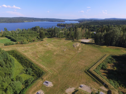
| Description | : | köla Parish Varmland Kola Cemetery https://www.google.com/maps/@59.8021418,12.2477264,494m/data=!3m1!1e3?hl=en-US |
frequently asked questions (FAQ):
-
Where is Köla Parish Cemetery?
Köla Parish Cemetery is located at Eda kommun ,Värmlands län ,Sweden.
-
Köla Parish Cemetery cemetery's updated grave count on graveviews.com?
20 memorials
-
Where are the coordinates of the Köla Parish Cemetery?
Latitude: 59.8021420
Longitude: 12.2477260
Nearby Cemetories:
1. Eda Kyrkogård
Charlottenberg, Eda kommun, Sweden
Coordinate: 59.8290500, 12.3148400
2. Järnskog Parish Cemetery
Eda kommun, Sweden
Coordinate: 59.6888000, 12.1474000
3. Vestmarka
Skotterud, Eidskog kommune, Norway
Coordinate: 59.9273000, 11.9902000
4. Austmarka Church Cemetery
Austmarka, Kongsvinger kommune, Norway
Coordinate: 60.1003704, 12.3249278
5. Brunskog Cemetery
Brunskog, Arvika kommun, Sweden
Coordinate: 59.6539420, 12.8926770
6. Holmedal Kyrka
Selen, Årjängs kommun, Sweden
Coordinate: 59.4736750, 11.9599380
7. Løken Cemetery
Loken, Aurskog-Høland kommune, Norway
Coordinate: 59.7971630, 11.4682240
8. Vinger Cemetery
Kongsvinger, Kongsvinger kommune, Norway
Coordinate: 60.1947560, 12.0096070
9. Aurskog kirkegård
Aurskog-Høland kommune, Norway
Coordinate: 59.9269310, 11.4560080
10. Oymark Church
Orje, Marker kommune, Norway
Coordinate: 59.4198227, 11.6639303
11. Östra Amtervik kyrkogård
Sunne kommun, Sweden
Coordinate: 59.7331050, 13.1978560
12. Auli
Nes, Asker kommune, Norway
Coordinate: 60.0374870, 11.3992330
13. Sillerud Parish Church Cemetery
Sillerud, Årjängs kommun, Sweden
Coordinate: 59.3087917, 12.3109972
14. Trøgstad Cemetery
Skjønhaug, Trøgstad kommune, Norway
Coordinate: 59.6364180, 11.3132480
15. Aarnes Cemetery
Årnes, Nes kommune, Norway
Coordinate: 60.1251790, 11.4719160
16. Ullern
Ulleren, Sør-Odal kommune, Norway
Coordinate: 60.2128180, 11.6351600
17. Blaker Kirkegård
Sorumsand, Sørum kommune, Norway
Coordinate: 60.0015830, 11.3016500
18. Brandval Parish Cemetery
Brandval, Kongsvinger kommune, Norway
Coordinate: 60.3160760, 12.0144770
19. Nes Kirke
Vormsund, Nes kommune, Norway
Coordinate: 60.1619024, 11.4500313
20. Sørum kirkegård
Sørum kommune, Norway
Coordinate: 60.0065970, 11.2347250
21. Gillberga Kyrka
Gillberga, Säffle kommun, Sweden
Coordinate: 59.3214500, 12.7781200
22. Skallerud Parish Cemetery
Skallerud, Kils kommun, Sweden
Coordinate: 59.5000000, 13.1666670
23. Enebakk
Enebakk kommune, Norway
Coordinate: 59.7621100, 11.1464500
24. Borgvik Lutheran Church Graveyard
Borgvik, Grums kommun, Sweden
Coordinate: 59.3666649, 12.9333334