
| Memorials | : | 0 |
| Location | : | Skotterud, Eidskog kommune, Norway |
| Coordinate | : | 59.9273000, 11.9902000 |
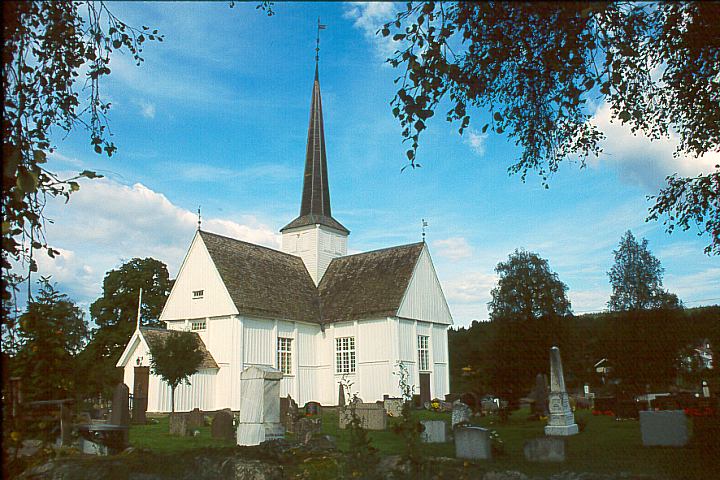
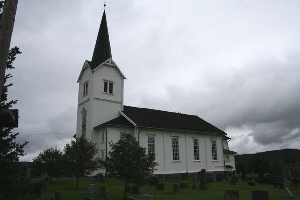
| Description | : | Eidskog and Vestmarka are two different Churches and cemeteries, Vestmarka is: Vestmarka Church in Vestmarka parish in Vinger and Odal deanery. Map data © 2017 Google Terms of Use GPS / POI: 59.9273,11.9902 GPS / UTM: 331792E, 6647136N BUILT: 1883 COUNTY: Hedmark MUNICIPALITY: Eidskog Diocese: Hamar Joint: Eidskog Joint Parish SEATING: 300 BUILDING GROUP: Sokn Church |
frequently asked questions (FAQ):
-
Where is Vestmarka?
Vestmarka is located at Skotterud, Eidskog kommune ,Hedmark fylke ,Norway.
-
Vestmarka cemetery's updated grave count on graveviews.com?
0 memorials
-
Where are the coordinates of the Vestmarka?
Latitude: 59.9273000
Longitude: 11.9902000
Nearby Cemetories:
1. Köla Parish Cemetery
Eda kommun, Sweden
Coordinate: 59.8021420, 12.2477260
2. Eda Kyrkogård
Charlottenberg, Eda kommun, Sweden
Coordinate: 59.8290500, 12.3148400
3. Austmarka Church Cemetery
Austmarka, Kongsvinger kommune, Norway
Coordinate: 60.1003704, 12.3249278
4. Järnskog Parish Cemetery
Eda kommun, Sweden
Coordinate: 59.6888000, 12.1474000
5. Vinger Cemetery
Kongsvinger, Kongsvinger kommune, Norway
Coordinate: 60.1947560, 12.0096070
6. Aurskog kirkegård
Aurskog-Høland kommune, Norway
Coordinate: 59.9269310, 11.4560080
7. Løken Cemetery
Loken, Aurskog-Høland kommune, Norway
Coordinate: 59.7971630, 11.4682240
8. Auli
Nes, Asker kommune, Norway
Coordinate: 60.0374870, 11.3992330
9. Aarnes Cemetery
Årnes, Nes kommune, Norway
Coordinate: 60.1251790, 11.4719160
10. Ullern
Ulleren, Sør-Odal kommune, Norway
Coordinate: 60.2128180, 11.6351600
11. Blaker Kirkegård
Sorumsand, Sørum kommune, Norway
Coordinate: 60.0015830, 11.3016500
12. Nes Kirke
Vormsund, Nes kommune, Norway
Coordinate: 60.1619024, 11.4500313
13. Sørum kirkegård
Sørum kommune, Norway
Coordinate: 60.0065970, 11.2347250
14. Brandval Parish Cemetery
Brandval, Kongsvinger kommune, Norway
Coordinate: 60.3160760, 12.0144770
15. Ullensaker Cemetery
Jessheim, Ullensaker kommune, Norway
Coordinate: 60.0839860, 11.1654040
16. Trøgstad Cemetery
Skjønhaug, Trøgstad kommune, Norway
Coordinate: 59.6364180, 11.3132480
17. Holmedal Kyrka
Selen, Årjängs kommun, Sweden
Coordinate: 59.4736750, 11.9599380
18. Rælingen kirkegård
Fjerdingby, Rælingen kommune, Norway
Coordinate: 59.9207950, 11.0832020
19. Lillestrøm
Lillestrom, Skedsmo kommune, Norway
Coordinate: 59.9500008, 11.0833330
20. Enebakk
Enebakk kommune, Norway
Coordinate: 59.7621100, 11.1464500
21. Skedsmo kirkegaard
Skedsmo kommune, Norway
Coordinate: 59.9942540, 11.0464590
22. Hovin Cemetery
Jessheim, Ullensaker kommune, Norway
Coordinate: 60.1424000, 11.1257800
23. Stalsberghagen
Lillestrom, Skedsmo kommune, Norway
Coordinate: 59.9458370, 11.0213320
24. Lørenskog Cemetery
Lørenskog kommune, Norway
Coordinate: 59.9249280, 10.9863810