| Memorials | : | 59 |
| Location | : | Fareham, Fareham Borough, England |
| Coordinate | : | 50.8849120, -1.2043980 |
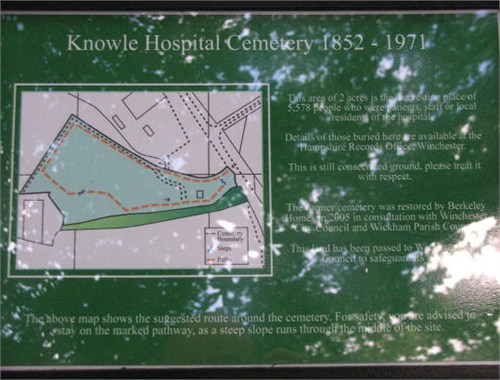
| Description | : | The Knowle Hospital formerly The Hampshire County Lunatic Asylum was in operation from 1852 and closed during 1996. Knowle Hosptial was designed as a psychiatric hospital by the architect J. Harris and was built near Fareham in Hampshire. The main building still remains although has long been developed into modern apartments and the surrounding buildings have been knocked down to make way for new housing. The Asylum's graveyard still remains, although now old and it would seem forgotten. Trees are now growing through the graves which has caused the headstones to crack and break. The paupers graves in the older part of the... Read More |
frequently asked questions (FAQ):
-
Where is Knowle Hospital Cemetery?
Knowle Hospital Cemetery is located at Fareham, Fareham Borough ,Hampshire ,England.
-
Knowle Hospital Cemetery cemetery's updated grave count on graveviews.com?
59 memorials
-
Where are the coordinates of the Knowle Hospital Cemetery?
Latitude: 50.8849120
Longitude: -1.2043980
Nearby Cemetories:
1. St Nicholas Churchyard
Wickham, City of Winchester, England
Coordinate: 50.8994865, -1.1827040
2. Fareham Cemetery
Fareham, Fareham Borough, England
Coordinate: 50.8623050, -1.1795840
3. St. John the Baptist Churchyard
Shedfield, City of Winchester, England
Coordinate: 50.9161100, -1.2023900
4. St. Peter and St. Paul Churchyard
Fareham, Fareham Borough, England
Coordinate: 50.8556300, -1.1753200
5. Holy Trinity Churchyard
Fareham, Fareham Borough, England
Coordinate: 50.8522480, -1.1834370
6. St. Peter's Churchyard
Titchfield, Fareham Borough, England
Coordinate: 50.8490620, -1.2330780
7. St. Nicholas' Churchyard
Boarhunt, City of Winchester, England
Coordinate: 50.8709800, -1.1442000
8. Posbrook Lane Cemetery
Titchfield, Fareham Borough, England
Coordinate: 50.8463100, -1.2403000
9. St John's Cemetery
Locks Heath, Fareham Borough, England
Coordinate: 50.8608400, -1.2651570
10. St Peter Churchyard
Curdridge, City of Winchester, England
Coordinate: 50.9219470, -1.2499850
11. St Bartholomew Churchyard
Botley, Eastleigh Borough, England
Coordinate: 50.9048000, -1.2754000
12. Crofton Cemetery
Stubbington, Fareham Borough, England
Coordinate: 50.8364160, -1.2173260
13. St Edmund Churchyard
Stubbington, Fareham Borough, England
Coordinate: 50.8345130, -1.2185160
14. Crofton Old Churchyard
Stubbington, Fareham Borough, England
Coordinate: 50.8344830, -1.2183660
15. Holy Trinity Churchyard
Newtown, City of Winchester, England
Coordinate: 50.9100400, -1.1322400
16. All Saints Churchyard
Botley, Eastleigh Borough, England
Coordinate: 50.9143000, -1.2737000
17. St Paul Churchyard
Sarisbury, Fareham Borough, England
Coordinate: 50.8756100, -1.2870670
18. Portchester Crematorium Gardens
Portchester, Fareham Borough, England
Coordinate: 50.8499680, -1.1382190
19. Holly Hill Cemetery
Sarisbury, Fareham Borough, England
Coordinate: 50.8678930, -1.2888890
20. St. James' Churchyard
Southwick, City of Winchester, England
Coordinate: 50.8739800, -1.1113800
21. St. Barnabas Churchyard
Swanmore, City of Winchester, England
Coordinate: 50.9443800, -1.1809100
22. St. Leonard Churchyard
Bursledon, Eastleigh Borough, England
Coordinate: 50.8850230, -1.3068370
23. St Mary Churchyard
Warsash, Fareham Borough, England
Coordinate: 50.8473220, -1.2910610
24. White Fathers' Priory Graveyard
City of Winchester, England
Coordinate: 50.9533740, -1.2216990


