
| Memorials | : | 46 |
| Location | : | Botley, Eastleigh Borough, England |
| Coordinate | : | 50.9143000, -1.2737000 |
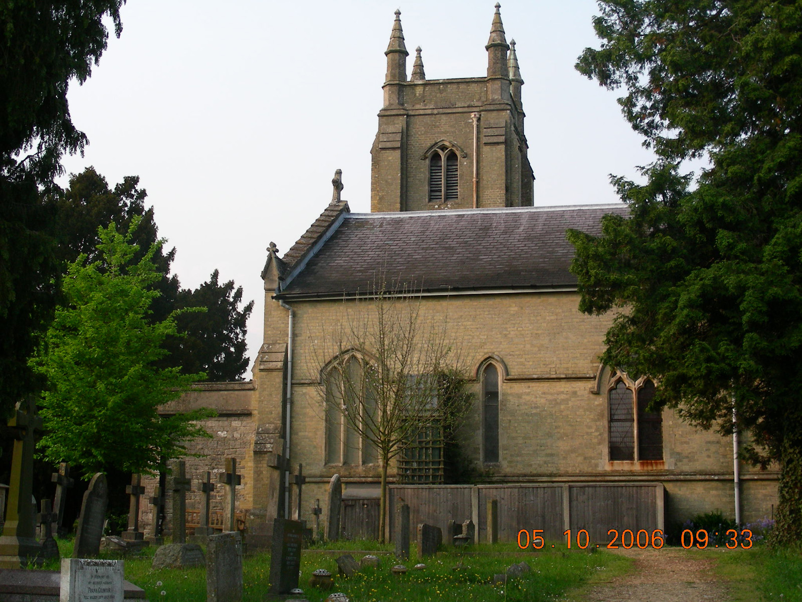
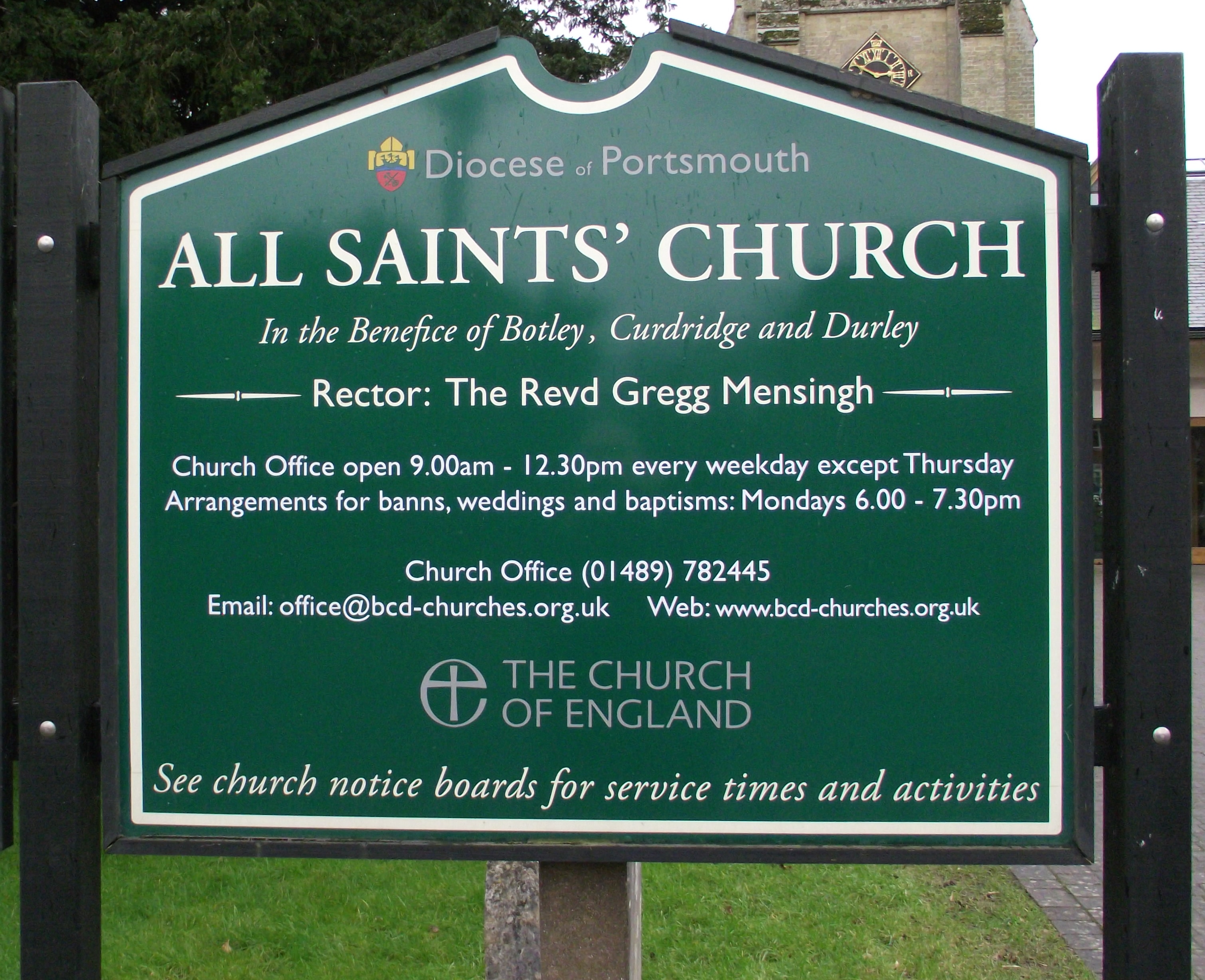
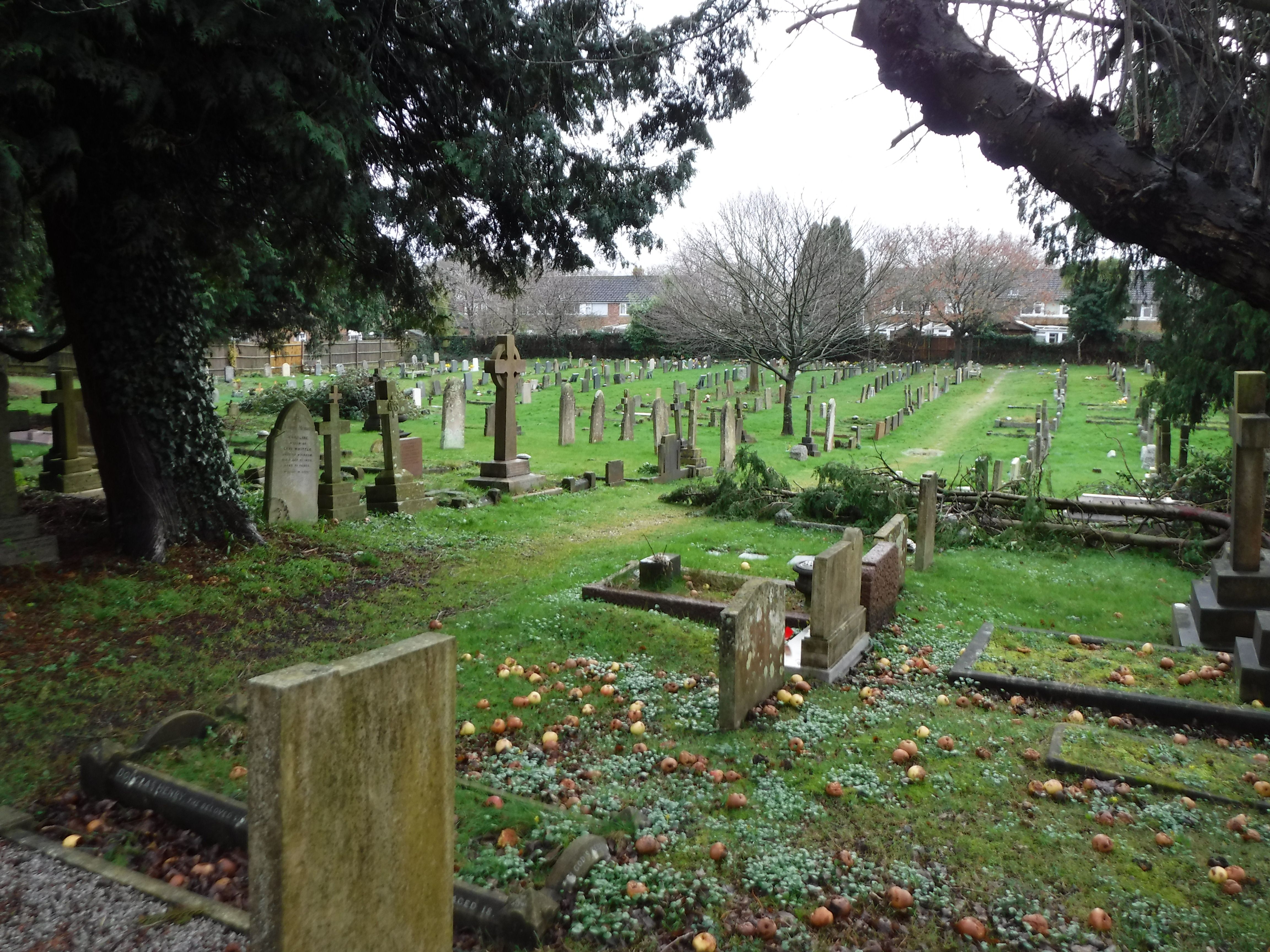
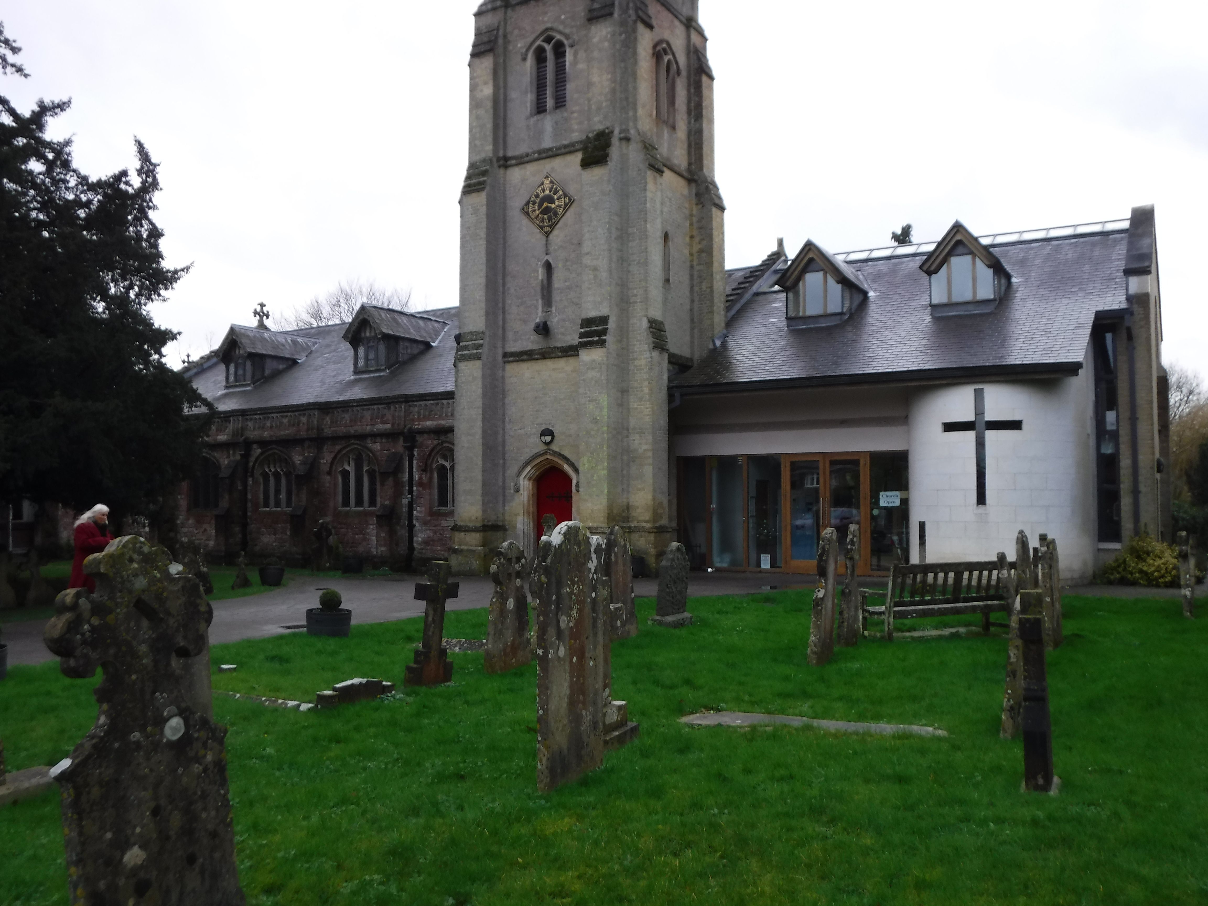
| Description | : | This is the main church for Botley Parish. It was consecrated at a service held on 22 August 1836 and replaced the old All Saints parish church located south of the village of Botley. The old parish church was rededicated as St Bartholomew. An old cemetery is also found in St Bartholomew's churchyard. Burials listed in parish records prior to the consecration of the new All Saints churchyard likely took place in the St Bartholomew churchyard. |
frequently asked questions (FAQ):
-
Where is All Saints Churchyard?
All Saints Churchyard is located at High Street Botley, Eastleigh Borough ,Hampshire , SO30 2EAEngland.
-
All Saints Churchyard cemetery's updated grave count on graveviews.com?
46 memorials
-
Where are the coordinates of the All Saints Churchyard?
Latitude: 50.9143000
Longitude: -1.2737000
Nearby Cemetories:
1. St Bartholomew Churchyard
Botley, Eastleigh Borough, England
Coordinate: 50.9048000, -1.2754000
2. St Peter Churchyard
Curdridge, City of Winchester, England
Coordinate: 50.9219470, -1.2499850
3. St John the Evangelist Churchyard
Hedge End, Eastleigh Borough, England
Coordinate: 50.9089200, -1.3091100
4. Albert Road Cemetery
Hedge End, Eastleigh Borough, England
Coordinate: 50.9066535, -1.3099266
5. Wessex Vale Crematorium
West End, Eastleigh Borough, England
Coordinate: 50.9376550, -1.3054100
6. St. Leonard Churchyard
Bursledon, Eastleigh Borough, England
Coordinate: 50.8850230, -1.3068370
7. Holy Cross Churchyard
Durley, City of Winchester, England
Coordinate: 50.9500800, -1.2822000
8. St. James' Church Cemetery
West End, Eastleigh Borough, England
Coordinate: 50.9267690, -1.3326580
9. St Paul Churchyard
Sarisbury, Fareham Borough, England
Coordinate: 50.8756100, -1.2870670
10. West End Cemetery and Memorial Gardens
West End, Eastleigh Borough, England
Coordinate: 50.9342600, -1.3316300
11. St James Churchyard
West End, Eastleigh Borough, England
Coordinate: 50.9243200, -1.3382300
12. St. John the Baptist Churchyard
Shedfield, City of Winchester, England
Coordinate: 50.9161100, -1.2023900
13. Holly Hill Cemetery
Sarisbury, Fareham Borough, England
Coordinate: 50.8678930, -1.2888890
14. Redcote Convent Cemetery
Bitterne, Southampton Unitary Authority, England
Coordinate: 50.9168600, -1.3510700
15. Fair Oak Cemetery
Fair Oak, Eastleigh Borough, England
Coordinate: 50.9615900, -1.2979800
16. White Fathers' Priory Graveyard
City of Winchester, England
Coordinate: 50.9533740, -1.2216990
17. Knowle Hospital Cemetery
Fareham, Fareham Borough, England
Coordinate: 50.8849120, -1.2043980
18. St Thomas Churchyard
Fair Oak, Eastleigh Borough, England
Coordinate: 50.9651300, -1.2966400
19. St Mary the Virgin Churchyard
Hound, Eastleigh Borough, England
Coordinate: 50.8762820, -1.3322160
20. St Mary Extra Cemetery
Southampton, Southampton Unitary Authority, England
Coordinate: 50.8948700, -1.3522600
21. Holy Saviour Churchyard
Bitterne, Southampton Unitary Authority, England
Coordinate: 50.9138840, -1.3583560
22. St John's Cemetery
Locks Heath, Fareham Borough, England
Coordinate: 50.8608400, -1.2651570
23. St Mary Churchyard
Sholing, Southampton Unitary Authority, England
Coordinate: 50.8991260, -1.3571350
24. St Peter Churchyard
Bishops Waltham, City of Winchester, England
Coordinate: 50.9560500, -1.2093900