
| Memorials | : | 3 |
| Location | : | Bell County, USA |
| Coordinate | : | 36.9140180, -83.5397530 |
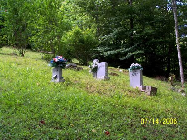
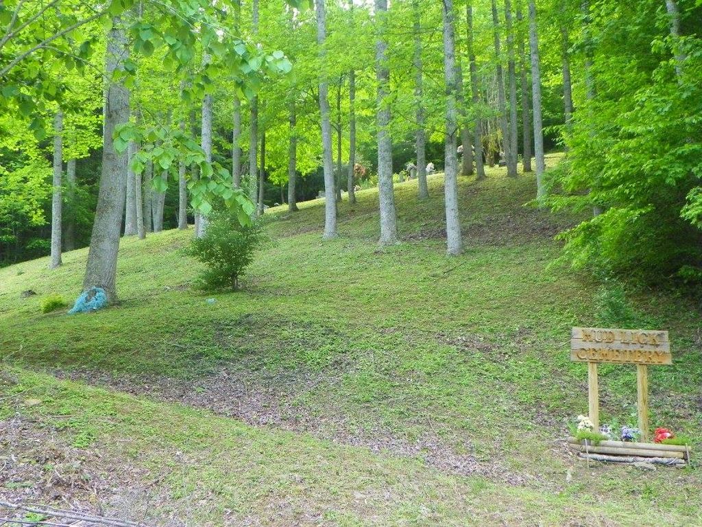
| Description | : | Location-Rt 66 to Redbird, right on Rt 2011. Cemetery is on right side of 2011 at the entrance to Mudlick Branch, on the hill. AKA Mudlick Cemetery |
frequently asked questions (FAQ):
-
Where is Knuckles Family Cemetery #3?
Knuckles Family Cemetery #3 is located at aka Mud Lick Cemetery Bell County ,Kentucky ,USA.
-
Knuckles Family Cemetery #3 cemetery's updated grave count on graveviews.com?
1 memorials
-
Where are the coordinates of the Knuckles Family Cemetery #3?
Latitude: 36.9140180
Longitude: -83.5397530
Nearby Cemetories:
1. Mudlick Cemetery
Beverly, Bell County, USA
Coordinate: 36.9139978, -83.5398980
2. Asher Cemetery #4
Bell County, USA
Coordinate: 36.9371986, -83.5430984
3. Asher Cemetery #1
Beverly, Bell County, USA
Coordinate: 36.9374350, -83.5441110
4. Saylor Cemetery #2
Field, Bell County, USA
Coordinate: 36.8910700, -83.5684100
5. Phillips Fork Cemetery
Warbranch, Leslie County, USA
Coordinate: 36.9250810, -83.4953370
6. Honey Branch Cemetery
Helton, Leslie County, USA
Coordinate: 36.9063988, -83.4728012
7. Simpson Family Cemetery
Helton, Leslie County, USA
Coordinate: 36.9059440, -83.4685470
8. Darbys Branch Cemetery #2
Brightshade, Clay County, USA
Coordinate: 36.9655200, -83.5873000
9. Asher Cemetery
Brightshade, Clay County, USA
Coordinate: 36.9651700, -83.5938100
10. Darbys Branch Cemetery #1
Brightshade, Clay County, USA
Coordinate: 36.9627600, -83.6077900
11. Lower Salt Trace Cemetery
Bledsoe, Harlan County, USA
Coordinate: 36.8626590, -83.4587710
12. Simpson-Fee Family Cemetery
Warbranch, Leslie County, USA
Coordinate: 36.9721792, -83.4612892
13. Grubb Cemetery
Brightshade, Clay County, USA
Coordinate: 36.9749200, -83.6205900
14. Rye Cove Cemetery
Warbranch, Leslie County, USA
Coordinate: 36.9709130, -83.4518710
15. Ora Jackson Cemetery
Brightshade, Clay County, USA
Coordinate: 36.9763990, -83.6216880
16. Indian Grave Branch Cemetery
Brightshade, Clay County, USA
Coordinate: 36.9869200, -83.6068200
17. Jackson Cemetery #3
Brightshade, Clay County, USA
Coordinate: 36.9721800, -83.6266400
18. Asher Cemetery
Queendale, Clay County, USA
Coordinate: 37.0041000, -83.5277000
19. Harrison Mills Cemetery
Flat Lick, Knox County, USA
Coordinate: 36.9242327, -83.6525923
20. Stewart Cemetery - Old Field Branch
Brightshade, Clay County, USA
Coordinate: 36.9708100, -83.6316600
21. Caldwell Family Cemetery
Warbranch, Leslie County, USA
Coordinate: 36.9675400, -83.4433000
22. Dillion Asher Cemetery
Queendale, Clay County, USA
Coordinate: 37.0080240, -83.5270360
23. Brummett Cemetery
Arjay, Bell County, USA
Coordinate: 36.8387850, -83.6182680
24. Abe Jackson Cemetery
Brightshade, Clay County, USA
Coordinate: 36.9867040, -83.6248960