
| Memorials | : | 0 |
| Location | : | Graysville, Monroe County, USA |
| Coordinate | : | 39.6286846, -81.1884447 |
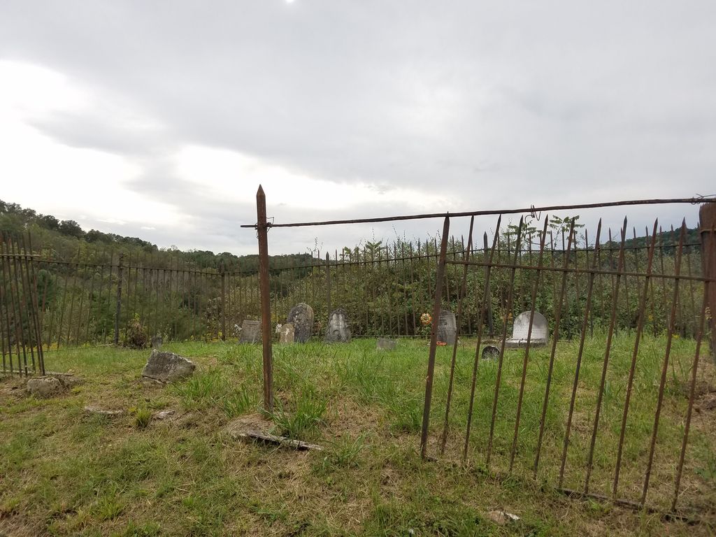
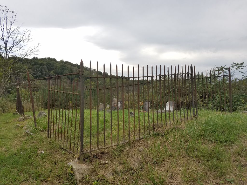
| Description | : | The cemetery is located in Lamping Homestead Park east of Clearfork Road (Township Road 307) about 0.25 miles south of its junction with Ohio State Route 537. The cemetery is located in Washington Township, Monroe County, Ohio, and is # 15752 (Lamping Cemetery) in “Ohio Cemeteries 1803-2003”, compiled by the Ohio Genealogical Society. The U.S. Geological Survey (USGS) Geographic Names Information System (GNIS) feature ID for the cemetery is 1963770 (Lamping Cemetery). |
frequently asked questions (FAQ):
-
Where is Lamping Cemetery?
Lamping Cemetery is located at Clearfork Road (Township Road 307) Graysville, Monroe County ,Ohio , 45734USA.
-
Lamping Cemetery cemetery's updated grave count on graveviews.com?
0 memorials
-
Where are the coordinates of the Lamping Cemetery?
Latitude: 39.6286846
Longitude: -81.1884447

Nearby Cemetories:
1. Henthorn Cemetery
Monroe County, USA
Coordinate: 39.6418991, -81.1994019
2. Smith Cemetery
Rinard Mills, Monroe County, USA
Coordinate: 39.6081291, -81.2001120
3. Mount Hope Cemetery
Monroe County, USA
Coordinate: 39.6217384, -81.2184448
4. Merrill Ridge Cemetery
Monroe County, USA
Coordinate: 39.6009064, -81.1931686
5. Low Gap Cemetery
Cline, Monroe County, USA
Coordinate: 39.6075745, -81.1592789
6. Miller Cemetery
Marr, Monroe County, USA
Coordinate: 39.6400000, -81.2272680
7. Pleasant Ridge Church of Christ Cemetery
Graysville, Monroe County, USA
Coordinate: 39.6625850, -81.2076540
8. Graysville Cemetery
Graysville, Monroe County, USA
Coordinate: 39.6632996, -81.1714020
9. Mann Cemetery
Graysville, Monroe County, USA
Coordinate: 39.6553001, -81.1502991
10. Scott Cemetery
Monroe County, USA
Coordinate: 39.6643982, -81.2117004
11. Pioneer Cemetery
Graysville, Monroe County, USA
Coordinate: 39.6672000, -81.1741000
12. Cline Family Cemetery
Monroe County, USA
Coordinate: 39.6669620, -81.1624430
13. McVay Cemetery
Sycamore Valley, Monroe County, USA
Coordinate: 39.6444016, -81.2427979
14. Adams Cemetery
Lebanon, Monroe County, USA
Coordinate: 39.6203300, -81.2480200
15. Rinard Mills Cemetery
Monroe County, USA
Coordinate: 39.5839615, -81.1567764
16. Rings Mill Cemetery
Poulton, Monroe County, USA
Coordinate: 39.6117407, -81.1212206
17. Greenbrier Cemetery
Greenbrier, Monroe County, USA
Coordinate: 39.6406000, -81.1186400
18. Hopewell Cemetery
Lebanon, Monroe County, USA
Coordinate: 39.5811844, -81.2267761
19. Hercher Cemetery
Monroe County, USA
Coordinate: 39.6702995, -81.2397003
20. Knowlton Cemetery
Monroe County, USA
Coordinate: 39.6852989, -81.2052994
21. Beardmore Cemetery
Perry Township, Monroe County, USA
Coordinate: 39.6706009, -81.1342010
22. Dougherty Cemetery
Monroe County, USA
Coordinate: 39.6767006, -81.1406021
23. Jericho Methodist Cemetery
Jericho, Monroe County, USA
Coordinate: 39.6150742, -81.1087189
24. Creighton Ridge Church of Christ Cemetery
Marr, Monroe County, USA
Coordinate: 39.6629320, -81.2612340