
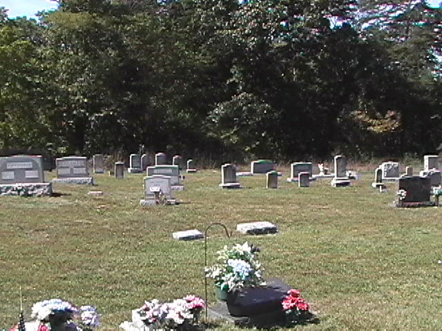
| Memorials | : | 87 |
| Location | : | Mount Pleasant, Frederick County, USA |
| Coordinate | : | 39.1725006, -78.2957993 |
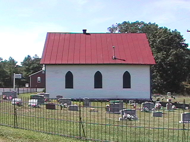
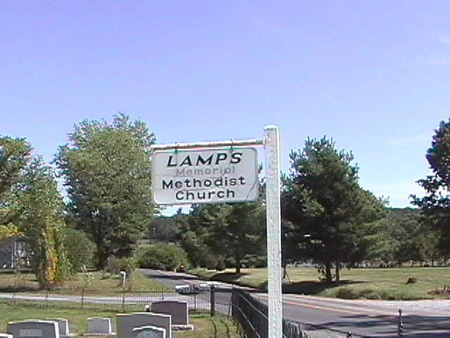
| Description | : | This active public cemetery surrounds the Lamp Memorial Methodist Church. Directions: Take Rt. 50 N. out of Winchester. 2.7 miles past rt 37 turn left on Wardensville Grade (Rt. 608). Go 3 1/2 miles to Lamps Memorial Church and cemetery beside the modern Mt Pleasant-Lamps United Methodist Church. Also nearby (1000 feet down the lane) is the Lamp Family Cemetery. |
frequently asked questions (FAQ):
-
Where is Lamps Memorial Methodist Church Cemetery?
Lamps Memorial Methodist Church Cemetery is located at 1760 Wardensville Grade Mount Pleasant, Frederick County ,Virginia , 22602USA.
-
Lamps Memorial Methodist Church Cemetery cemetery's updated grave count on graveviews.com?
87 memorials
-
Where are the coordinates of the Lamps Memorial Methodist Church Cemetery?
Latitude: 39.1725006
Longitude: -78.2957993
Nearby Cemetories:
1. Lamps Cemetery
Mount Williams, Frederick County, USA
Coordinate: 39.1740790, -78.2929980
2. Clowser Cemetery
Hayfield, Frederick County, USA
Coordinate: 39.1902906, -78.3351269
3. Wisecarver Cemetery
Frederick County, USA
Coordinate: 39.1375008, -78.2872009
4. Saint Peter's Lutheran Church Cemetery
Mount Williams, Frederick County, USA
Coordinate: 39.1273994, -78.2970963
5. Round Hill Presbyterian Church Cemetery
Round Hill, Frederick County, USA
Coordinate: 39.1899986, -78.2397003
6. Harper Graveyard
Round Hill, Frederick County, USA
Coordinate: 39.2076988, -78.2508163
7. Round Hill United Methodist Church Cemetery
Round Hill, Frederick County, USA
Coordinate: 39.1942711, -78.2374115
8. Mount Pleasant Meeting House Cemetery
Mount Pleasant, Frederick County, USA
Coordinate: 39.1208000, -78.3043976
9. Mount Olive United Methodist Church Cemetery
Hayfield, Frederick County, USA
Coordinate: 39.2261009, -78.2872009
10. Hodgson Cemetery
Round Hill, Frederick County, USA
Coordinate: 39.1963997, -78.2319031
11. White Graveyard
Hayfield, Frederick County, USA
Coordinate: 39.2279015, -78.2931976
12. Saint Johns Lutheran Church Cemetery
Hayfield, Frederick County, USA
Coordinate: 39.1530991, -78.3651962
13. Rosedale Baptist Church Cemetery
Round Hill, Frederick County, USA
Coordinate: 39.1929016, -78.2219009
14. Taylor Furnace Farm Cemetery
Mountain Falls, Frederick County, USA
Coordinate: 39.1547500, -78.3708500
15. Joseph Brumback Family Cemetery
Opequon, Frederick County, USA
Coordinate: 39.1119340, -78.3114700
16. Sunrise Cemetery
Frederick County, USA
Coordinate: 39.1161003, -78.2566986
17. Poor Farm Cemetery
Round Hill, Frederick County, USA
Coordinate: 39.2123985, -78.2233963
18. Pitman-Keller Cemetery
Marlboro, Frederick County, USA
Coordinate: 39.1036180, -78.3180790
19. Michael Anderson Graveyard
Rock Enon, Frederick County, USA
Coordinate: 39.2357674, -78.3515320
20. Grange Hall Cemetery
Nain, Frederick County, USA
Coordinate: 39.2313995, -78.2241974
21. Pritchard Family Cemetery
Kernstown, Frederick County, USA
Coordinate: 39.1452900, -78.1964100
22. Rock Enon Church Cemetery
Rock Enon, Frederick County, USA
Coordinate: 39.2178612, -78.3863525
23. Old Opequon Cemetery
Kernstown, Frederick County, USA
Coordinate: 39.1393814, -78.1949387
24. Kern-Beemer Cemetery
Kernstown, Frederick County, USA
Coordinate: 39.1393585, -78.1934280