
| Memorials | : | 0 |
| Location | : | Los Indios, Cameron County, USA |
| Coordinate | : | 26.0453400, -97.6977600 |
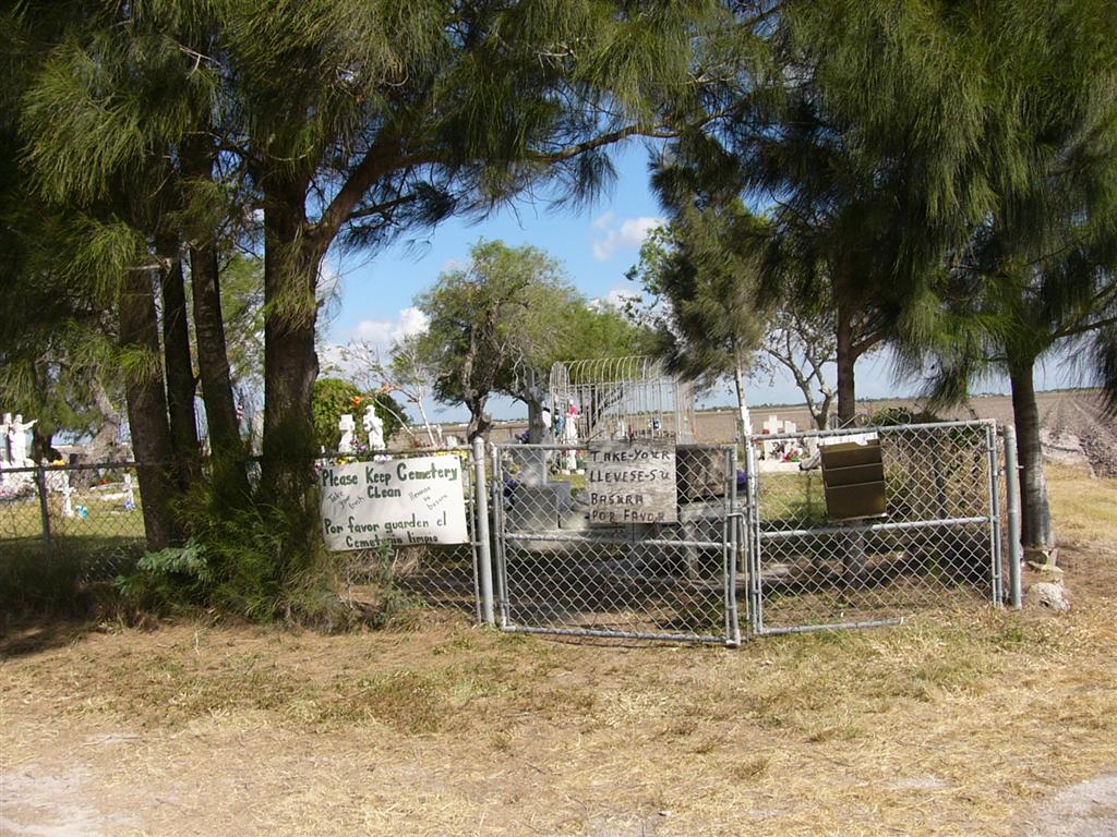
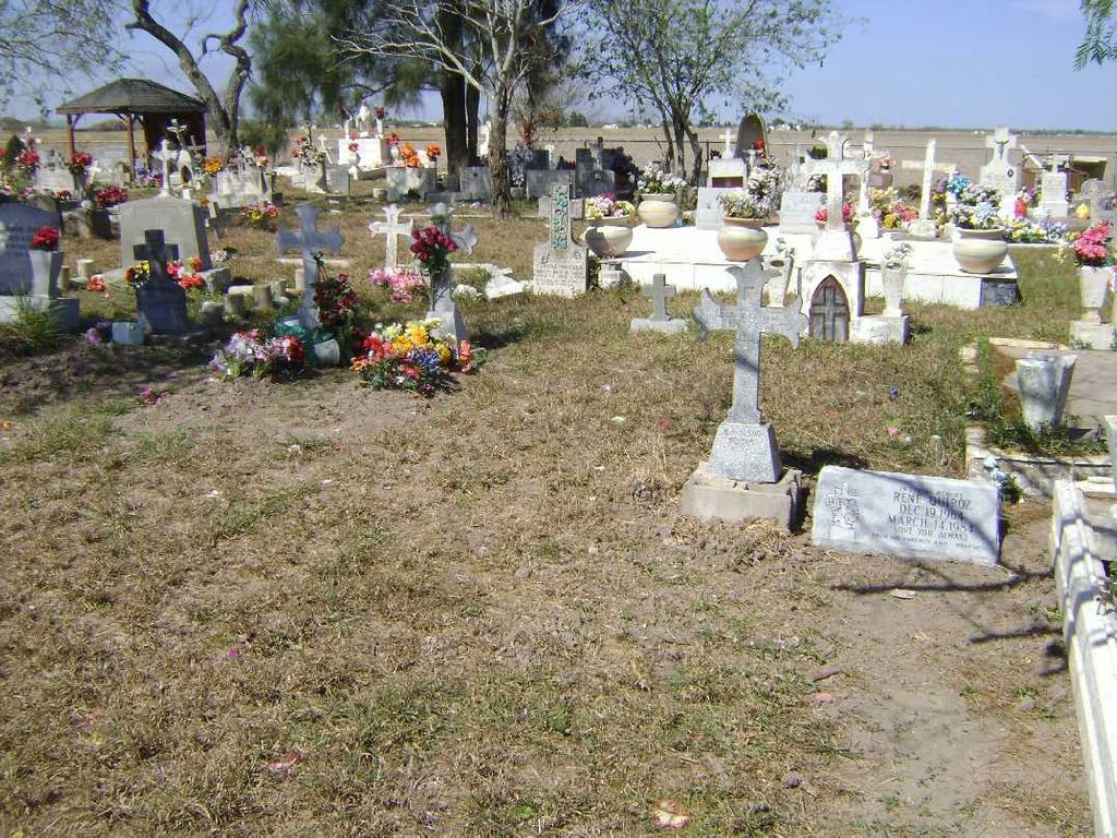
| Description | : | Landrum Cemetery, originally known as Los Flores, is on the East side of FM 2520, just north of Hwy 281, Military Highway. It is off the road about 300 ft and is sometimes hidden in a corn field. The narrow drive is usually open. The land was owned by James L Landrum who donated a piece to Evaristo Gonzalez to use as a cemetery for his family. |
frequently asked questions (FAQ):
-
Where is Landrum Cemetery?
Landrum Cemetery is located at Los Indios, Cameron County ,Texas ,USA.
-
Landrum Cemetery cemetery's updated grave count on graveviews.com?
0 memorials
-
Where are the coordinates of the Landrum Cemetery?
Latitude: 26.0453400
Longitude: -97.6977600
Nearby Cemetories:
1. Garcia Cemetery
Ranchito, Cameron County, USA
Coordinate: 26.0455250, -97.6993560
2. Palm In Field Cemetery
Carricitos, Cameron County, USA
Coordinate: 26.0442510, -97.7071330
3. Gomez Cemetery
Los Indios, Cameron County, USA
Coordinate: 26.0462960, -97.7170370
4. La Paloma Cemetery
La Paloma, Cameron County, USA
Coordinate: 26.0451170, -97.6710500
5. Escamilla Family Cemetery
Ranchito, Cameron County, USA
Coordinate: 26.0343900, -97.6506100
6. El Calaboz Cemetery
Ranchito, Cameron County, USA
Coordinate: 26.0340800, -97.6503200
7. Escamilla Cemetery
El Calaboz, Cameron County, USA
Coordinate: 26.0340800, -97.6503200
8. Los Indios Cemetery
Los Indios, Cameron County, USA
Coordinate: 26.0507400, -97.7472500
9. Aguilar Cemetery
Las Rusias, Cameron County, USA
Coordinate: 26.0566200, -97.7482400
10. Juan Ramiro Garcia Family Cemetery
Las Rusias, Cameron County, USA
Coordinate: 26.0526000, -97.7556900
11. Old Garcia Cemetery
Ranchito, Cameron County, USA
Coordinate: 26.0260800, -97.6399200
12. Las Rucias Memorial Cemetery
Las Rusias, Cameron County, USA
Coordinate: 26.0540300, -97.7592500
13. Jose Padilla Grave
San Benito, Cameron County, USA
Coordinate: 26.1028670, -97.6931700
14. Vasquez Cemetery
Ranchito, Cameron County, USA
Coordinate: 26.0267700, -97.6358400
15. Avalos Family Cemetery
Ranchito, Cameron County, USA
Coordinate: 26.0267650, -97.6358410
16. Zepeda Cemetery
Ranchito, Cameron County, USA
Coordinate: 26.0269500, -97.6351800
17. Sanchez Cemetery
Ranchito, Cameron County, USA
Coordinate: 26.0263000, -97.6323300
18. Moreno Cemetery
Los Indios, Cameron County, USA
Coordinate: 26.0535600, -97.7700400
19. Weaver Family Cemetery
Las Rusias, Cameron County, USA
Coordinate: 26.0535600, -97.7700400
20. Agado Family Cemetery
San Benito, Cameron County, USA
Coordinate: 26.1118200, -97.6914000
21. Esparza Cemetery
Cameron County, USA
Coordinate: 26.0245400, -97.6270200
22. Weaver I Cemetery
Los Indios, Cameron County, USA
Coordinate: 26.0657650, -97.7687070
23. Cementerio de Rancho Viejo
Rancho Viejo, Matamoros Municipality, Mexico
Coordinate: 26.0223170, -97.7721410
24. El Naranjo Cemetery
Ranchito, Cameron County, USA
Coordinate: 26.0191200, -97.6212200