
| Memorials | : | 0 |
| Location | : | Stony Creek, Caswell County, USA |
| Coordinate | : | 36.2565420, -79.4391190 |
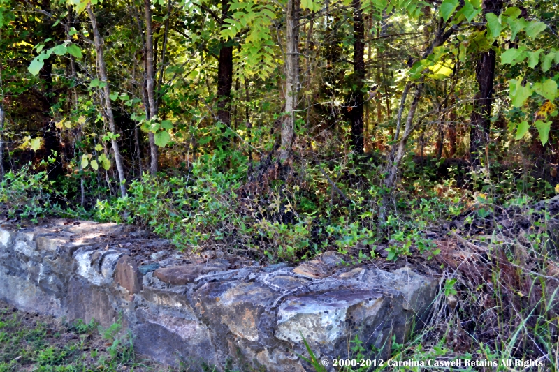
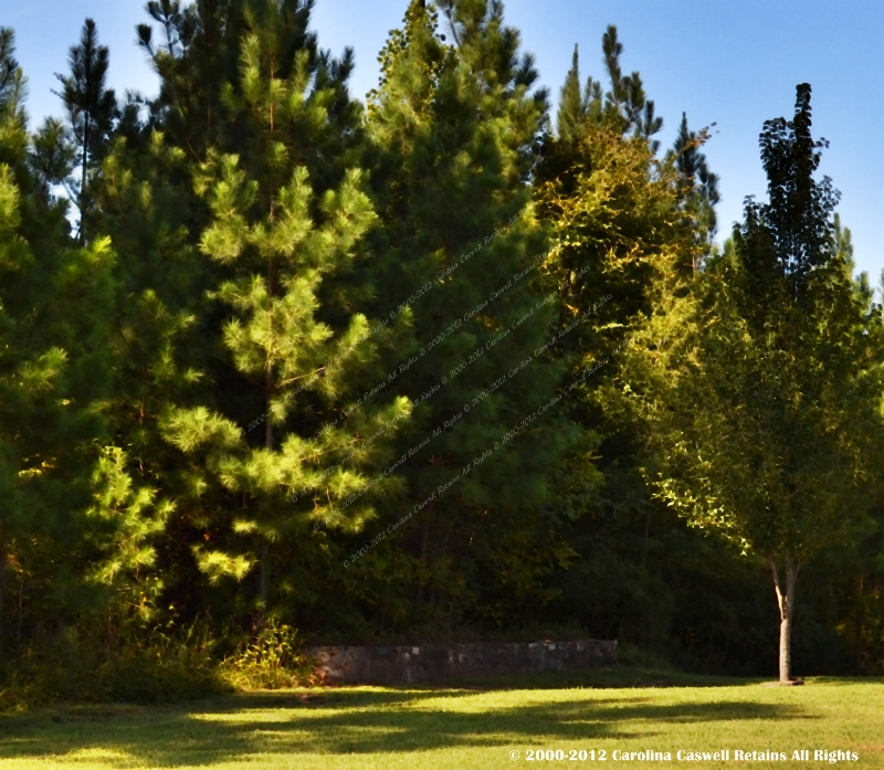
| Description | : | Family Cemetery on Private Property No Recorded Right of Public Access Property Owner's Permission Required Scott Cemetery and Leath Cemetery Family cemetery of Nancy Ann and Thomas Hornbuckle. "On Kerr Chapel Road across from the old Somers-Scott House. There is a marble marker, with the names of four burials, which is attached to the rock wall around the cemetery. There could be others buried inside the wall, but there's no way to be sure." (Grant Pinnix) INSCRIPTION: Freeman Leath Born 1792 - Died 1854 His Wife Susan Hornbuckle Born 1798 - Died 1854 Richard Kernodle [Blank] - Died 1854 His Wife M. Elizabeth Leath Born... Read More |
frequently asked questions (FAQ):
-
Where is Leath-Kernodle-Hornbuckle Family Cemetery?
Leath-Kernodle-Hornbuckle Family Cemetery is located at Kerr Stony Creek, Caswell County ,North Carolina ,USA.
-
Leath-Kernodle-Hornbuckle Family Cemetery cemetery's updated grave count on graveviews.com?
0 memorials
-
Where are the coordinates of the Leath-Kernodle-Hornbuckle Family Cemetery?
Latitude: 36.2565420
Longitude: -79.4391190
Nearby Cemetories:
1. Scott Family Cemetery
Stony Creek, Caswell County, USA
Coordinate: 36.2562560, -79.4391610
2. Brown Cemetery
Stony Creek, Caswell County, USA
Coordinate: 36.2582030, -79.4203380
3. Stoney Creek AME Church Cemetery
Stony Creek, Caswell County, USA
Coordinate: 36.2624850, -79.4199410
4. Simpson Cemetery
Stony Creek, Caswell County, USA
Coordinate: 36.2496460, -79.4592300
5. Underwood-Boswell Family Cemetery
Altamahaw, Alamance County, USA
Coordinate: 36.2433820, -79.4599650
6. Family Cemetery on Pagetown Road
Stony Creek, Caswell County, USA
Coordinate: 36.2670100, -79.4629700
7. Kerrs Chapel Baptist Church Cemetery
Stony Creek, Caswell County, USA
Coordinate: 36.2598640, -79.4098020
8. Harris-Swift Cemetery
Stony Creek, Caswell County, USA
Coordinate: 36.2687480, -79.4844800
9. Stony Creek Presbyterian Church Cemetery
Burlington, Alamance County, USA
Coordinate: 36.2184060, -79.4489680
10. Pinnix Family Cemetery
Milesville, Caswell County, USA
Coordinate: 36.2857960, -79.4039120
11. Williamson Cemetery
Cherry Grove, Caswell County, USA
Coordinate: 36.2979370, -79.4437910
12. Spirit and Truth Baptist Church Cemetery
Milesville, Caswell County, USA
Coordinate: 36.2963860, -79.4131980
13. Massey-Garrison Family Cemetery
Milesville, Caswell County, USA
Coordinate: 36.3014820, -79.4211640
14. Heydon Family Cemetery
Cherry Grove, Caswell County, USA
Coordinate: 36.3055890, -79.4444190
15. Simpson Family Cemetery
Camp Springs, Caswell County, USA
Coordinate: 36.2867690, -79.4928750
16. Ruffin and Miles Family Cemetery
Milesville, Caswell County, USA
Coordinate: 36.3076108, -79.4149997
17. Lea Cemetery
Anderson, Caswell County, USA
Coordinate: 36.2589300, -79.3702770
18. Union Ridge Church Cemetery
Burlington, Alamance County, USA
Coordinate: 36.2077020, -79.4006800
19. Concord Christian Church Cemetery
Cherry Grove, Caswell County, USA
Coordinate: 36.3150000, -79.4390000
20. Union Chapel United Church of Christ Cemetery
Burlington, Alamance County, USA
Coordinate: 36.2072250, -79.4000490
21. Family Cemetery on Byrd's Sawmill Road
Jericho, Caswell County, USA
Coordinate: 36.2760600, -79.3701600
22. Page's Arbor Baptist Church Cemetery
Anderson, Caswell County, USA
Coordinate: 36.2507630, -79.3649660
23. Allred New Mission Baptist Church Cemetery
Anderson, Caswell County, USA
Coordinate: 36.2583330, -79.3644300
24. Camp Springs United Methodist Church Cemetery
Camp Springs, Caswell County, USA
Coordinate: 36.2952766, -79.4972229