
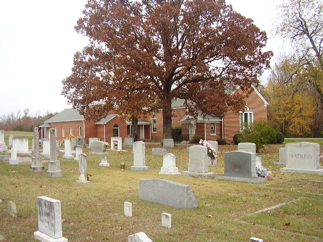
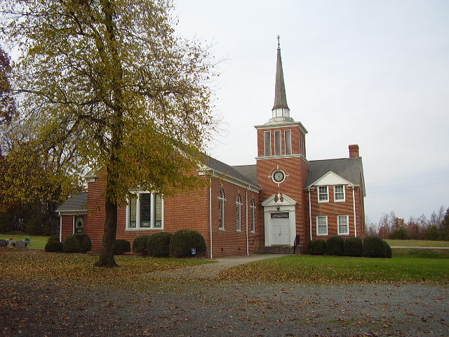
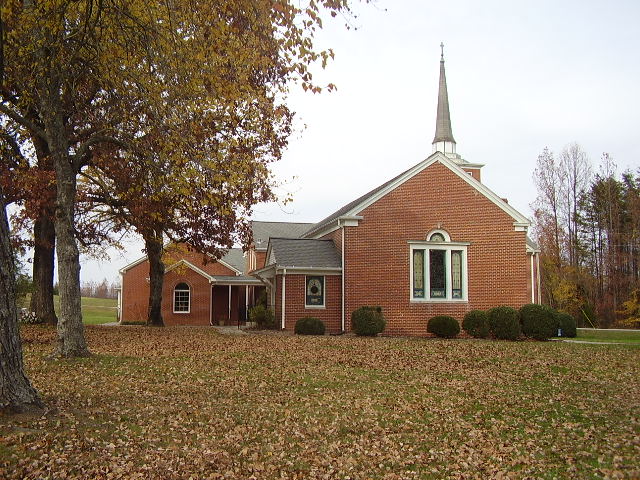
| Memorials | : | 1 |
| Location | : | Camp Springs, Caswell County, USA |
| Coordinate | : | 36.2952766, -79.4972229 |
| Description | : | At the intersection of Cherry Grove Rd. (SR-1133) and Camp Springs Rd. (SR-1146). |
frequently asked questions (FAQ):
-
Where is Camp Springs United Methodist Church Cemetery?
Camp Springs United Methodist Church Cemetery is located at 9168 Cherry Grove Rd Camp Springs, Caswell County ,North Carolina , 27320USA.
-
Camp Springs United Methodist Church Cemetery cemetery's updated grave count on graveviews.com?
1 memorials
-
Where are the coordinates of the Camp Springs United Methodist Church Cemetery?
Latitude: 36.2952766
Longitude: -79.4972229
Nearby Cemetories:
1. Camp Springs UMC Cemetery
Camp Springs, Caswell County, USA
Coordinate: 36.2930250, -79.5012760
2. Family Cemetery on Apple Road
Camp Springs, Caswell County, USA
Coordinate: 36.2989100, -79.5002500
3. Simpson Family Cemetery
Camp Springs, Caswell County, USA
Coordinate: 36.2867690, -79.4928750
4. Lambeth Family Cemetery
Camp Springs, Caswell County, USA
Coordinate: 36.3077030, -79.5116780
5. Norman Family Cemetery
Camp Springs, Caswell County, USA
Coordinate: 36.3129850, -79.5007770
6. Bouldin Family Cemetery
Camp Springs, Caswell County, USA
Coordinate: 36.2827340, -79.5144080
7. Boswell-Lambeth-Williams-Saunders Family Cemetery
Camp Springs, Caswell County, USA
Coordinate: 36.2849870, -79.5195260
8. Pleasant View Assembly of God Church Cemetery
Camp Springs, Caswell County, USA
Coordinate: 36.2828550, -79.5180770
9. Brown Family Cemetery
Camp Springs, Caswell County, USA
Coordinate: 36.3175200, -79.4922640
10. Brown Arbor Baptist Church Cemetery
Camp Springs, Caswell County, USA
Coordinate: 36.2748030, -79.5112650
11. Brown's Chapel Baptist Church Cemetery
Matkins, Caswell County, USA
Coordinate: 36.2736270, -79.5196330
12. Harris-Swift Cemetery
Stony Creek, Caswell County, USA
Coordinate: 36.2687480, -79.4844800
13. Cherry Grove Baptist Church Cemetery
Cherry Grove, Caswell County, USA
Coordinate: 36.2736270, -79.5205660
14. Fieldstone Drive Family Cemetery
Ashland, Caswell County, USA
Coordinate: 36.3261700, -79.4995400
15. Rice Cemetery
Ashland, Caswell County, USA
Coordinate: 36.3270020, -79.5245150
16. Ware Family Cemetery
Ashland, Caswell County, USA
Coordinate: 36.3323080, -79.5118200
17. Family Cemetery on Pagetown Road
Stony Creek, Caswell County, USA
Coordinate: 36.2670100, -79.4629700
18. Williamson Cemetery
Cherry Grove, Caswell County, USA
Coordinate: 36.2979370, -79.4437910
19. Heydon Family Cemetery
Cherry Grove, Caswell County, USA
Coordinate: 36.3055890, -79.4444190
20. Trinity Baptist Church Cemetery
Locust Hill, Caswell County, USA
Coordinate: 36.3418720, -79.4982020
21. Paschal-Butler Family Cemetery
Locust Hill, Caswell County, USA
Coordinate: 36.3403470, -79.4815830
22. Trinity Old Baptist Church Cemetery
Locust Hill, Caswell County, USA
Coordinate: 36.3422660, -79.4955680
23. Paschal Family Cemetery
Ashland, Caswell County, USA
Coordinate: 36.3387660, -79.5214030
24. Concord Christian Church Cemetery
Cherry Grove, Caswell County, USA
Coordinate: 36.3150000, -79.4390000