
| Memorials | : | 45 |
| Location | : | Shanesville, Tuscarawas County, USA |
| Coordinate | : | 40.5134000, -81.6540100 |
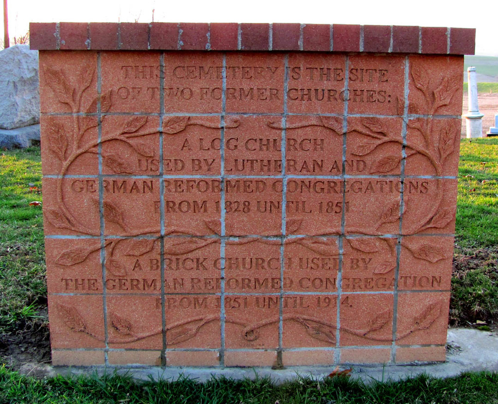
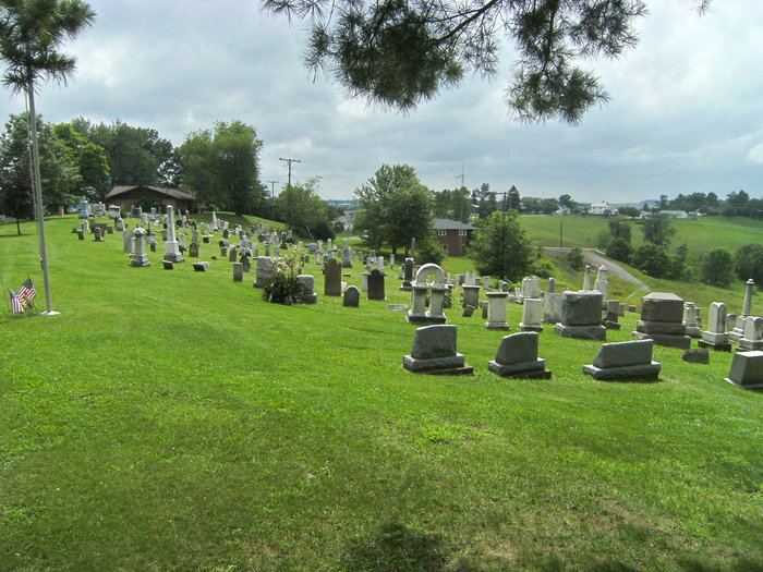
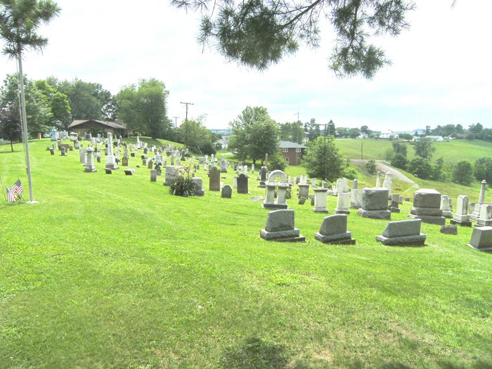
| Description | : | The cemetery is located on the west side of Hillcrest Drive NW between its intersections with Woodland and with Orchard. The cemetery is located in Sugar Creek Township, Tuscarawas County, Ohio, and is # 11872 (Shanesville First Reformed Cemetery / Sugarcreek Cemetery / Old Shanesville Cemetery) in “Ohio Cemeteries 1803-2003”, compiled by the Ohio Genealogical Society. The cemetery is registered with the Ohio Division of Real Estate and Professional Licensing (ODRE) as Old Shanesville Cemetery with registration license number CGR.0000980116. The U.S. Geological Survey (USGS) Geographic Names Information System (GNIS) feature ID for the cemetery is 1963858 (Shanesville First... Read More |
frequently asked questions (FAQ):
-
Where is Shanesville First Reformed Cemetery?
Shanesville First Reformed Cemetery is located at Hillcrest Drive NW Shanesville, Tuscarawas County ,Ohio , 44681USA.
-
Shanesville First Reformed Cemetery cemetery's updated grave count on graveviews.com?
45 memorials
-
Where are the coordinates of the Shanesville First Reformed Cemetery?
Latitude: 40.5134000
Longitude: -81.6540100
Nearby Cemetories:
1. Henry Zahner Farm Cemetery
Shanesville, Tuscarawas County, USA
Coordinate: 40.5149000, -81.6559000
2. East Lawn Cemetery
Sugarcreek, Tuscarawas County, USA
Coordinate: 40.5086770, -81.6536210
3. Nelson D. Yoder Cemetery
Sugarcreek, Tuscarawas County, USA
Coordinate: 40.4997580, -81.6525130
4. Yoder Cemetery
Sugarcreek, Tuscarawas County, USA
Coordinate: 40.5279740, -81.6518240
5. Laura Machan Farm Cemetery
Walnut Creek, Holmes County, USA
Coordinate: 40.5280640, -81.6667080
6. Maranatha Fellowship Church Cemetery
Sugarcreek, Tuscarawas County, USA
Coordinate: 40.4965530, -81.6616730
7. Union Church Cemetery
Sugarcreek, Tuscarawas County, USA
Coordinate: 40.5202240, -81.6321990
8. Miller-Mast Cemetery
Sugar Creek Township, Tuscarawas County, USA
Coordinate: 40.5192030, -81.6263930
9. Hardscrabble Cemetery
Tuscarawas County, USA
Coordinate: 40.5388985, -81.6521988
10. Levi L Yoder Farm Cemetery
Farmerstown, Holmes County, USA
Coordinate: 40.4907000, -81.6780550
11. Schrock Cemetery
Barrs Mills, Tuscarawas County, USA
Coordinate: 40.5404000, -81.6366840
12. Moses Erb Farm Cemetery
Farmerstown, Holmes County, USA
Coordinate: 40.4996310, -81.6908280
13. Floyd Miller Farm Cemetery
Walnut Creek, Holmes County, USA
Coordinate: 40.5326300, -81.6873700
14. Jacobson Mausoleum
Auburn Township, Tuscarawas County, USA
Coordinate: 40.4803341, -81.6644602
15. Maranatha Church Grounds
Sugarcreek, Tuscarawas County, USA
Coordinate: 40.4811470, -81.6683330
16. Union Hill Cemetery
Sugarcreek, Tuscarawas County, USA
Coordinate: 40.5047410, -81.6103290
17. Miller Cemetery
Winklepleck Grove, Tuscarawas County, USA
Coordinate: 40.5193080, -81.6055850
18. Sugar Creek Land Company Cemetery
Farmerstown, Holmes County, USA
Coordinate: 40.5071430, -81.7038970
19. Walter Cemetery
Sugar Creek Township, Tuscarawas County, USA
Coordinate: 40.5497017, -81.6352997
20. Deitz Cemetery
Sugarcreek, Tuscarawas County, USA
Coordinate: 40.4916992, -81.6110992
21. Albert Schlabach Farm Cemetery
Charm, Holmes County, USA
Coordinate: 40.4771400, -81.6746270
22. James A Miller Farm Cemetery
Walnut Creek, Holmes County, USA
Coordinate: 40.5255700, -81.7037880
23. Yoder Cemetery
Walnut Creek, Holmes County, USA
Coordinate: 40.5416985, -81.6939011
24. Miller Cemetery
Walnut Creek, Holmes County, USA
Coordinate: 40.5397420, -81.6979810