| Memorials | : | 0 |
| Location | : | Lewes, Lewes District, England |
| Coordinate | : | 50.8681240, 0.0083870 |
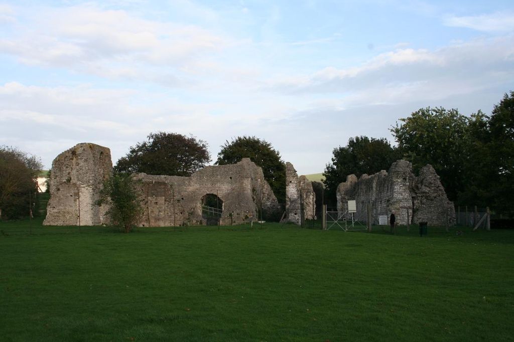
| Description | : | Lewes Priory was the first Cluniac foundation in England (the order of Cluny is a Benedictine offshoot founded at a time when reformist ideas were gaining momentum within the Church). It was established in 1078 on the site of a Saxon church which was dedicated to St. Pancras. The great church was one of the largest churches in England and boasted a nave 432 feet long. At the time of the Dissolution, many of the buildings of the Priory were demolished immediately and the land was granted to Thomas Cromwell. He built a large home on the site which survived... Read More |
frequently asked questions (FAQ):
-
Where is Lewes Priory?
Lewes Priory is located at Off Cockshut Road Lewes, Lewes District ,East Sussex , BN7 2QSEngland.
-
Lewes Priory cemetery's updated grave count on graveviews.com?
0 memorials
-
Where are the coordinates of the Lewes Priory?
Latitude: 50.8681240
Longitude: 0.0083870
Nearby Cemetories:
1. Southover Parish Church of St John the Baptist
Lewes, Lewes District, England
Coordinate: 50.8690840, 0.0062220
2. Saint Michael's Churchyard
Lewes, Lewes District, England
Coordinate: 50.8722440, 0.0070970
3. All Saints Churchyard
Lewes, Lewes District, England
Coordinate: 50.8723630, 0.0135060
4. St. Anne's Churchyard
Lewes, Lewes District, England
Coordinate: 50.8723390, 0.0017700
5. Lewes Cemetery
Lewes, Lewes District, England
Coordinate: 50.8707680, -0.0017370
6. Lewes Goal
Lewes, Lewes District, England
Coordinate: 50.8756155, 0.0115680
7. St. John Sub Castro Churchyard
Lewes, Lewes District, England
Coordinate: 50.8759800, 0.0093800
8. St Thomas A Becket Churchyard
Lewes, Lewes District, England
Coordinate: 50.8744780, 0.0187450
9. HMP Lewes
Lewes District, England
Coordinate: 50.8729973, -0.0048753
10. Saint Michael The Archangel Churchyard
South Malling, Lewes District, England
Coordinate: 50.8811470, 0.0069090
11. St Nicholas Churchyard
Iford, Lewes District, England
Coordinate: 50.8483860, -0.0007940
12. St Peter Churchyard
Hamsey, Lewes District, England
Coordinate: 50.8911800, 0.0095670
13. St Pancras Churchyard
Kingston, Lewes District, England
Coordinate: 50.8562900, -0.0245250
14. Monk's House Grounds
Rodmell, Lewes District, England
Coordinate: 50.8387500, 0.0165280
15. St Peters Churchyard
Rodmell, Lewes District, England
Coordinate: 50.8384680, 0.0177350
16. St Andrew Churchyard
Beddingham, Lewes District, England
Coordinate: 50.8524971, 0.0516700
17. St. Mary the Virgin Churchyard
Glynde, Lewes District, England
Coordinate: 50.8646000, 0.0683000
18. St Mary the Virgin Churchyard
Ringmer, Lewes District, England
Coordinate: 50.8939750, 0.0543920
19. Southease Churchyard
Southease, Lewes District, England
Coordinate: 50.8294960, 0.0191830
20. St Mary Churchyard
Barcombe, Lewes District, England
Coordinate: 50.9108230, 0.0165980
21. St Laurence Churchyard
Falmer, Lewes District, England
Coordinate: 50.8623110, -0.0762390
22. St. Peter's Churchyard
West Firle, Lewes District, England
Coordinate: 50.8448639, 0.0884910
23. St Laurence Churchyard
Telscombe, Lewes District, England
Coordinate: 50.8128300, -0.0064050
24. St Marys Churchyard
Tarring Neville, Lewes District, England
Coordinate: 50.8155480, 0.0485160

