
| Memorials | : | 0 |
| Location | : | Gap, Lancaster County, USA |
| Coordinate | : | 40.0046000, -75.9822000 |
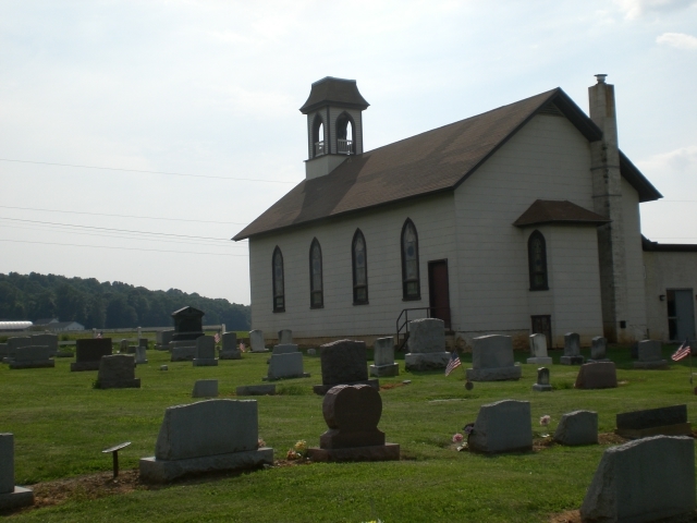
| Description | : | Limeville United Methodist Church 5783 Limeville Rd Gap, PA 17527 717) 442-4010ý cemetery adjoins church Formerly an Evangelical United Brethren Church founded in 1879 |
frequently asked questions (FAQ):
-
Where is Limeville United Methodist Cemetery?
Limeville United Methodist Cemetery is located at Gap, Lancaster County ,Pennsylvania ,USA.
-
Limeville United Methodist Cemetery cemetery's updated grave count on graveviews.com?
0 memorials
-
Where are the coordinates of the Limeville United Methodist Cemetery?
Latitude: 40.0046000
Longitude: -75.9822000
Nearby Cemetories:
1. Buena Vista Amish Cemetery
Gap, Lancaster County, USA
Coordinate: 40.0220000, -75.9795000
2. Millwood Mennonite Cemetery
Gap, Lancaster County, USA
Coordinate: 40.0159970, -76.0146190
3. Old Road Mennonite Cemetery
Gap, Lancaster County, USA
Coordinate: 40.0332489, -75.9807281
4. Pequea Baptist Cemetery
Gap, Lancaster County, USA
Coordinate: 40.0271000, -75.9567000
5. Simmontown Mennonite Church Cemetery
Gap, Lancaster County, USA
Coordinate: 39.9842230, -76.0120010
6. Sadsbury Friends Burial Ground
Christiana, Lancaster County, USA
Coordinate: 39.9708080, -75.9906830
7. Saint John's Episcopal Church Cemetery
Compass, Chester County, USA
Coordinate: 40.0229111, -75.9439392
8. Pequea Evangelical Congregational Church Cemetery
Gap, Lancaster County, USA
Coordinate: 40.0334960, -76.0083930
9. Brinton Family Burial Ground
Lancaster County, USA
Coordinate: 39.9772910, -76.0114550
10. Gap View Mennonite Cemetery
Gap, Lancaster County, USA
Coordinate: 39.9818660, -76.0184270
11. Bellevue Presbyterian Cemetery
Gap, Lancaster County, USA
Coordinate: 39.9890213, -76.0244446
12. Beacon Light Amish Cemetery
West Caln Township, Chester County, USA
Coordinate: 40.0071070, -75.9274910
13. Maple Grove Mennonite Cemetery
Atglen, Chester County, USA
Coordinate: 39.9597549, -75.9676666
14. Pequea Presbyterian Cemetery
Gap, Lancaster County, USA
Coordinate: 40.0523380, -75.9916900
15. Mount Zion African Methodist Episcopal Cemetery
Atglen, Chester County, USA
Coordinate: 39.9546390, -75.9850720
16. Sandy Hill Mennonite Cemetery
West Caln Township, Chester County, USA
Coordinate: 40.0094000, -75.9157000
17. Spring Garden Cemetery
Kinzers, Lancaster County, USA
Coordinate: 40.0384600, -76.0339360
18. Sandy Hill African Methodist Episcopal Cemetery
West Caln Township, Chester County, USA
Coordinate: 40.0185200, -75.9133000
19. Atglen Methodist Cemetery
Atglen, Chester County, USA
Coordinate: 39.9477900, -75.9741700
20. East Sadsbury Friends Burial Ground
Parkesburg, Chester County, USA
Coordinate: 39.9796490, -75.9149740
21. Our Lady of the Seven Dolors Roman Catholic Cemetery
Parkesburg, Chester County, USA
Coordinate: 39.9632912, -75.9295197
22. Upper Octorara Presbyterian Church Cemetery
Sadsbury Township, Chester County, USA
Coordinate: 39.9742012, -75.9163971
23. Penningtonville Cemetery
Atglen, Chester County, USA
Coordinate: 39.9461340, -75.9729050
24. Blank Cemetery
Lancaster County, USA
Coordinate: 40.0448520, -76.0386890