
| Memorials | : | 2 |
| Location | : | Gap, Lancaster County, USA |
| Coordinate | : | 40.0332489, -75.9807281 |
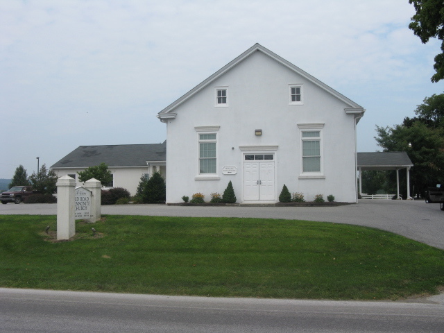
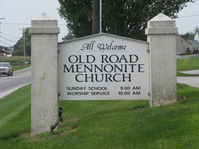
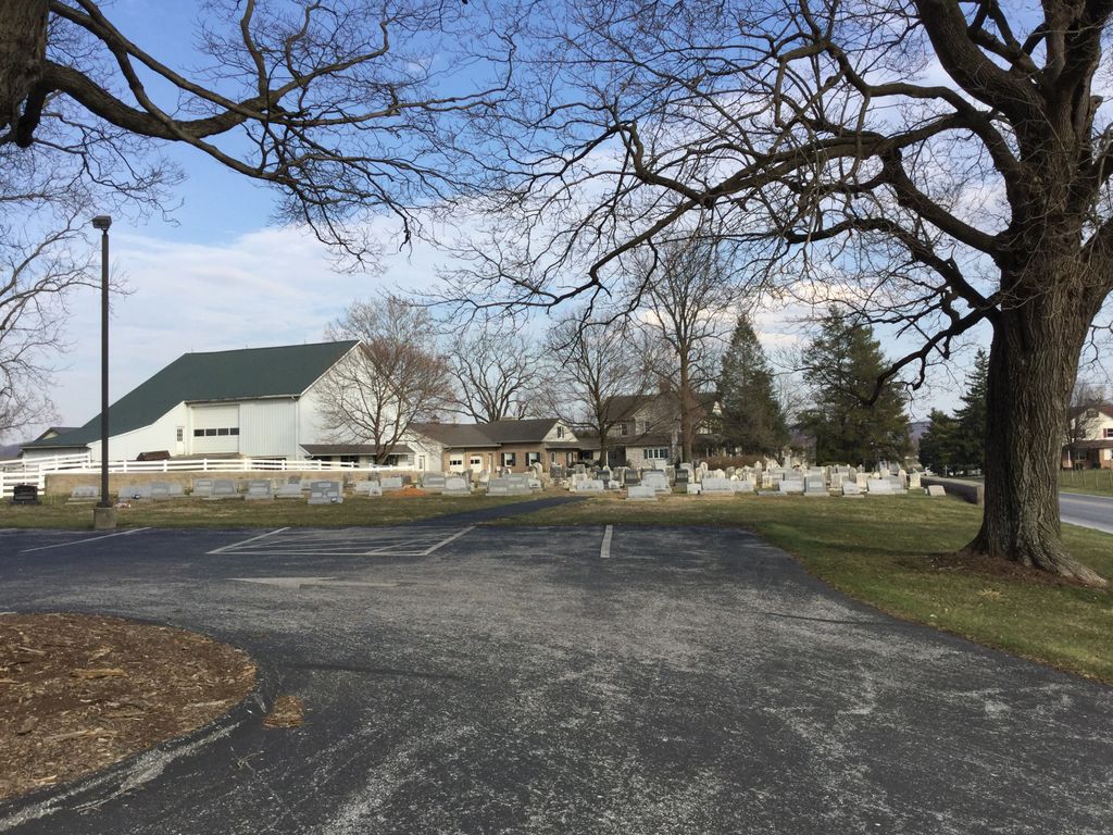
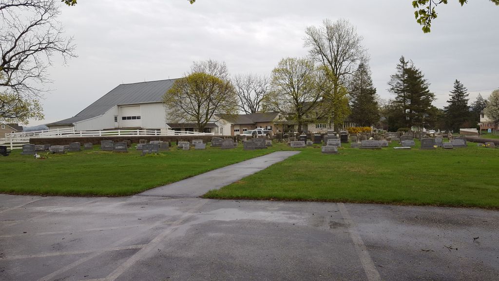
| Description | : | Old Road Mennonite Church (Previously called White Horse Meetinghouse) 5795 Old Philadelphia Pike Gap, PA 17527 (717) 768-3450 Old Road Mennonite Church (White Horse, Lancaster County, Pennsylvania, USA) Old Road (or White Horse) Mennonite Church (Mennonite Church), located near Martin Family Graveyard one mile east of White Horse, Lancaster County, PA, is a part of the Hershey circuit of the Lancaster Conference. Until 1841 the congregation met for worship in private homes and in the Pequea Presbyterian church. In 1841 a stone meetinghouse was built along the Old Philadelphia Pike. In 1892 a frame building farther from the road and larger replaced it. This meetinghouse was... Read More |
frequently asked questions (FAQ):
-
Where is Old Road Mennonite Cemetery?
Old Road Mennonite Cemetery is located at 5795 Old Philadelphia Pike Gap, Lancaster County ,Pennsylvania , 17527USA.
-
Old Road Mennonite Cemetery cemetery's updated grave count on graveviews.com?
2 memorials
-
Where are the coordinates of the Old Road Mennonite Cemetery?
Latitude: 40.0332489
Longitude: -75.9807281
Nearby Cemetories:
1. Buena Vista Amish Cemetery
Gap, Lancaster County, USA
Coordinate: 40.0220000, -75.9795000
2. Pequea Baptist Cemetery
Gap, Lancaster County, USA
Coordinate: 40.0271000, -75.9567000
3. Pequea Presbyterian Cemetery
Gap, Lancaster County, USA
Coordinate: 40.0523380, -75.9916900
4. Pequea Evangelical Congregational Church Cemetery
Gap, Lancaster County, USA
Coordinate: 40.0334960, -76.0083930
5. Limeville United Methodist Cemetery
Gap, Lancaster County, USA
Coordinate: 40.0046000, -75.9822000
6. Saint John's Episcopal Church Cemetery
Compass, Chester County, USA
Coordinate: 40.0229111, -75.9439392
7. Millwood Mennonite Cemetery
Gap, Lancaster County, USA
Coordinate: 40.0159970, -76.0146190
8. Gault Graveyard
Gap, Lancaster County, USA
Coordinate: 40.0698060, -75.9767970
9. Meadville Mennonite Cemetery
Gap, Lancaster County, USA
Coordinate: 40.0717020, -75.9875280
10. Spring Garden Cemetery
Kinzers, Lancaster County, USA
Coordinate: 40.0384600, -76.0339360
11. Blank Cemetery
Lancaster County, USA
Coordinate: 40.0448520, -76.0386890
12. Zion African Union Cemetery
West Caln Township, Chester County, USA
Coordinate: 40.0490479, -75.9218970
13. Beacon Light Amish Cemetery
West Caln Township, Chester County, USA
Coordinate: 40.0071070, -75.9274910
14. Mount Hope Christian Chapel Cemetery
Gap, Lancaster County, USA
Coordinate: 40.0760790, -76.0113160
15. Sandy Hill African Methodist Episcopal Cemetery
West Caln Township, Chester County, USA
Coordinate: 40.0185200, -75.9133000
16. Simmontown Mennonite Church Cemetery
Gap, Lancaster County, USA
Coordinate: 39.9842230, -76.0120010
17. Sandy Hill Mennonite Cemetery
West Caln Township, Chester County, USA
Coordinate: 40.0094000, -75.9157000
18. Bellevue Presbyterian Cemetery
Gap, Lancaster County, USA
Coordinate: 39.9890213, -76.0244446
19. Gap View Mennonite Cemetery
Gap, Lancaster County, USA
Coordinate: 39.9818660, -76.0184270
20. Cambridge Methodist Burial Ground
Cambridge, Chester County, USA
Coordinate: 40.0814918, -75.9360128
21. Cambridge Union Cemetery
Cambridge, Chester County, USA
Coordinate: 40.0816100, -75.9355900
22. Cambridge Amish Cemetery
Cambridge, Chester County, USA
Coordinate: 40.0817740, -75.9351240
23. Cambridge Friends Burial Ground
Cambridge, Chester County, USA
Coordinate: 40.0821700, -75.9351500
24. Brinton Family Burial Ground
Lancaster County, USA
Coordinate: 39.9772910, -76.0114550