
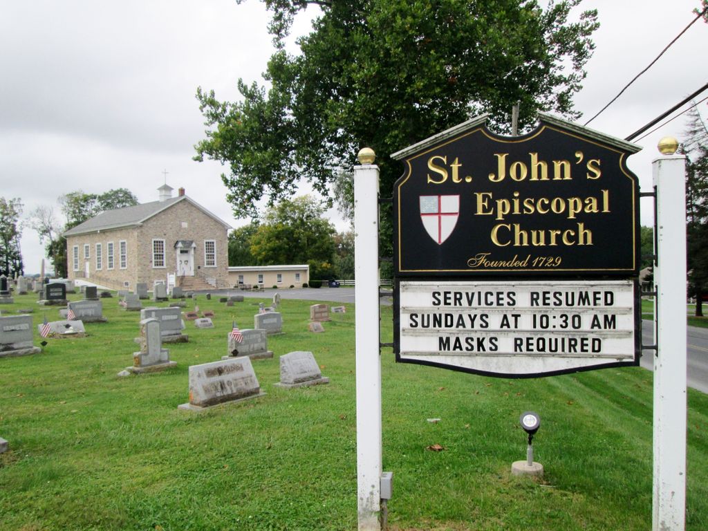
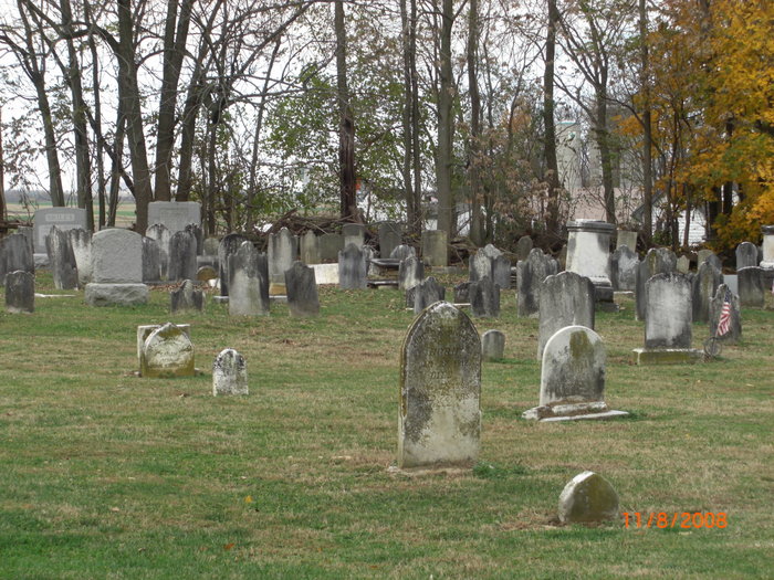
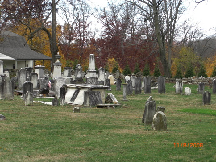
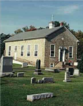
| Memorials | : | 2 |
| Location | : | Compass, Chester County, USA |
| Phone | : | 717-442-4302 |
| Website | : | www.stjohnscompass.org |
| Coordinate | : | 40.0229111, -75.9439392 |
frequently asked questions (FAQ):
-
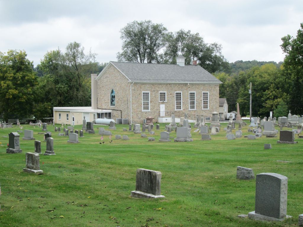
Where is Saint John's Episcopal Church Cemetery?
Saint John's Episcopal Church Cemetery is located at 1520 West King’s Highway Compass, Chester County ,Pennsylvania , 17527USA.
-
Saint John's Episcopal Church Cemetery cemetery's updated grave count on graveviews.com?
2 memorials
-
Where are the coordinates of the Saint John's Episcopal Church Cemetery?
Latitude: 40.0229111
Longitude: -75.9439392


Nearby Cemetories:
1. Pequea Baptist Cemetery
Gap, Lancaster County, USA
Coordinate: 40.0271000, -75.9567000
2. Beacon Light Amish Cemetery
West Caln Township, Chester County, USA
Coordinate: 40.0071070, -75.9274910
3. Sandy Hill African Methodist Episcopal Cemetery
West Caln Township, Chester County, USA
Coordinate: 40.0185200, -75.9133000
4. Sandy Hill Mennonite Cemetery
West Caln Township, Chester County, USA
Coordinate: 40.0094000, -75.9157000
5. Buena Vista Amish Cemetery
Gap, Lancaster County, USA
Coordinate: 40.0220000, -75.9795000
6. Old Road Mennonite Cemetery
Gap, Lancaster County, USA
Coordinate: 40.0332489, -75.9807281
7. Zion African Union Cemetery
West Caln Township, Chester County, USA
Coordinate: 40.0490479, -75.9218970
8. Limeville United Methodist Cemetery
Gap, Lancaster County, USA
Coordinate: 40.0046000, -75.9822000
9. Pequea Presbyterian Cemetery
Gap, Lancaster County, USA
Coordinate: 40.0523380, -75.9916900
10. East Sadsbury Friends Burial Ground
Parkesburg, Chester County, USA
Coordinate: 39.9796490, -75.9149740
11. Pequea Evangelical Congregational Church Cemetery
Gap, Lancaster County, USA
Coordinate: 40.0334960, -76.0083930
12. Upper Octorara Presbyterian Church Cemetery
Sadsbury Township, Chester County, USA
Coordinate: 39.9742012, -75.9163971
13. Gault Graveyard
Gap, Lancaster County, USA
Coordinate: 40.0698060, -75.9767970
14. Dawson Family Cemetery
West Caln Township, Chester County, USA
Coordinate: 40.0009930, -75.8796790
15. Millwood Mennonite Cemetery
Gap, Lancaster County, USA
Coordinate: 40.0159970, -76.0146190
16. West Caln Friends Burial Ground
Wagontown, Chester County, USA
Coordinate: 40.0109000, -75.8694000
17. Cambridge Methodist Burial Ground
Cambridge, Chester County, USA
Coordinate: 40.0814918, -75.9360128
18. Cambridge Union Cemetery
Cambridge, Chester County, USA
Coordinate: 40.0816100, -75.9355900
19. Meadville Mennonite Cemetery
Gap, Lancaster County, USA
Coordinate: 40.0717020, -75.9875280
20. Cambridge Amish Cemetery
Cambridge, Chester County, USA
Coordinate: 40.0817740, -75.9351240
21. Cambridge Friends Burial Ground
Cambridge, Chester County, USA
Coordinate: 40.0821700, -75.9351500
22. Our Lady of the Seven Dolors Roman Catholic Cemetery
Parkesburg, Chester County, USA
Coordinate: 39.9632912, -75.9295197
23. Sadsbury Friends Burial Ground
Christiana, Lancaster County, USA
Coordinate: 39.9708080, -75.9906830
24. Simmontown Mennonite Church Cemetery
Gap, Lancaster County, USA
Coordinate: 39.9842230, -76.0120010