
| Memorials | : | 7 |
| Location | : | Putnam County, USA |
| Coordinate | : | 40.3796997, -92.8193970 |
frequently asked questions (FAQ):
-
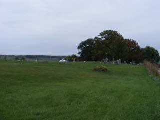
Where is Lipp Cemetery?
Lipp Cemetery is located at Putnam County ,Missouri ,USA.
-
Lipp Cemetery cemetery's updated grave count on graveviews.com?
6 memorials
-
Where are the coordinates of the Lipp Cemetery?
Latitude: 40.3796997
Longitude: -92.8193970
Nearby Cemetories:
1. Young Cemetery
Putnam County, USA
Coordinate: 40.3931007, -92.8336029
2. Ledford Cemetery
Putnam County, USA
Coordinate: 40.4042015, -92.8414001
3. Bland Cemetery
Putnam County, USA
Coordinate: 40.4071999, -92.7972031
4. Cox Cemetery
Morrow Township, Adair County, USA
Coordinate: 40.3414570, -92.8080440
5. Husted Cemetery
Putnam County, USA
Coordinate: 40.3608017, -92.7671967
6. Martinstown Cemetery
Unionville, Putnam County, USA
Coordinate: 40.4092000, -92.7708000
7. Elko Cemetery
Putnam County, USA
Coordinate: 40.4141900, -92.8623600
8. Montgomery Cemetery
Martinstown, Putnam County, USA
Coordinate: 40.4108170, -92.7715590
9. Lone Pine Cemetery
Martinstown, Putnam County, USA
Coordinate: 40.4188995, -92.7739029
10. Bunker Cemetery
Livonia, Putnam County, USA
Coordinate: 40.4333500, -92.8323700
11. Buster-Butler Cemetery
Putnam County, USA
Coordinate: 40.4333600, -92.8323600
12. Rose Cemetery
Unionville, Putnam County, USA
Coordinate: 40.4343987, -92.7825012
13. Haynes Cemetery
Putnam County, USA
Coordinate: 40.3964005, -92.9000015
14. Hogg Cemetery
Graysville, Putnam County, USA
Coordinate: 40.4300919, -92.7613449
15. Hurley Cemetery
Putnam County, USA
Coordinate: 40.4225006, -92.7491989
16. Riggins Cemetery
Putnam County, USA
Coordinate: 40.3927994, -92.9077988
17. Morelock Cemetery
Stahl, Adair County, USA
Coordinate: 40.3106003, -92.8246994
18. Cain Ford Cemetery
Lowground, Putnam County, USA
Coordinate: 40.3549995, -92.7322006
19. Pherigo Cemetery
Unionville, Putnam County, USA
Coordinate: 40.4174995, -92.9067001
20. Shibleys Point Cemetery
Shibleys Point, Adair County, USA
Coordinate: 40.3163986, -92.7619019
21. Allen-Claybrook Cemetery
Stahl, Adair County, USA
Coordinate: 40.3033000, -92.8319000
22. Branstutter Cemetery
Adair County, USA
Coordinate: 40.3032990, -92.8319016
23. Hatfield Cemetery
Putnam County, USA
Coordinate: 40.3499985, -92.7241974
24. Anders Cemetery
Putnam County, USA
Coordinate: 40.4397011, -92.8983002