
| Memorials | : | 0 |
| Location | : | Stahl, Adair County, USA |
| Coordinate | : | 40.3033000, -92.8319000 |
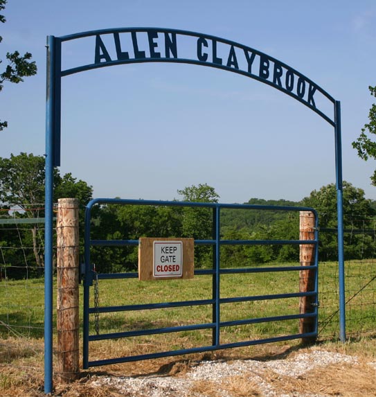
| Description | : | Small inactive cemetery on family farm. Also known a Branstetter/Branstutter cemetery. From "family legends" other burials are presumed to be here including some infants. However, no information is known about them at this point in time (2011). |
frequently asked questions (FAQ):
-
Where is Allen-Claybrook Cemetery?
Allen-Claybrook Cemetery is located at Stahl, Adair County ,Missouri ,USA.
-
Allen-Claybrook Cemetery cemetery's updated grave count on graveviews.com?
0 memorials
-
Where are the coordinates of the Allen-Claybrook Cemetery?
Latitude: 40.3033000
Longitude: -92.8319000
Nearby Cemetories:
1. Branstutter Cemetery
Adair County, USA
Coordinate: 40.3032990, -92.8319016
2. Morelock Cemetery
Stahl, Adair County, USA
Coordinate: 40.3106003, -92.8246994
3. Cox Cemetery
Morrow Township, Adair County, USA
Coordinate: 40.3414570, -92.8080440
4. Shibleys Point Cemetery
Shibleys Point, Adair County, USA
Coordinate: 40.3163986, -92.7619019
5. Megrew Cemetery
Adair County, USA
Coordinate: 40.2778015, -92.7613983
6. Union Cemetery
Novinger, Adair County, USA
Coordinate: 40.2461020, -92.8056240
7. Daniel Cemetery
Novinger, Adair County, USA
Coordinate: 40.2360992, -92.8352966
8. Husted Cemetery
Putnam County, USA
Coordinate: 40.3608017, -92.7671967
9. Lipp Cemetery
Putnam County, USA
Coordinate: 40.3796997, -92.8193970
10. Broyles Cemetery
Adair County, USA
Coordinate: 40.2458000, -92.7643967
11. Green Grove Cemetery
Novinger, Adair County, USA
Coordinate: 40.3122390, -92.7180810
12. Young Cemetery
Putnam County, USA
Coordinate: 40.3931007, -92.8336029
13. Cain Ford Cemetery
Lowground, Putnam County, USA
Coordinate: 40.3549995, -92.7322006
14. Hatfield Cemetery
Putnam County, USA
Coordinate: 40.3499985, -92.7241974
15. Campbell Cemetery
Adair County, USA
Coordinate: 40.2164001, -92.7660980
16. Ledford Cemetery
Putnam County, USA
Coordinate: 40.4042015, -92.8414001
17. Riggins Cemetery
Putnam County, USA
Coordinate: 40.3927994, -92.9077988
18. Haynes Cemetery
Putnam County, USA
Coordinate: 40.3964005, -92.9000015
19. Bland Cemetery
Putnam County, USA
Coordinate: 40.4071999, -92.7972031
20. Novinger Cemetery
Novinger, Adair County, USA
Coordinate: 40.2494011, -92.7052994
21. Nineveh Cemetery
Adair County, USA
Coordinate: 40.2708015, -92.6931000
22. Novinger Family Cemetery
Novinger, Adair County, USA
Coordinate: 40.2356970, -92.7163180
23. Elko Cemetery
Putnam County, USA
Coordinate: 40.4141900, -92.8623600
24. Martinstown Cemetery
Unionville, Putnam County, USA
Coordinate: 40.4092000, -92.7708000