
| Memorials | : | 0 |
| Location | : | Putnam County, USA |
| Coordinate | : | 40.3499985, -92.7241974 |
frequently asked questions (FAQ):
-
Where is Hatfield Cemetery?
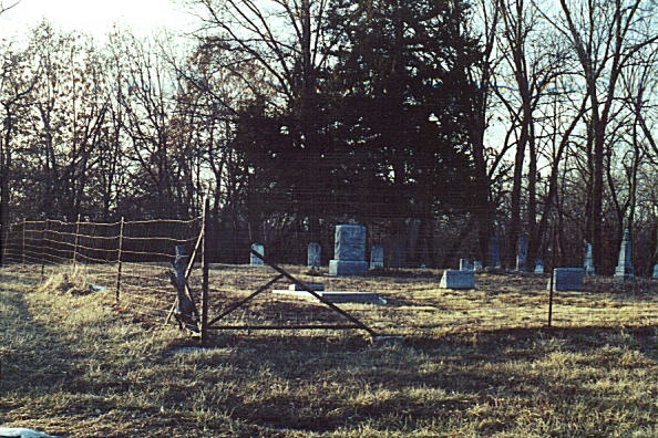
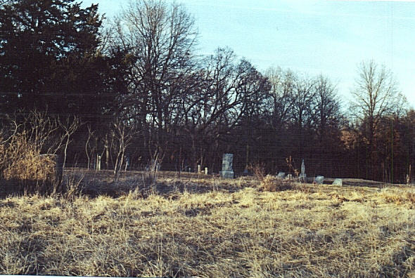
Hatfield Cemetery is located at Putnam County ,Missouri ,USA.
-
Hatfield Cemetery cemetery's updated grave count on graveviews.com?
0 memorials
-
Where are the coordinates of the Hatfield Cemetery?
Latitude: 40.3499985
Longitude: -92.7241974

Nearby Cemetories:
1. Cain Ford Cemetery
Lowground, Putnam County, USA
Coordinate: 40.3549995, -92.7322006
2. Husted Cemetery
Putnam County, USA
Coordinate: 40.3608017, -92.7671967
3. Green Grove Cemetery
Novinger, Adair County, USA
Coordinate: 40.3122390, -92.7180810
4. Shibleys Point Cemetery
Shibleys Point, Adair County, USA
Coordinate: 40.3163986, -92.7619019
5. Pleasant Home Cemetery
Worthington, Putnam County, USA
Coordinate: 40.4099800, -92.7106800
6. Cox Cemetery
Morrow Township, Adair County, USA
Coordinate: 40.3414570, -92.8080440
7. Martinstown Cemetery
Unionville, Putnam County, USA
Coordinate: 40.4092000, -92.7708000
8. Worthington Cemetery
Worthington, Putnam County, USA
Coordinate: 40.4096985, -92.6778030
9. Montgomery Cemetery
Martinstown, Putnam County, USA
Coordinate: 40.4108170, -92.7715590
10. Hurley Cemetery
Putnam County, USA
Coordinate: 40.4225006, -92.7491989
11. Hazel Creek Union Cemetery
Adair County, USA
Coordinate: 40.3056900, -92.6427200
12. Megrew Cemetery
Adair County, USA
Coordinate: 40.2778015, -92.7613983
13. Cooper Cemetery
Worthington, Schuyler County, USA
Coordinate: 40.3960991, -92.6418991
14. Lipp Cemetery
Putnam County, USA
Coordinate: 40.3796997, -92.8193970
15. Lone Pine Cemetery
Martinstown, Putnam County, USA
Coordinate: 40.4188995, -92.7739029
16. Bland Cemetery
Putnam County, USA
Coordinate: 40.4071999, -92.7972031
17. Gillespie Cemetery
Worthington, Schuyler County, USA
Coordinate: 40.4068985, -92.6500015
18. Nineveh Cemetery
Adair County, USA
Coordinate: 40.2708015, -92.6931000
19. New Harmony Cemetery
Greentop, Schuyler County, USA
Coordinate: 40.3528200, -92.6149200
20. Hogg Cemetery
Graysville, Putnam County, USA
Coordinate: 40.4300919, -92.7613449
21. Morelock Cemetery
Stahl, Adair County, USA
Coordinate: 40.3106003, -92.8246994
22. Young Cemetery
Putnam County, USA
Coordinate: 40.3931007, -92.8336029
23. Allen-Claybrook Cemetery
Stahl, Adair County, USA
Coordinate: 40.3033000, -92.8319000
24. Branstutter Cemetery
Adair County, USA
Coordinate: 40.3032990, -92.8319016