
| Memorials | : | 2 |
| Location | : | Lister, Central Kootenay Regional District, Canada |
| Coordinate | : | 49.0441667, -116.4691667 |
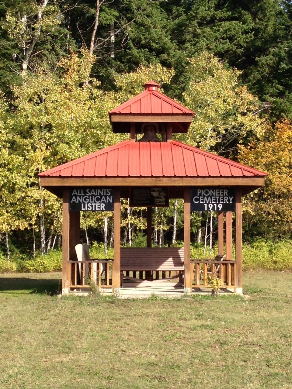
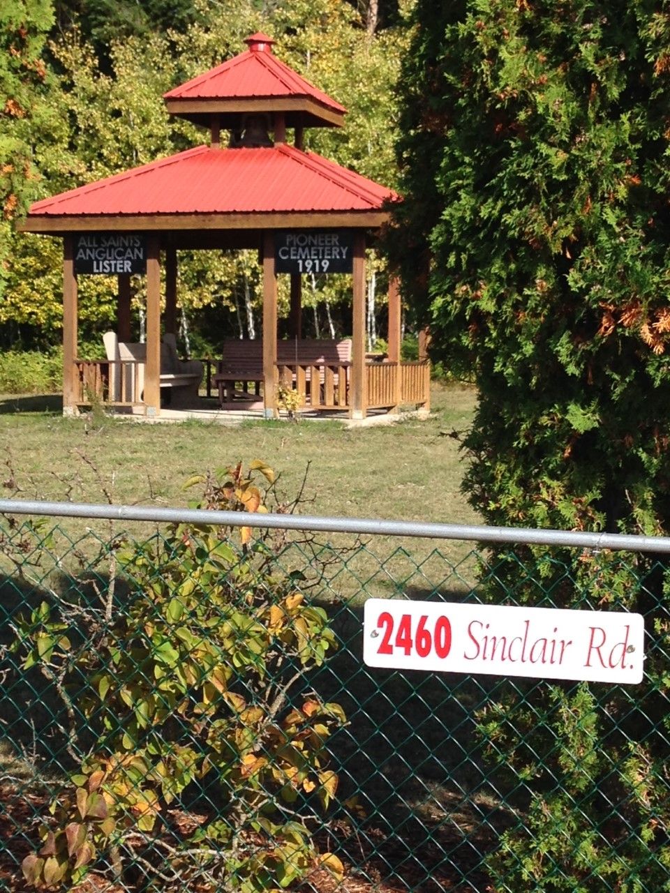
| Description | : | Central Kootenay, British Columbia From the town of Creston drive south on Hiway 21 for 3.7 km's (2.3 mi.). Turn left on Mallory Rd. by the Indian Mission. Follow Mallory Rd. for about 3 miles, past the golf course and airport turnoff, all the way to the intersection with Sinclair Rd. Turn left (North) on Sinclair Rd. The Lister Anglican Church Cemetery is on the right hand side of the road just past the school. |
frequently asked questions (FAQ):
-
Where is Lister All Saints Anglican Church Cemetery?
Lister All Saints Anglican Church Cemetery is located at Lister, Central Kootenay Regional District ,British Columbia ,Canada.
-
Lister All Saints Anglican Church Cemetery cemetery's updated grave count on graveviews.com?
2 memorials
-
Where are the coordinates of the Lister All Saints Anglican Church Cemetery?
Latitude: 49.0441667
Longitude: -116.4691667
Nearby Cemetories:
1. Lister Community Cemetery
Lister, Central Kootenay Regional District, Canada
Coordinate: 49.0466400, -116.4690100
2. St. Peter's Cemetery
Creston, Central Kootenay Regional District, Canada
Coordinate: 49.0617730, -116.5173680
3. Porthill Cemetery
Porthill, Boundary County, USA
Coordinate: 48.9994000, -116.4840000
4. Forest Lawn Cemetery
Creston, Central Kootenay Regional District, Canada
Coordinate: 49.0991400, -116.4626400
5. Pioneer Cemetery
Creston, Central Kootenay Regional District, Canada
Coordinate: 49.0921800, -116.5127700
6. Goat River Cemetery
Creston, Central Kootenay Regional District, Canada
Coordinate: 49.1411200, -116.3992060
7. Copeland Cemetery
Copeland, Boundary County, USA
Coordinate: 48.9202995, -116.3783035
8. Yahk Cemetery
Yahk, Central Kootenay Regional District, Canada
Coordinate: 49.0885510, -116.0776230
9. Mountain View Mennonite Cemetery
Bonners Ferry, Boundary County, USA
Coordinate: 48.7389000, -116.2968000
10. Saint Michaels Mission Cemetery
Boundary County, USA
Coordinate: 48.7080700, -116.3684000
11. Woodland Mennonite Church Cemetery
Bonners Ferry, Boundary County, USA
Coordinate: 48.7010470, -116.3335570
12. Grandview Cemetery
Bonners Ferry, Boundary County, USA
Coordinate: 48.6851300, -116.2932700
13. Moravia Cemetery
Moravia, Boundary County, USA
Coordinate: 48.6591988, -116.3741989
14. Parker Family Cemetery
Boundary County, USA
Coordinate: 48.6665200, -116.2619200
15. Paradise Valley Cemetery
Bonners Ferry, Boundary County, USA
Coordinate: 48.6453018, -116.3080978
16. Holy Myrrhbearers Orthodox Church Parish Cemetery
Bonners Ferry, Boundary County, USA
Coordinate: 48.6190260, -116.3598830
17. Boswell Cemetery
Boswell, Central Kootenay Regional District, Canada
Coordinate: 49.4552000, -116.7615000
18. Moyie Cemetery
Moyie, East Kootenay Regional District, Canada
Coordinate: 49.2743920, -115.8350350
19. Boulder Creek Cemetery
Boundary County, USA
Coordinate: 48.6194000, -116.0571976
20. Sylvanite Cemetery
Lincoln County, USA
Coordinate: 48.7210000, -115.8745000
21. Leonia Cemetery
Leonia, Boundary County, USA
Coordinate: 48.6161720, -116.0497860
22. McArthur Cemetery
Boundary County, USA
Coordinate: 48.5246000, -116.4350000
23. Ymir Cemetery
Ymir, Central Kootenay Regional District, Canada
Coordinate: 49.2815230, -117.2055080
24. Salmo Doukhobor Cemetery
Salmo, Central Kootenay Regional District, Canada
Coordinate: 49.2307400, -117.2521700