
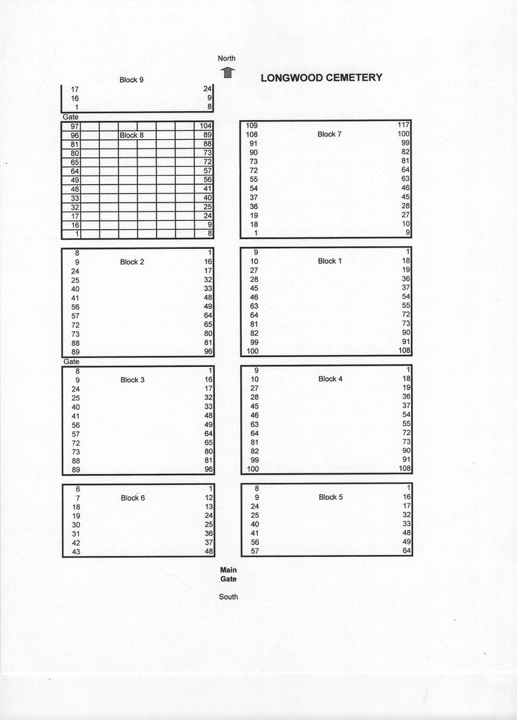
| Memorials | : | 26 |
| Location | : | Ponca City, Kay County, USA |
| Coordinate | : | 36.7257800, -96.9951700 |
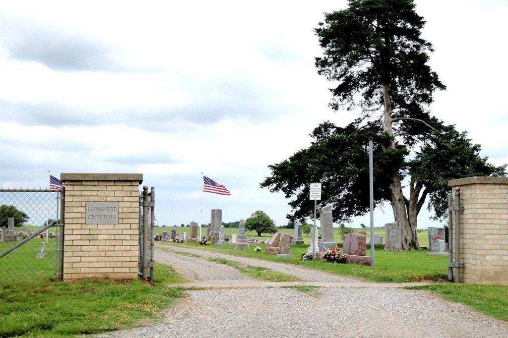
| Description | : | The Longwood Cemetery is located approximately 4.5 miles northeast of Ponca City, Kay County, OK in the community known as Longwood, OK. located next to Longwood Baptist Church. Directions: From the intersection of Lake Road (E. Highland) and U.S. Highway 77, go east on Lake Road approximately 4 miles to Longwood Road and turn north (left). Travel approximately 1 mile north to the cemetery. |
frequently asked questions (FAQ):
-
Where is Longwood Cemetery?
Longwood Cemetery is located at Ponca City, Kay County ,Oklahoma ,USA.
-
Longwood Cemetery cemetery's updated grave count on graveviews.com?
26 memorials
-
Where are the coordinates of the Longwood Cemetery?
Latitude: 36.7257800
Longitude: -96.9951700
Nearby Cemetories:
1. Sunset Memorial Park
Ponca City, Kay County, USA
Coordinate: 36.6804500, -96.9937000
2. Sunset Memorial Park
Osage County, USA
Coordinate: 36.6803017, -96.9935989
3. Resthaven Memorial Park
Ponca City, Kay County, USA
Coordinate: 36.7550011, -97.0588989
4. Grace Episcopal Church Columbarium
Ponca City, Kay County, USA
Coordinate: 36.7037630, -97.0683930
5. First Christian Church Columbarium
Ponca City, Kay County, USA
Coordinate: 36.7053210, -97.0788450
6. Odd Fellows Cemetery
Ponca City, Kay County, USA
Coordinate: 36.6893997, -97.1046066
7. Saint Marys Catholic Cemetery
Ponca City, Kay County, USA
Coordinate: 36.6875000, -97.1038971
8. Oak Grove Cemetery
Ponca City, Kay County, USA
Coordinate: 36.6876500, -97.1072600
9. Grandview Cemetery
Kaw City, Kay County, USA
Coordinate: 36.7681007, -96.8582993
10. Ponca Tribal Cemetery
Ponca City, Kay County, USA
Coordinate: 36.6432991, -97.1132965
11. Prairie Chapel Cemetery
Blackwell, Kay County, USA
Coordinate: 36.7964400, -97.1400700
12. Wolf Creek Cemetery
Newkirk, Kay County, USA
Coordinate: 36.8678017, -97.0049973
13. Banner Cemetery
Kildare, Kay County, USA
Coordinate: 36.8403015, -97.1292038
14. Round Grove Cemetery
Tonkawa, Kay County, USA
Coordinate: 36.7094002, -97.1967010
15. Cowboy Hill Cemetery
Ponca City, Kay County, USA
Coordinate: 36.6068993, -97.1380997
16. Bressie Cemetery
Noble County, USA
Coordinate: 36.5497017, -96.9863968
17. Saint Johns Cemetery
Blackwell, Kay County, USA
Coordinate: 36.8252983, -97.1900024
18. Newkirk Cemetery
Newkirk, Kay County, USA
Coordinate: 36.9110985, -97.0496979
19. Washunga Cemetery
Newkirk, Kay County, USA
Coordinate: 36.9119000, -97.0478700
20. White Eagle Monument
Marland, Noble County, USA
Coordinate: 36.5695300, -97.1448000
21. Burbank Cemetery
Burbank, Osage County, USA
Coordinate: 36.7005997, -96.7431030
22. Pixley Cemetery
Fairfax, Osage County, USA
Coordinate: 36.5074997, -96.9616852
23. Tonkawa Indian Cemetery
Tonkawa, Kay County, USA
Coordinate: 36.6726100, -97.2643800
24. Blackwell Cemetery
Blackwell, Kay County, USA
Coordinate: 36.7752991, -97.2809982