
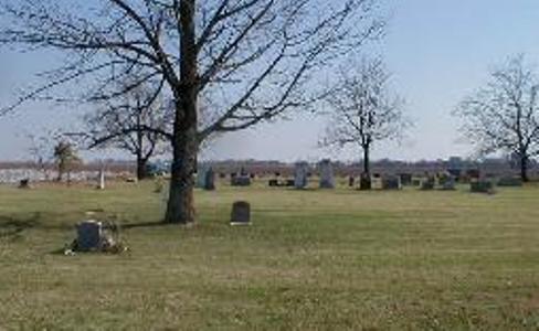
| Memorials | : | 2 |
| Location | : | Lake City, Craighead County, USA |
| Coordinate | : | 35.8457985, -90.4308014 |
| Description | : | Directions: Cross the St. Francis river bridge at Lake City, Arkansas. Turn left (north on the levee road) on County Road #505. The cemetery is 3.5 miles up river on the river side of the levee. It is approximately 1.5 miles past the Lower Cane Island Cemetery. |
frequently asked questions (FAQ):
-
Where is Lower Cane Island Cemetery?
Lower Cane Island Cemetery is located at Lake City, Craighead County ,Arkansas ,USA.
-
Lower Cane Island Cemetery cemetery's updated grave count on graveviews.com?
1 memorials
-
Where are the coordinates of the Lower Cane Island Cemetery?
Latitude: 35.8457985
Longitude: -90.4308014

Nearby Cemetories:
1. Upper Cane Island Cemetery
Craighead County, USA
Coordinate: 35.8706017, -90.4222031
2. Lake City Cemetery
Lake City, Craighead County, USA
Coordinate: 35.8133011, -90.4282990
3. Lake City Memorial Cemetery
Lake City, Craighead County, USA
Coordinate: 35.8097353, -90.4299793
4. Burrow Cemetery
Monette, Craighead County, USA
Coordinate: 35.8913994, -90.4119034
5. Bowman Cemetery
Bowman, Craighead County, USA
Coordinate: 35.8270170, -90.4877190
6. Black Oak Cemetery
Black Oak, Craighead County, USA
Coordinate: 35.8377570, -90.3690290
7. Mangrum Cemetery
Mangrum, Craighead County, USA
Coordinate: 35.7900009, -90.3760986
8. Monette Memorial Cemetery
Monette, Craighead County, USA
Coordinate: 35.8846092, -90.3494034
9. Prairie Cemetery
Lunsford, Craighead County, USA
Coordinate: 35.7566390, -90.4528330
10. Macey Cemetery
Monette, Craighead County, USA
Coordinate: 35.9303000, -90.3669000
11. Caraway Cemetery
Caraway, Craighead County, USA
Coordinate: 35.7667007, -90.3407974
12. Crockett Cemetery
Greene County, USA
Coordinate: 35.9791985, -90.4233017
13. Ridge View Mennonite Church Cemetery
Jonesboro, Craighead County, USA
Coordinate: 35.8101780, -90.5901150
14. Lansing-Cox Cemetery
Greene County, USA
Coordinate: 35.9794600, -90.4447900
15. Brookland Methodist Cemetery
Brookland, Craighead County, USA
Coordinate: 35.9015160, -90.5847330
16. Wilson Cemetery
Bay, Craighead County, USA
Coordinate: 35.7139170, -90.4766110
17. Parsons Cemetery
Greene County, USA
Coordinate: 35.9866982, -90.4032974
18. Nober Cemetery
Brookland, Craighead County, USA
Coordinate: 35.8932991, -90.6038971
19. Noble Cemetery
Craighead County, USA
Coordinate: 35.8931240, -90.6043840
20. Davis Spur Cemetery
Bay, Craighead County, USA
Coordinate: 35.7340460, -90.5517550
21. Sims Cemetery
Craighead County, USA
Coordinate: 35.9639015, -90.5550003
22. Cooper Cemetery
Craighead County, USA
Coordinate: 35.8821983, -90.6216965
23. Leachville Cemetery
Leachville, Mississippi County, USA
Coordinate: 35.9270000, -90.2537000
24. Pine Log Cemetery
Brookland, Craighead County, USA
Coordinate: 35.9314003, -90.6053009