
| Memorials | : | 2 |
| Location | : | Tanum, Tanums kommun, Sweden |
| Coordinate | : | 58.8186640, 11.3311100 |
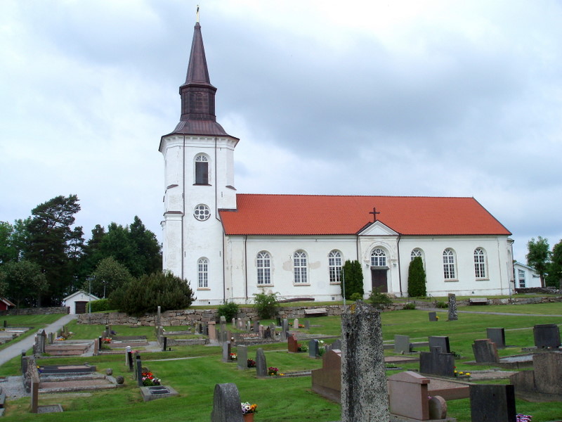
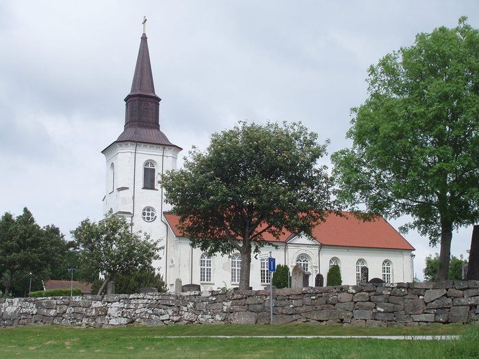
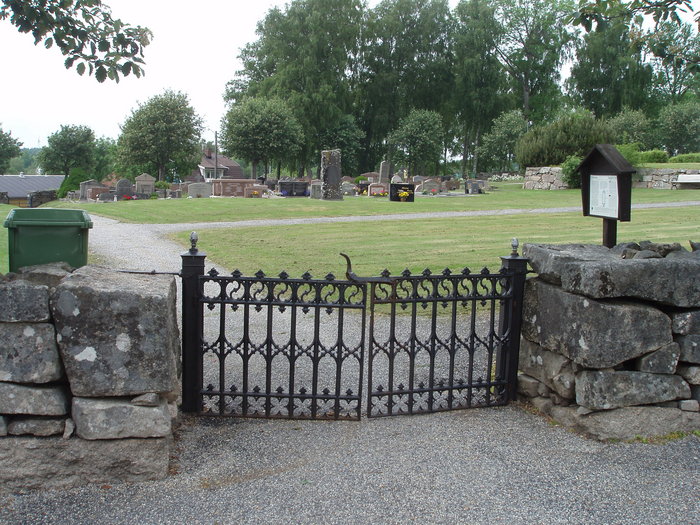
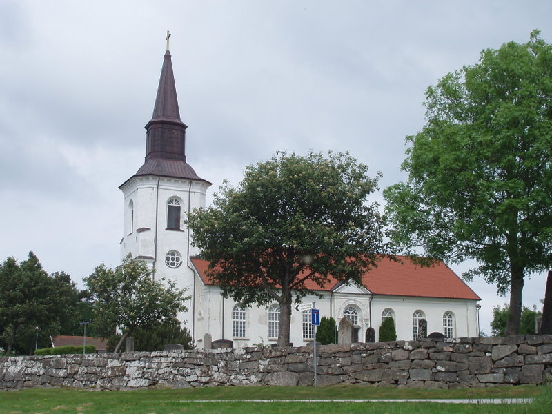
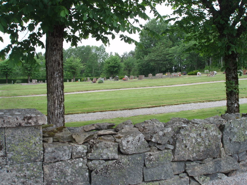
| Description | : | Lurvägen, 45792 Tanumshede - Sweden Phone: +46 (0)525 24001 Lur's Church was rebuilt in 1862, reincorporating many of the features and materials from the earlier church that stood on the site. The pulpit is decorated with panels depicting the four evangelists, which were made in the seventeenth century. The baptismal font, carved, of soapstone, was created in the thirteenth century. The altarpiece was made in the seventeenth century, though the paintings it frames date two hundred years later. The modern church is built in a neo classical style though much of the construction material and decorative features came from the original medieval... Read More |
frequently asked questions (FAQ):
-
Where is Lur's kyrkogård?
Lur's kyrkogård is located at Tanum, Tanums kommun ,Västra Götalands län ,Sweden.
-
Lur's kyrkogård cemetery's updated grave count on graveviews.com?
2 memorials
-
Where are the coordinates of the Lur's kyrkogård?
Latitude: 58.8186640
Longitude: 11.3311100
Nearby Cemetories:
1. Lurs Kyrka Gård
Lur, Tanums kommun, Sweden
Coordinate: 58.8186860, 11.3311100
2. Reso Galto
Tanum, Tanums kommun, Sweden
Coordinate: 58.8112080, 11.1851120
3. Tanumshede Kyrkogård
Tanumshede, Tanums kommun, Sweden
Coordinate: 58.7155130, 11.3333420
4. Grebbestad Kyrkogård
Tanum, Tanums kommun, Sweden
Coordinate: 58.6952440, 11.2524680
5. Naverstad Kyrkogård
Tanums kommun, Sweden
Coordinate: 58.7634830, 11.5671670
6. Myren
Strömstad, Strömstads kommun, Sweden
Coordinate: 58.9329880, 11.1835560
7. Strömstad kyrkogård
Strömstad, Strömstads kommun, Sweden
Coordinate: 58.9382520, 11.1750700
8. Sydkoster kyrkogård
Strömstads kommun, Sweden
Coordinate: 58.8855170, 11.0237000
9. Hogdal kyrkogård
Hogdal, Strömstads kommun, Sweden
Coordinate: 59.0260830, 11.2301720
10. Fjällbacka Kyrkogård
Fjällbacka, Tanums kommun, Sweden
Coordinate: 58.6005191, 11.2845430
11. Stensholmen War Cemetery
Tanums kommun, Sweden
Coordinate: 58.5757500, 11.2746110
12. Kville Kyrkogård
Kville, Tanums kommun, Sweden
Coordinate: 58.5683290, 11.3668480
13. Idd kirke
Halden kommune, Norway
Coordinate: 59.0862840, 11.4346680
14. Solli gravlund
Halden kommune, Norway
Coordinate: 59.0954910, 11.4430320
15. Slavekirkegården
Oslo, Oslo kommune, Norway
Coordinate: 59.1135500, 11.4002833
16. Rölanda kyrka
Rolanda, Dals-Eds kommun, Sweden
Coordinate: 58.8419720, 11.9146110
17. Os gravlund
Halden, Halden kommune, Norway
Coordinate: 59.1284500, 11.3903300
18. Bottna kyrkogård
Tanums kommun, Sweden
Coordinate: 58.5042897, 11.3792237
19. Svenneby gamla
Svenneby, Tanums kommun, Sweden
Coordinate: 58.4997640, 11.3240520
20. Berg Church
Halden, Halden kommune, Norway
Coordinate: 59.1379563, 11.3292295
21. Dals-Eds Kyrkogård
Ed, Dals-Eds kommun, Sweden
Coordinate: 58.9058200, 11.9385800
22. Asak kirkegård
Asak, Halden kommune, Norway
Coordinate: 59.1440900, 11.4541500
23. Tossene Church
Tossene, Sotenäs kommun, Sweden
Coordinate: 58.4501804, 11.3683834
24. Hunnebostrand
Hunnebostrand, Sotenäs kommun, Sweden
Coordinate: 58.4448349, 11.3102999