| Memorials | : | 1 |
| Location | : | Oatmeal, Burnet County, USA |
| Coordinate | : | 30.6964910, -98.0820880 |
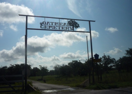
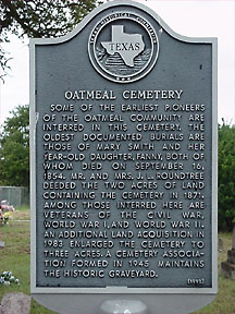
| Description | : | Some of the earliest pioneers of the Oatmeal community are interred in this cemetery. The oldest documented burials are those of Mary Smith and her year-old daughter, Fanny, both of whom died on September 16, 1854. Mr. and Mrs. J. L. Roundtree deeded the two acres of land containing the cemetery in 1871. Among those interred here are veterans of the Civil War, World War I, and World War II. An additional land acquisition in 1983 enlarged the cemetery to three acres. A cemetery association formed in 1945 maintains the historic graveyard. |
frequently asked questions (FAQ):
-
Where is Oatmeal Cemetery?
Oatmeal Cemetery is located at Oatmeal, Burnet County ,Texas ,USA.
-
Oatmeal Cemetery cemetery's updated grave count on graveviews.com?
0 memorials
-
Where are the coordinates of the Oatmeal Cemetery?
Latitude: 30.6964910
Longitude: -98.0820880
Nearby Cemetories:
1. Mount Zion Cemetery
Burnet County, USA
Coordinate: 30.7275009, -98.1113968
2. South San Gabriel Cemetery
South San Gabriel, Burnet County, USA
Coordinate: 30.7050400, -98.0246000
3. Bear Creek Cemetery
Bertram, Burnet County, USA
Coordinate: 30.7625008, -98.0378036
4. Norred Cemetery
Burnet County, USA
Coordinate: 30.6968994, -98.1838989
5. Adian Family Cemetery
Burnet County, USA
Coordinate: 30.7348500, -98.2015700
6. Holland Cemetery
Burnet, Burnet County, USA
Coordinate: 30.7157993, -98.2121964
7. Shady Grove Cemetery
Shady Grove, Burnet County, USA
Coordinate: 30.8113995, -98.0821991
8. Odd Fellows Cemetery
Burnet, Burnet County, USA
Coordinate: 30.7503000, -98.2190600
9. Old Burnet Cemetery
Burnet, Burnet County, USA
Coordinate: 30.7503100, -98.2197700
10. Burnet City Cemetery
Burnet, Burnet County, USA
Coordinate: 30.7509600, -98.2194900
11. Flippin Cemetery
Burnet, Burnet County, USA
Coordinate: 30.7446995, -98.2313995
12. Magill Family Cemetery
Burnet, Burnet County, USA
Coordinate: 30.7406006, -98.2352982
13. Smithwick Cemetery
Smithwick, Burnet County, USA
Coordinate: 30.5641500, -98.1415130
14. Mormon Mill Cemetery
Burnet County, USA
Coordinate: 30.6322002, -98.2319031
15. Strickling Cemetery
Burnet County, USA
Coordinate: 30.8435993, -98.0950012
16. Richland Cemetery
Smithwick, Burnet County, USA
Coordinate: 30.5800000, -98.1927700
17. Bertram Place Cemetery
Bertram, Burnet County, USA
Coordinate: 30.7906700, -97.9423000
18. Post Mountain Cemetery
Burnet, Burnet County, USA
Coordinate: 30.7572002, -98.2510986
19. Pangle Cemetery
Burnet County, USA
Coordinate: 30.5781002, -98.2118988
20. Frazier Ranch Cemetery
Burnet, Burnet County, USA
Coordinate: 30.8225280, -98.2111310
21. Mahomet Cemetery
Mahomet, Burnet County, USA
Coordinate: 30.8155994, -97.9332962
22. Bethel Cemetery
Burnet, Burnet County, USA
Coordinate: 30.8575001, -98.1628036
23. Lewis Family Cemetery
Burnet County, USA
Coordinate: 30.5249996, -98.1361008
24. Konvicka Cemetery
Burnet County, USA
Coordinate: 30.6180992, -98.2694016


