
| Memorials | : | 19 |
| Location | : | Manchester, Adams County, USA |
| Coordinate | : | 38.6886080, -83.6038110 |
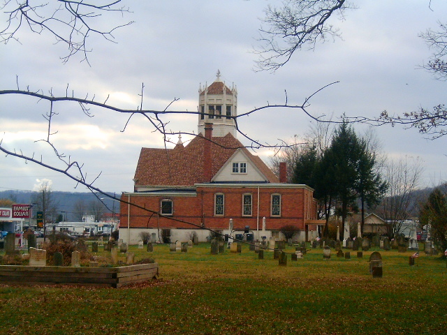
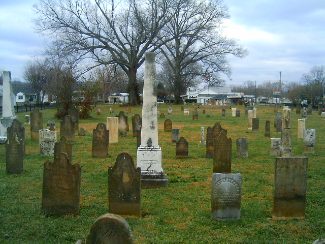
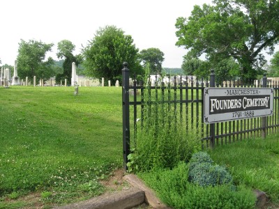
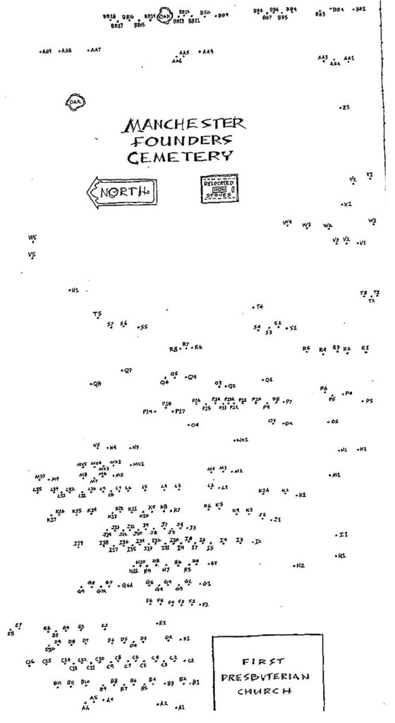
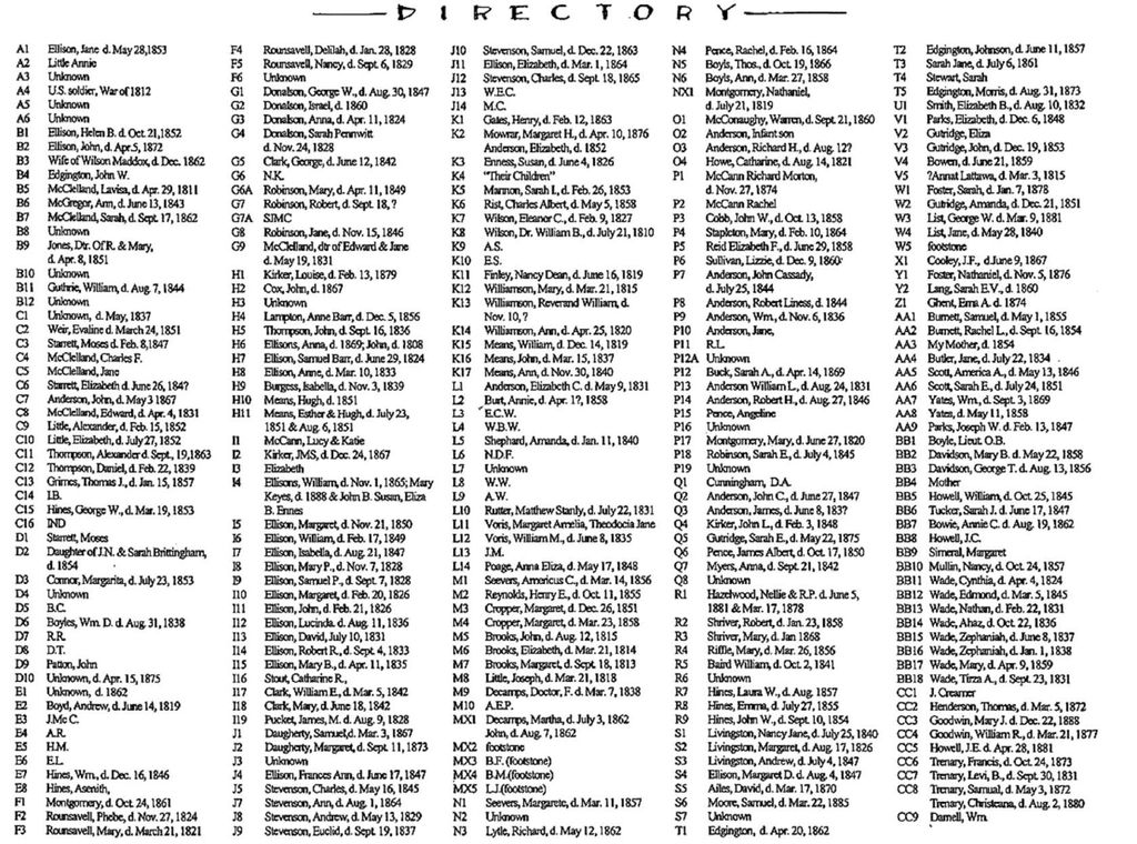
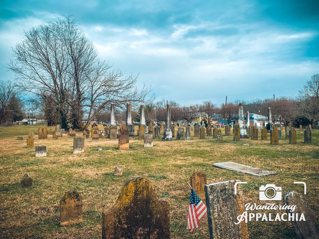
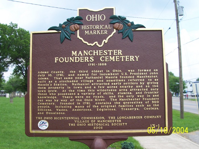
| Description | : | Last interment was 22 Dec 1888. No longer accepting burials. The cemetery is located east of Manchester Presbyterian Church with E 3rd Street as its northern boundary, E 2nd Street as its southern boundary, and Jack Roush Way as its eastern boundary. The cemetery is located in Manchester Township, Adams County, Ohio, and is # 94 (Manchester Presbyterian Church Cemetery / Manchester Street Cemetery / Manchester Second Street Cemetery) in “Ohio Cemeteries 1803-2003”, compiled by the Ohio Genealogical Society. The U.S. Geological Survey (USGS) Geographic Names Information System (GNIS) feature ID for the cemetery is 1731196 (Manchester Second Street Cemetery). |
frequently asked questions (FAQ):
-
Where is Manchester Presbyterian Church Cemetery?
Manchester Presbyterian Church Cemetery is located at E 2nd Street (US 52) Manchester, Adams County ,Ohio , 45144USA.
-
Manchester Presbyterian Church Cemetery cemetery's updated grave count on graveviews.com?
19 memorials
-
Where are the coordinates of the Manchester Presbyterian Church Cemetery?
Latitude: 38.6886080
Longitude: -83.6038110
Nearby Cemetories:
1. Manchester IOOF Cemetery
Manchester, Adams County, USA
Coordinate: 38.6944000, -83.5997000
2. Wilson-Nash Cemetery
Sand Hill, Lewis County, USA
Coordinate: 38.6748486, -83.6156435
3. Cedar Leaf Cemetery
Concord, Lewis County, USA
Coordinate: 38.6782990, -83.5727997
4. Sullivan Cemetery
Sand Hill, Lewis County, USA
Coordinate: 38.6653045, -83.6195853
5. Pownall Cemetery
Manchester, Adams County, USA
Coordinate: 38.6737700, -83.6354400
6. Wilson Family Cemetery
Sand Hill, Lewis County, USA
Coordinate: 38.6646336, -83.6293851
7. Little Cemetery
Sprigg Township, Adams County, USA
Coordinate: 38.6886340, -83.6489860
8. Ellis Cemetery #1
Manchester, Adams County, USA
Coordinate: 38.6746910, -83.6683390
9. Dryden Family Cemetery
Bradysville, Adams County, USA
Coordinate: 38.6948600, -83.6703520
10. Shelton Cemetery
Lewis County, USA
Coordinate: 38.6741667, -83.5363889
11. Bentonville Union Church Cemetery
Bentonville, Adams County, USA
Coordinate: 38.7422500, -83.6193700
12. Boone Cemetery
Sprigg Township, Adams County, USA
Coordinate: 38.6573400, -83.6631900
13. Little Cemetery #1
Sprigg Township, Adams County, USA
Coordinate: 38.6571510, -83.6631940
14. Quinn Chapel Cemetery
Monroe Township, Adams County, USA
Coordinate: 38.7255592, -83.5494385
15. Loughridge Cemetery
Manchester, Adams County, USA
Coordinate: 38.7367830, -83.5649360
16. Pence Cemetery
Manchester, Adams County, USA
Coordinate: 38.7279100, -83.6582900
17. Doyle Cemetery
Lewis County, USA
Coordinate: 38.6825000, -83.5286111
18. Fearis Cemetery
Lewis County, USA
Coordinate: 38.6274986, -83.5916977
19. East Fork Cemetery
Fearisville, Lewis County, USA
Coordinate: 38.6361100, -83.5548400
20. Hopewell Cemetery
Sprigg Township, Adams County, USA
Coordinate: 38.7432070, -83.6508880
21. Wilson Family Cemetery
Maysville, Mason County, USA
Coordinate: 38.6277770, -83.6366660
22. Means Cemetery
Covedale, Lewis County, USA
Coordinate: 38.6532454, -83.5322550
23. Bradford Cemetery (Defunct)
Sprigg Township, Adams County, USA
Coordinate: 38.6371994, -83.6707993
24. Hackett Cemetery
Wrightsville, Adams County, USA
Coordinate: 38.7073480, -83.5104270