
| Memorials | : | 21 |
| Location | : | Monroe Township, Adams County, USA |
| Coordinate | : | 38.7255592, -83.5494385 |
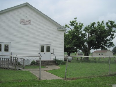
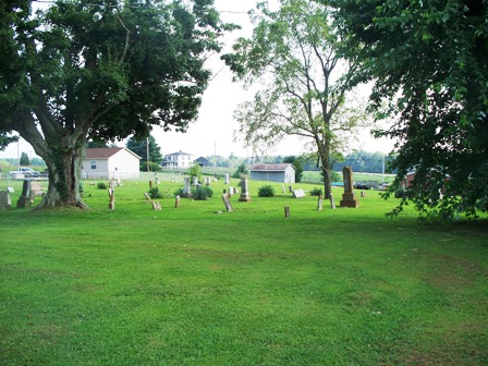
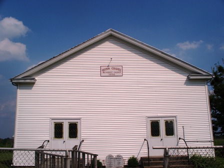
| Description | : | The cemetery is located on the east side of Pumpkin Ridge Road (County Road 10) just north of its intersection with Gift Ridge Road (County Road 2) and Bat Roost Road (County Road 2). The cemetery is located in Monroe Township, Adams County, Ohio, and is # 66 (Quinn Chapel Cemetery) in “Ohio Cemeteries 1803-2003”, compiled by the Ohio Genealogical Society. The U.S. Geological Survey (USGS) Geographic Names Information System (GNIS) feature ID for the cemetery is 1731208 (Quinn Chapel Cemetery). |
frequently asked questions (FAQ):
-
Where is Quinn Chapel Cemetery?
Quinn Chapel Cemetery is located at Pumpkin Ridge Road (County Road 10) Monroe Township, Adams County ,Ohio , 45144USA.
-
Quinn Chapel Cemetery cemetery's updated grave count on graveviews.com?
21 memorials
-
Where are the coordinates of the Quinn Chapel Cemetery?
Latitude: 38.7255592
Longitude: -83.5494385
Nearby Cemetories:
1. Loughridge Cemetery
Manchester, Adams County, USA
Coordinate: 38.7367830, -83.5649360
2. Naylor Cemetery
Monroe Township, Adams County, USA
Coordinate: 38.7247009, -83.5188980
3. Morrison Cemetery
Monroe Township, Adams County, USA
Coordinate: 38.7247840, -83.5112320
4. Fenton Cemetery
Monroe Township, Adams County, USA
Coordinate: 38.7360992, -83.5096970
5. Hackett Cemetery
Wrightsville, Adams County, USA
Coordinate: 38.7073480, -83.5104270
6. Nixon Chapel Cemetery
Tiffin Township, Adams County, USA
Coordinate: 38.7618880, -83.5593530
7. Doyle Cemetery
Lewis County, USA
Coordinate: 38.6825000, -83.5286111
8. Manchester IOOF Cemetery
Manchester, Adams County, USA
Coordinate: 38.6944000, -83.5997000
9. Cedar Leaf Cemetery
Concord, Lewis County, USA
Coordinate: 38.6782990, -83.5727997
10. Nesbitt Cemetery
Monroe Township, Adams County, USA
Coordinate: 38.7219600, -83.4840700
11. Shelton Cemetery
Lewis County, USA
Coordinate: 38.6741667, -83.5363889
12. Hale Cemetery
West Union, Adams County, USA
Coordinate: 38.7753320, -83.5715390
13. Adams County Poor Farm Cemetery
West Union, Adams County, USA
Coordinate: 38.7777050, -83.5673500
14. Manchester Presbyterian Church Cemetery
Manchester, Adams County, USA
Coordinate: 38.6886080, -83.6038110
15. Bentonville Union Church Cemetery
Bentonville, Adams County, USA
Coordinate: 38.7422500, -83.6193700
16. Chandler Cemetery
Manchester, Adams County, USA
Coordinate: 38.6986600, -83.4828800
17. Collings Family Cemetery
West Union, Adams County, USA
Coordinate: 38.7853800, -83.5462500
18. Ralston Cemetery
West Union, Adams County, USA
Coordinate: 38.7616910, -83.4863480
19. Concord Cemetery
Concord, Lewis County, USA
Coordinate: 38.6855000, -83.4902100
20. West Union Village Cemetery
West Union, Adams County, USA
Coordinate: 38.7889300, -83.5482400
21. Lovejoy Cemetery
West Union, Adams County, USA
Coordinate: 38.7881012, -83.5333023
22. Foster Cemetery
West Union, Adams County, USA
Coordinate: 38.7285560, -83.4667360
23. Jackman Cemetery
Manchester, Adams County, USA
Coordinate: 38.6951500, -83.4762100
24. Harmony Cemetery
West Union, Adams County, USA
Coordinate: 38.7689800, -83.4871800