
| Memorials | : | 39 |
| Location | : | Bentonville, Adams County, USA |
| Coordinate | : | 38.7422500, -83.6193700 |
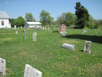
| Description | : | Entire cemetery has been photographed. The cemetery is located on the southeast corner of the intersection of Ohio State Route 41 and Cabin Creek Road (County Road 11). The cemetery is located in Scott Township, Adams County, Ohio, and is # 84 (Bentonville Union Church Cemetery / Bentonville Cemetery) in “Ohio Cemeteries 1803-2003”, compiled by the Ohio Genealogical Society. The U.S. Geological Survey (USGS) Geographic Names Information System (GNIS) feature ID for the cemetery is 1731176 (Bentonville Cemetery). |
frequently asked questions (FAQ):
-
Where is Bentonville Union Church Cemetery?
Bentonville Union Church Cemetery is located at Ohio State Route 41 and Cabin Creek Road (County Road 11) Bentonville, Adams County ,Ohio , 45144USA.
-
Bentonville Union Church Cemetery cemetery's updated grave count on graveviews.com?
39 memorials
-
Where are the coordinates of the Bentonville Union Church Cemetery?
Latitude: 38.7422500
Longitude: -83.6193700
Nearby Cemetories:
1. Hopewell Cemetery
Sprigg Township, Adams County, USA
Coordinate: 38.7432070, -83.6508880
2. Pence Cemetery
Manchester, Adams County, USA
Coordinate: 38.7279100, -83.6582900
3. Kirker Cemetery
West Union, Adams County, USA
Coordinate: 38.7783012, -83.6027985
4. Loughridge Cemetery
Manchester, Adams County, USA
Coordinate: 38.7367830, -83.5649360
5. Hale Cemetery
West Union, Adams County, USA
Coordinate: 38.7753320, -83.5715390
6. Manchester IOOF Cemetery
Manchester, Adams County, USA
Coordinate: 38.6944000, -83.5997000
7. Nixon Chapel Cemetery
Tiffin Township, Adams County, USA
Coordinate: 38.7618880, -83.5593530
8. Adams County Poor Farm Cemetery
West Union, Adams County, USA
Coordinate: 38.7777050, -83.5673500
9. Brier Ridge Cemetery
Bentonville, Adams County, USA
Coordinate: 38.7786800, -83.6712500
10. Manchester Presbyterian Church Cemetery
Manchester, Adams County, USA
Coordinate: 38.6886080, -83.6038110
11. Quinn Chapel Cemetery
Monroe Township, Adams County, USA
Coordinate: 38.7255592, -83.5494385
12. Smith Cemetery
Liberty Township, Adams County, USA
Coordinate: 38.7963620, -83.5934450
13. Little Cemetery
Sprigg Township, Adams County, USA
Coordinate: 38.6886340, -83.6489860
14. Dryden Family Cemetery
Bradysville, Adams County, USA
Coordinate: 38.6948600, -83.6703520
15. Wilson-Nash Cemetery
Sand Hill, Lewis County, USA
Coordinate: 38.6748486, -83.6156435
16. Bissinger Cemetery
Liberty Township, Adams County, USA
Coordinate: 38.8058014, -83.6528015
17. Pownall Cemetery
Manchester, Adams County, USA
Coordinate: 38.6737700, -83.6354400
18. Ebenezer Churchyard
Ripley, Brown County, USA
Coordinate: 38.7228012, -83.7074966
19. Collings Family Cemetery
West Union, Adams County, USA
Coordinate: 38.7853800, -83.5462500
20. West Union Village Cemetery
West Union, Adams County, USA
Coordinate: 38.7889300, -83.5482400
21. Hickory Ridge Cemetery
Aberdeen, Brown County, USA
Coordinate: 38.7510986, -83.7127991
22. Cedar Leaf Cemetery
Concord, Lewis County, USA
Coordinate: 38.6782990, -83.5727997
23. Lee-Armstrong Cemetery
West Union, Adams County, USA
Coordinate: 38.7921100, -83.5482200
24. Sullivan Cemetery
Sand Hill, Lewis County, USA
Coordinate: 38.6653045, -83.6195853