
| Memorials | : | 136 |
| Location | : | Manson, Chelan County, USA |
| Coordinate | : | 47.8800000, -120.1300000 |
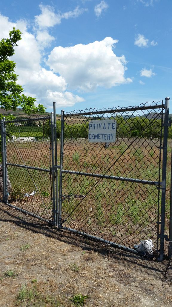
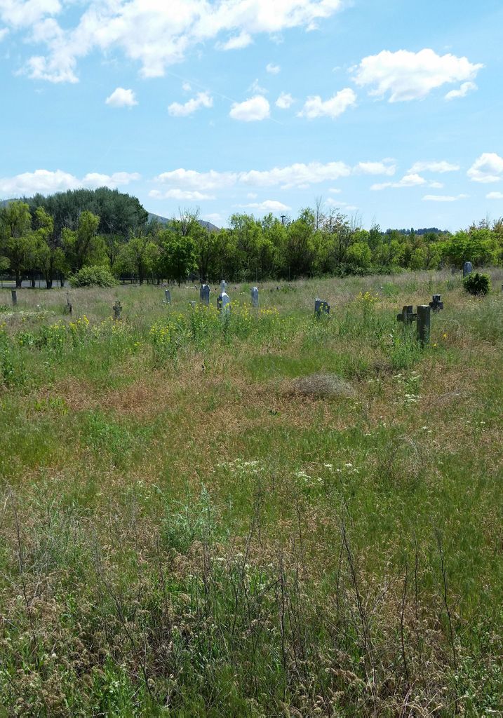
| Description | : | Located next to the Mill Bay Resort. The resort manager maintains the cemetery grounds. This cemetery is also known as the Indian Burial Ground and the Mill Bay Cemetery. |
frequently asked questions (FAQ):
-
Where is Manson Indian Cemetery?
Manson Indian Cemetery is located at Manson, Chelan County ,Washington ,USA.
-
Manson Indian Cemetery cemetery's updated grave count on graveviews.com?
136 memorials
-
Where are the coordinates of the Manson Indian Cemetery?
Latitude: 47.8800000
Longitude: -120.1300000

Nearby Cemetories:
1. Saint Andrews Episcopal Church
Chelan, Chelan County, USA
Coordinate: 47.8397460, -120.0183780
2. Chelan Fraternal Cemetery
Chelan, Chelan County, USA
Coordinate: 47.8502998, -120.0081024
3. Mount Olivet Cemetery
Chelan, Chelan County, USA
Coordinate: 47.8451000, -119.9946000
4. Ballard Family Cemetery
Stayman, Chelan County, USA
Coordinate: 47.7811100, -120.1133300
5. Riverview Cemetery
Chelan, Chelan County, USA
Coordinate: 47.8335991, -119.9944000
6. Brays Landing Cemetery
Douglas County, USA
Coordinate: 47.7364120, -120.1704660
7. Fletcher Cemetery
Douglas County, USA
Coordinate: 47.7430992, -119.9403000
8. Dick Family Cemetery
Okanogan County, USA
Coordinate: 48.0502700, -119.9241700
9. Miller Family Cemetery
Okanogan County, USA
Coordinate: 48.0530300, -119.9288000
10. Pateros Cemetery
Pateros, Okanogan County, USA
Coordinate: 48.0516600, -119.9097300
11. Kummer Cemetery
Waterville, Douglas County, USA
Coordinate: 47.6559000, -120.0332000
12. Entiat Cemetery
Entiat, Chelan County, USA
Coordinate: 47.6755981, -120.3043976
13. Orondo Community Cemetery
Orondo, Douglas County, USA
Coordinate: 47.6486015, -120.2136002
14. Waterville Cemetery
Waterville, Douglas County, USA
Coordinate: 47.6418500, -120.0685940
15. Methow Cemetery
Methow, Okanogan County, USA
Coordinate: 48.1102982, -120.0124969
16. Gate of Heaven Catholic Cemetery
Waterville, Douglas County, USA
Coordinate: 47.6382100, -120.0671690
17. Packwood Memorial Cemetery
Dyer, Douglas County, USA
Coordinate: 48.0118305, -119.8178880
18. Badger Mountain View Cemetery
Douglas County, USA
Coordinate: 47.6088000, -120.0476000
19. Douglas Lutheran Cemetery
Douglas County, USA
Coordinate: 47.6189003, -119.9614029
20. Mansfield Cemetery
Mansfield, Douglas County, USA
Coordinate: 47.8088880, -119.6508330
21. Bridgeport Cemetery
Bridgeport, Douglas County, USA
Coordinate: 48.0050000, -119.6738800
22. Happy Home Cemetery
Farmer, Douglas County, USA
Coordinate: 47.6268997, -119.8125000
23. Locust Grove Cemetery
Brewster, Okanogan County, USA
Coordinate: 48.1114006, -119.7746964
24. Buckingham Cemetery
Douglas County, USA
Coordinate: 47.8669014, -119.6286011